[Color image.] Caption at top: 'The harbor of Charleston, S.C.--From sketches by our special artist.--Fort Moultrie, on Sullivan's Island.' Caption at middle: 'Fort Pinckney, Charleston, S.C.' Caption at bottom: 'Fort Sumter, Charleston, S.C.' [full date Dec. 1, 1860.]
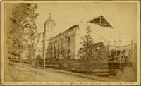
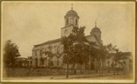
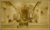
Caption: 'Cook's Earthquake Views of Charleston and Vicinity. Taken after the 31st of August, 1886. [Marked as] No.16, First Presbyterian Church [and] No.99, Rear of Scotch Church.' Handwritten at bottom, front: 'Charleston Earthquake scene - First Presbyterian Church - side and rear view.'
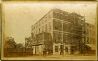
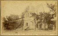
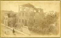
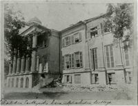
Caption: 'Cook's Earthquake Views of Charleston and Vicinity. Taken after the 31st of August, 1886. No.117, Citadel Square Baptist Church.' Also, handwritten at bottom, front: 'Charleston Earthquake scene - Citadel Square Baptist Church.'
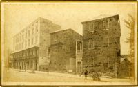
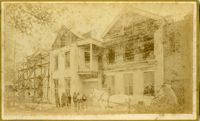
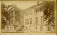
Caption: 'Cook's Earthquake Views of Charleston and Vicinity. Taken after the 31st of August, 1886. No.4, Roper Hospital.' Shows Roper Hospital when at Queen Street location.
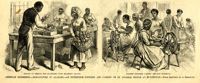
Main caption: 'American industries.--Silk culture in Alabama--an enterprise founded and carried on by Colored people at Huntsville.--from a sketch by A. Berghaus.' Caption left: 'Method of feeding the silkworms with mulberry leaves.' Caption right: 'Colored children carding the raw material.' [full date August 17, 1878.]
Caption: 'Cook's Earthquake Views of Charleston and Vicinity. Taken after the 31st of August, 1886. No.134, Dr. Frazer's, Tradd Street.' Charleston city directory for 1886 shows listing for Dr. Henry D. Fraser at 139 Tradd, with offices at 137 Tradd.
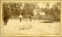
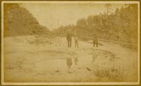
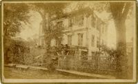
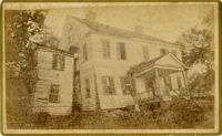
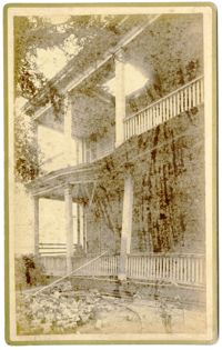
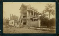
Caption: 'Charleston Earthquake. Photographs by Dr. E.P. Howland, taken on his visit to Charleston and the earthquake region of Ten Mile Hill and Summervile. Over 150 Photographs were taken. House of Mr. Ravenell [sic], President Northeastern R.R.'
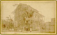
Caption: 'Cook's Earthquake Views of Charleston and Vicinity. Taken after the 31st of August, 1886. No.78, Residence Wm. Johnson, Wentworth Street.' Charleston city directory for 1886 shows a William Johnson at 107 Wentworth Street.
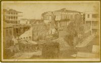
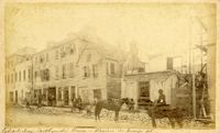
Charleston Earthquake scene. Written on front, at bottom: 'Commercial Cotton Press, East Bay.' Charleston city directory for 1886 lists Commercial Wharf and Cotton Press, Co. on East Bay Street and Longitude Lane.
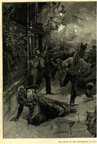
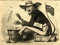
Political cartoon, caption: 'King Jeff the First. "Let them burn! Let the women and children suffer! I'm bound to keep warm!"' [full date January 4, 1862.]
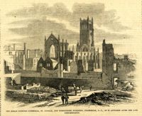
Caption: 'The Roman Catholic Cathedral, St. Finbar, and surrounding buildings, S.C., as it appeared after the late conflagration.' [full date November 1, 1862.]
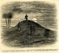
Caption: 'Moonlight scene on Sullivan's Island, Charleston Harbor--the sentry challenging Frank Leslie's Special Artist and Correspondent, who were guests of the Richland Rifles.--from a sketch by our Special Artist now in Charleston.' [full date March 2, 1861.]
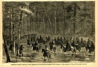
Caption: 'Sherman's march through South Carolina--advance from McPhersonville, February 1, 1865.--sketched by William Waud.--[see page 133.]' [full date March 4, 1865.]
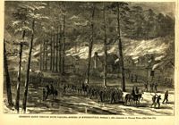
Caption: 'Sherman's march through South Carolina--burning of McPhersonville, February 1, 1865.--sketched by William Waud.--[see page 133.]' [full date March 4, 1865.]
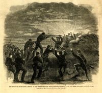
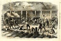
Caption: 'The Siege of Charleston--charge of the Twenty-Fourth Massachusetts Regiment upon the Rebel rifle-pits, August 26, 1863. Sketched by Mr. Theodore R. Davis.--[see page 621.]' [full date September 26, 1863.]
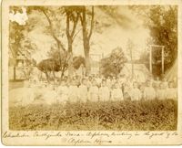
Caption: 'Charleston Earthquake. Photographs by Dr. E.P. Howland, taken on his visit to Charleston and the earthquake region of Ten Mile Hill and Summerville. Over 150 photographs were taken. Orphans and tents in which they lived.' Written on front, at bottom: 'Charleston Earthquake scene - orphans, standing the yard of the Orphan House.'
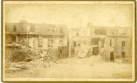
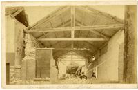
Caption: 'Cook's Earthquake Views of Charleston and Vicinity. Taken after the 31st of August, 1886. No.116, wreck in George Street.' Written on front, at bottom: 'Charleston Earthquake view - Ruins in George St.'
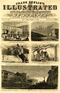
Main caption: 'The present appearance of Charleston, S.C., showing the effects of the Federal bombardment.--from recent sketches by our special artist.' Caption top left: 'Nos.165, 167 and 169 Meeting Street, Charleston, S.C.' Caption top right: 'East Bay Street, looking south.' Caption middle left: 'Kitchen attached to 53 Wentworth Street--effect of two shells.' Caption middle right: 'Gentleman's ordinary, Charleston Hotel.' Caption bottom: 'Vendue Range.' [full date March 25, 1865.]
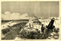
Caption: 'The siege of Charleston--View from the sea-face of Fort Wagner.--sketched by Mr. Theodore R. Davis.--[See Page 621.]' [full date September 26, 1863.]
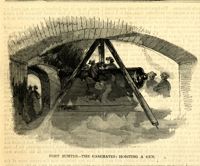
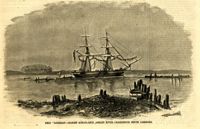
Caption: 'Scene on the Floating Battery in Charleston Harbor, S.C., during the bombardment of Fort Sumpter (sic).--from a sketch by an Officer.--see page 355.' [full date April 27, 1861.]
Caption: 'Sketches in Charleston, South Carolina. 1.Cotton Day. 2. A Limb of the Law. 3. Gossips. 4.Light-wood cart. 5. "A Relic". 6. Milk Girl.7. In the Market-Poultry Dealer. 8."Horse" Car.' [full date July 17, 1875.]
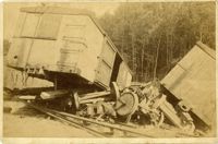
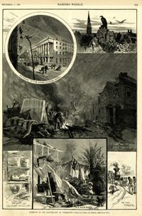
Main caption: 'Incidents of the Earthquake at Charleston.--drawn by Schell and Hogan.--[see page 590.]' Caption top left: 'In front of the Charleston Hotel.' Caption top right: 'looking over the roofs.' Caption middle: 'A camp on the East Battery.' Caption bottom left: 'The front wall gone.' Caption bottom center: 'In a rich man's garden.' Caption bottom right: ' On the track.' [full date September 11, 1886.]
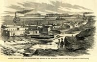
Caption: 'General Halleck's fleet of mortar-boats for service on the Mississippi.--sketched by Mr. Alexander Simplot.--[see page 827.]' [full date December 28, 1861.]
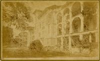
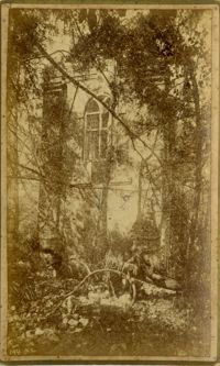
Caption: 'Cook's Earthquake Views of Charleston and Vicinity. Series No.2. No.181, Beresford Street.' This may be Beresford Alley which is also known as Clifford Street.