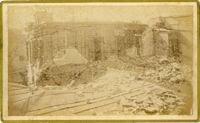
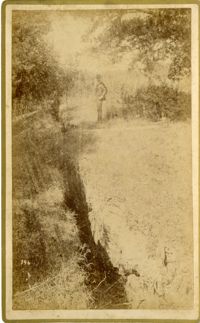
Caption: 'Cook's Earthquake Views of Charleston and Vicinity. Taken after the 31st of August, 1886. No.135, Corner State and Chalmers Streets.' Written on front, at bottom: 'Charleston Earthquake views - ruins cor[ner] Chalmers & State Str.'
Caption: 'Cook's Earthquake Views of Charleston and Vicinity. Series No.2. No.187, residence of Mr. A. Lengnick.' Charleston city directory for 1886 shows Albert Lengnick at 11 Pitt Street.
Caption: 'The Siege of Charleston--the morning call to the Rebels.--sketched from the naval battery by Mr. Theodore R. Davis.--[see page 603.]' [full date September 19, 1863.]
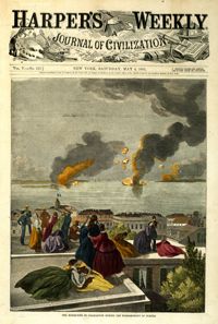
Caption: 'Charleston--Celebration of her recovery from the effects of the Earthquake.--from a photograph by Cook.--[see page 818.]' [full date November 12, 1887.]
Caption: 'Cook's Earthquake Views of Charleston and Vicinity. Series No.2. No.167, rear of residence of Geo. [George] W. Williams, Jr.' Charleston city directory for 1886 shows George W. Williams, Jr. at 2 Atlantic Street.
Caption: 'Cook's Earthquake Views of Charleston and Vicinity. Series No.2. No.182, Porch of Lazarus House.' Hassell Street. Charleston city directory for 1886 shows Mrs. B.D. Lazarus at 64 Hassell Street.
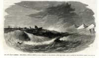
Caption: 'The advance upon Charleston--entrance to the Stono River, S.C.--from a sketch by Lieut. Coleman, 100th N.Y.S. Vol.' Also identified with captions: 'Kiawah Island and River. John's Island. Stono River. Cole's Island. Old Rebel Fort.' [full date April 25, 1863.]
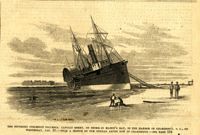
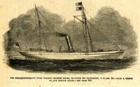
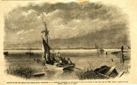
Caption: 'The Southern steamship Columbia. Captain Berry, on shore in Maffit's Bay, in the harbor of Charleston, S.C., on Wednesday, Jan. 23.--from a sketch by our Special Artist in Charleston.--see page 194.' [full date February 16, 1861.]
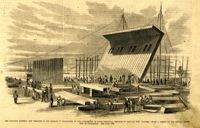
Caption: 'The Floating Battery, now erecting in the harbor of Charleston by the authorities of South Carolina. Designed to capture Fort Sumter.--from a sketch by our Special Artist now in Charleston. See page 194.' [full date February 16, 1861.]
Caption: 'The Anglo-Confederate prize steamer Princess Royal captured off Charleston, January 29.--from a sketch by our Special Artist.--see page 366.' [full date February 28, 1863.]
Caption: 'The Civil War in America: the Federal ironclad Keokuk as she appeared on the morning after the fight.--from a sketch by our Special Artist.--see page 542.' [full date May 16. 1863.]
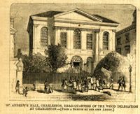
Caption: 'St. Andrew's Hall, Charleston, head-quarters of the Wood Delegation at Charleston.--[from a sketch by our own artist.]' [full date May 5, 1860.]
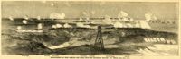
Caption: 'Bombardment of Fort Sumter--The fleet engaging Batteries Wagner and Gregg.--[See Page 587]' Identified by captions are the Swamp Angel, Fort Johnson, Fort Sumter, Fort Gregg, Battery Wagner and iron-clads. [full date September 12, 1863.]
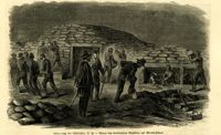
Caption (in German): 'Belagerung von Charleston, S.C.--Bauen von bombenfesten Gewoelben auf Morris Island.' {Siege of Charleston, S.C.--Building of bombproof bunkers on Morris Island.}
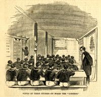
Caption: 'Port Royal Island--1. Camp Saxton (Smith's Plantation)--the new headquarters of the 1st S.C. Vol. (Colored), Col. Higginson. 2. Mitchellville, the new south village for Contrabands, Hilton Head.--from sketches by our Special Artist.--see page 317.' [full date February 7, 1863.]
Caption: 'The War in Virginia--railroad bridges over the Rappahannock, at Rappahannock Station.--from a sketch by our Special Artist, Edwin Forbes.' [full date October 31, 1863.]
Caption: 'Eastport, Mississippi, General Thomas's head-quarters, January, 1865.--sketched by Adam Rohe.--[see page 110.] [full date February 18. 1865.]
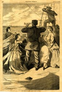
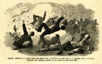
Caption: 'Terrified effects of a shell from a Rebel ram, bursting on board the U.S. gunboat Keystone State, January 31.--from a sketch by an Officer.--see page 365.' [full date February 28, 1863.]
Caption: 'The siege of Charleston--the "Segar Steamer" which propelled the Rebel torpedo.--sketched by an occasional contributor. [see page 695.]' [full date October 31, 1863.]
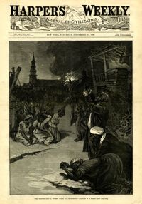
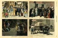
[Color image.] Main caption: 'After the Earthquake at Charleston.--drawn by W.A. Rogers and W.P. Snyder from sketches by Frederic Remington and A.J. Gustin.--[see page 610.]' Caption upper left: 'Open air preaching.' Caption upper right: 'Subsistence Committee.' Caption lower left: 'Negro prayer-meeting.' Caption lower right: 'Relief committee.' [full date September 18, 1886.]
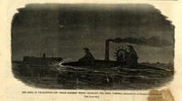
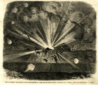
Caption: 'Siege of Charleston--the magazine of Fort Moultrie exploded by a shell from the grounded monitor Weehawken, Sept. 8.--from a sketch by our own Special Artist, W.T. Crane.' [full date October 3, 1863.]
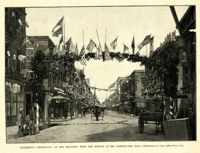
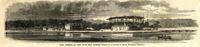
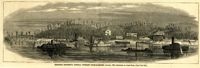
Caption: 'The Charleston Convention--view of the South Carolina Institute building, in Meeting Street, Charleston, S.C., where the Democratic Convention will hold its meeting during the present month of April.--from a sketch by our Special Artist.--see page 804.' [full date April 14, 1860.]
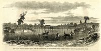
Caption: 'Remains of the new bridge over Ashley River, Charleston, S.C., partially destroyed by the Rebels on the evacuation of the city, Feb 18, 1865.--from a sketch by our Special Artist, W.T. Crane.' [full date June 10, 1865.]
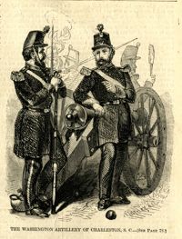
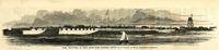
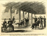
Caption: 'The Richland Rifles enjoying the "after-dinner hour," at their quarters on Sullivan's Island, Charleston Harbor, S.C. From a sketch taken on the spot by our Special Artist now in Charleston.' [full date March 2, 1861.]
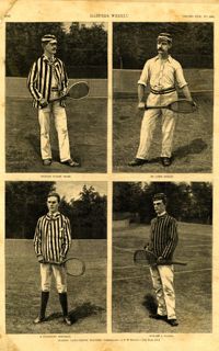
Main caption: 'Leading lawn-tennis players.--photographed by E.M. Bidwell.--[see page 583.]' Caption top left: 'Richard Dudley Sears.' Caption top right: 'Dr. James Dwight.' Caption bottom left: 'R. Livingston Beeckman.' Caption bottom right: 'Howard A. Taylor.' [full date September 11, 1886.]
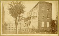
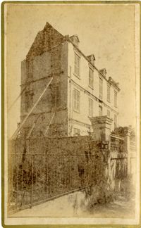
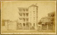
Caption: 'Cook's Earthquake Views of Charleston and Vicinity. Taken after the 31st of August, 1886. No.65, _____ Holmes, East Battery.' Written on front, at bottom: 'Charleston Earthquake scene - Holmes residence, East Battery.' Charleston city directory for 1886 shows Charles R. Holmes, Jr., at 19 East Battery.