Search
« Previous |
51 - 60 of 255
|
Next »
Search Results
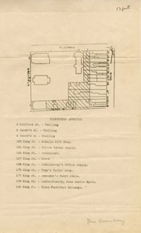
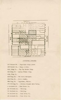
- Description:
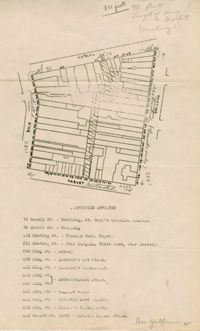
- Map of area bounded by Hasell, Meeting, King and Market Street.
- Description:
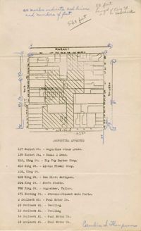
- Map of area bounded by Horlbeck Alley, King, Market, and Meeting Street.
- Description:
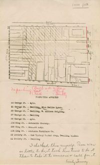
- Map of area bounded by Society, Meeting, George, and King Street.
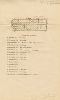
- Description:
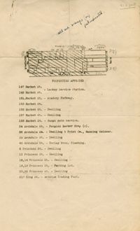
- Map of area bounded by Market, King, Princess, and Archdale Street.
- Description:
- Map of area bounded by Jacob's Alley, Archdale, Clifford, and King Street.
- Description:
- Map of area bounded by Clifford, King, Beresford, and Archdale Street.
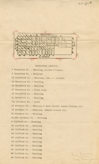
- Description:
- Map of area bounded by Princess, King, Beresford, and Archdale Street.
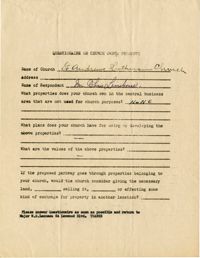
- Description:
- Church owned property questionnaire filled out for St. Andrew's Lutheran Church.
- Description:
- Map of area bounded by Market Street, Meeting Street, Horlbeck Street, and King Street.
- Description:
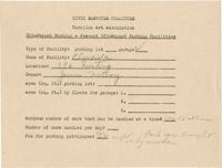
- Off-street parking facilities survey filled out for Al--cida on 396 Meeting Street.