Page 54 of the City Engineer's Plat Book with six plats. Plat 1 shows lots located near the intersection of Broad Street and Friend Street. Plat 2 shows land between the Ashley River's low water mark and Smith Street, and between Beaufain Street and Broad Street. It also labels Comings Creek, and an "Edge of High Land." Other Streets on Plat 2 include "Barre Street," Gadsden Street, Beaufain Street, Lynch Street, Queen Street, and Rutledge Street. Plat 3 shows numerous city blocks, "School Land," and a large creek near the Ashley River. Other streets on Plat 3 include Beaufain Street, Wentworth Street, Montague Street, Bull Street, and Pitt Street. Plat 4 shows a similar stretch of land to Plat 3. Plat 5 shows features a lot on Beaufain Street. Plat 6 shows a lot and buildings located near the intersection of King Street and Hutson Street.
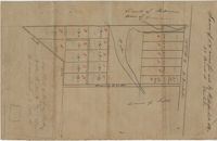
Copy of a plan of lots No.1-7, 9-11 on Cumberland Street in Charleston, Ward No.3. Indicates some buildings including a brick stable at No. 9 and DeBorr’s house and lot. “Lands of Mr. Edwards" is written above the lots. Names associated with this plat include De Borr, Edwards, and Charles Parker. Notable geographic locations include Church Street, Corr Alley or Philadelphia Street, Cumberland Street, and Ward Number 3.
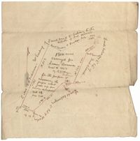
1300 acres surveyed for James Bowman, no land type or detail, shows property boundaries and neighboring plots. Names associated with this plat are James Bowman, Morris, Oswald, Warley, E.B. Fishburn, Lindsey, and B.G.O. Bryan. Notable geographic locations include New road leading to Parkers Ferry [?].
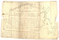
Small description of a 264 acre land, near Wappoo Creek, including land description. Names associated with this plat are John Schnerlie, Thomas S. Jones, and Edwin R. Dorrill. Notable geographic locations include the Ashley River, Wappoo Creek, Ashley Bridge Ferry Road, and Charleston District.
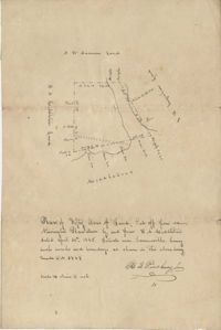
Plat consists of 50 acres titled Newington Plantation bounding on Middleton Plantation. Names associated with this plat include Johnson Middleton, N.W. Ancrum, G.H. Ingraham, R.B. Pinckney and H.A. Middleton.
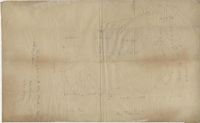
Pencil sketch of a plot of land that includes roads, creeks, and ponds, shows surrounding neighbors and little land detail. Names associated with this plat are Rich Jenkins. Notable geographic locations include Road to Bear Bluff and Wadmalaw River Marsh.
Plat of 1126 acres in St. James Goose Creek on Wasamasaw [Wassamassaw] Swamp. Plat is in pencil and is difficult to read the few details, although there are a few outlines of buildings included, but difficult to tell what they are. Names associated with this plat include Daniel Gelyer, J. Ferrels, Thomas Cusack [?], and James Haney. Notable geographic locations include Wasamasaw [Wassamassaw] Swamp, Sheep Island, Goose Creek, Road to Dorchester, and Ekells Branch.
Plat of 1199 acres in St. Johns Parish. Names associated with this plat are Daniel Gelyer, Peter Sanders, James Rown, Thompson, Meadwell, S. Brichelle [?] and Maun. Notable geographic locations include Berkeley.
Copy of two tracts of land A and B. A containing 1144 acres, and B, containing 580 located north of the Santee River and Duck Creek for Georgetown District. John Hutchinson, Chardon, Laroche, Foijsin, Gail Huger, Isaac Huger, Mark Hugin, Ford, Job. Rothmaklen, Jospeh Purcell and Charles Parker. Notable geographic locations include Mosquito Creek, Four Mile Creek, Belin Creek Duck Creek, Minim Creek, Santee River, Winyaw Bay, and Georgetown District.