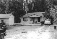
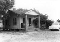
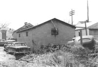
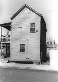
Outbuilding (small house) behind house on site affected by the construction of Interstate 26 (I-26). Surveyor notations on back of photo: "Dkt.: 10.471. Property owner: Pauline P. Badger. Tract: 132. Station: 5476+50 Lt. Date: Aug. 23, 1960. In R/W - Bought." [See collection description for explanation of surveyor notations.]
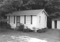
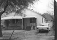
House on site affected by the construction of Interstate 26 (I-26). Surveyor notations on back of photo: "Dkt.: 10.471. Property owner: W.A. Buero. Tract: 133. Station: 5476+80 Lt. Date: Aug. 23, 1960. In R/W - Bought." [See collection description for explanation of surveyor notations.]
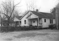
House on site affected by the construction of Interstate 26 (I-26). Surveyor notations on back of photo: "Dkt.: 10.471. Property owner: Sivley J. McKay. Tract: 134. Station: 5477+10 Lt. Date: Aug. 23, 1960. In R/W - Bought." [See collection description for explanation of surveyor notations.]
House on site affected by the construction of Interstate 26 (I-26). Sign for Owen's Dry Cleaners at left of photograph. Surveyor notations on back of photo: "Dkt.: 10.471. Property owner: Harry M. Charpia, Jr. Tract: 135. Station: 5377+50 Lt. Date: Aug. 23, 1960. In R/W - Bought." [See collection description for explanation of surveyor notations.]
House on site affected by the construction of Interstate 26 (I-26). Surveyor notations on back of photo: "Dkt.: 10.471. Property owner: Harry M. Charpia, Jr. Tract: 135. Station: 5377+50 Lt. Date: Aug. 23, 1960. In R/W - Bought." [See collection description for explanation of surveyor notations.]
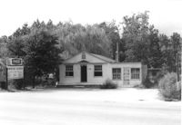
Owen's Dry Cleaners, on site affected by the construction of Interstate 26 (I-26). Building address number 2160. Surveyor notations on back of photo: "Dkt.: 10.471. Property owner: Willa W.S. Owens. Tract: 136. Station: 5477+80 Lt. Date: Aug. 23, 1960. In R/W - Bought." [See collection description for explanation of surveyor notations.]
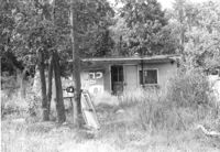
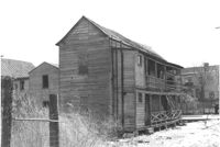
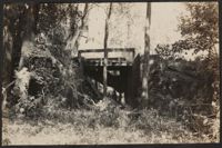
Small dilapidated building on site affected by the construction of Interstate 26 (I-26). Behind building in previous photograph (I-26 Photo 115). Surveyor notations on back of photo: "Dkt.: 10.471. Property owner: Willa W.S. Owens. Tract: 136. Station: 5477+80 Lt. Date: Aug. 23, 1960. In R/W - Bought." [See collection description for explanation of surveyor notations.]
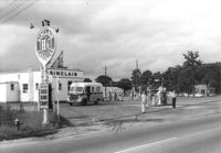
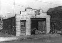
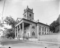
Sinclair gasoline station on site affected by the construction of Interstate 26 (I-26). Surveyor notations on back of photo: "Dkt.: 10.471. Property owner: Sinclair Refining Co. Tract: 138. Station: 1+50 Rt. (Remount Road). Date: Aug. 23, 1960. Proximity." [See collection description for explanation of surveyor notations.]
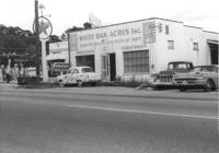
White Oak Acres, Inc. (butcher shop) on site affected by the construction of Interstate 26 (I-26). Neighboring Texaco gas station in background. Surveyor notations on back of photo: "Dkt.: 10.471. Property owner: R.H. Bowers. Tract: 139. Station: 1+30 Lt. (Remount Road). Date: Aug. 23, 1960. Proximity." [See collection description for explanation of surveyor notations.]
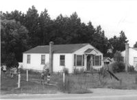
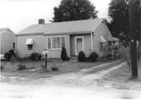
House on site affected by the construction of Interstate 26 (I-26). Surveyor notations on back of photo: "Dkt.: 10.471. Property owner: Mildred G. Bowers. Tract: 141. Station: 3+00 Lt. (Remount Road). Date: Aug. 23, 1960. Proximity." [See collection description for explanation of surveyor notations.]
Madame Baptiste writes to her brother Bishop Patrick Lynch about the health of their family, the Ursuline Convent in Columbia and the prevalence of yellow fever. September 18, 1858. 4p.
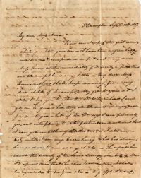
A letter from Anna Bella Wilkinson to her father, who is in Charleston for business. She discusses her trips to Town, and passes on an apology from her mother for not packing Dr. Wilkinson's shaving apparatus.
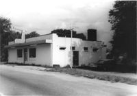
Building -- Simmons Garage -- on site affected by the construction of the Crosstown. Address: 76 Cooper Street or 78 Cooper Street. Front facade has stepped parapet. Surveyor notations on back of photo: "Dkt.: 10.518. Property owner: Helen Phillips Brown. Tract: 10. Station: 39+30 Rt. North Bound Survey of Route 17. Date: Mar. 6, 1963. In R/W - Bought. [See collection description for explanation of surveyor notations.]
Letter from Hetty Heyward to her mother, Mary Barnwell, in Beaufort, South Carolina. Hetty comments mostly about family affairs and health, frequently mentioning the "Fever" plaguing the area, and looks forward to a trip from Charleston to Beaufort to visit her mother. 4p.
Letter of thanks from Sarah Dehon of the Charleston Protestant Episcopal Domestic Missionary Society to Revd William H. W. Barnwell for remarks made on their behalf during a recent sermon given by Barnwell. February 7, 1834.
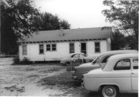
House on site affected by the construction of Interstate 26 (I-26). Surveyor notations on back of photo: "Dkt.: 10.471. Property owner: Palmetto Flower Corp. Tract: 143. Station: 5479+35 Lt. Date: Aug. 23, 1960. Building No. 1. In R/W - Bought." [See collection description for explanation of surveyor notations.]
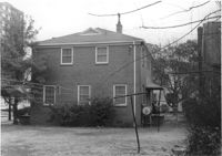
Dwelling on site affected by the construction of Interstate 26 (I-26). Appears to be a triplex or apartment house. Surveyor notations on back of photo: "Dkt.: 10.471. Property owner: Palmetto Flower Corp. Tract: 143. Station: 5480+00 Lt. Date: Aug. 23, 1960. Building No. 2. In R/W - Bought." [See collection description for explanation of surveyor notations.]
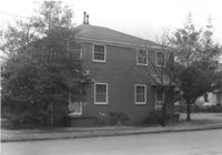
Dwelling on site affected by the construction of Interstate 26 (I-26). Surveyor notations on back of photo: "Dkt.: 10.471. Property owner: Palmetto Flower Corp. Tract: 143. Station: 5480+20 Lt. Date: Aug. 23, 1960. Building No. 3. In R/W - Bought." [See collection description for explanation of surveyor notations.]
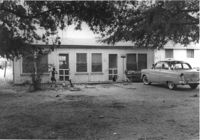
Dwelling on site affected by the construction of Interstate 26 (I-26). Appears to be a duplex. Surveyor notations on back of photo: "Dkt.: 10.471. Property owner: Palmetto Flower Corp. Tract: 143. Station: 5480+30 Lt. Date: Aug. 23, 1960. Building No. 4. In R/W - Bought." [See collection description for explanation of surveyor notations.]
Dwelling on site affected by the construction of Interstate 26 (I-26). Appears to be apartments. Surveyor notations on back of photo: "Dkt.: 10.471. Property owner: Palmetto Flower Corp. Tract: 143. Station: 5480+20 Lt. Date: Aug. 23, 1960. Building No. 5. In R/W - Bought." [See collection description for explanation of surveyor notations.]
Dwelling on site affected by the construction of Interstate 26 (I-26). Appears to be a duplex. Surveyor notations on back of photo: "Dkt.: 10.471. Property owner: Palmetto Flower Corp. Tract: 143. Station: 5479+50 Lt. Date: Aug. 23, 1960. Building No. 6. In R/W - Bought." [See collection description for explanation of surveyor notations.]
Dwelling on site affected by the construction of Interstate 26 (I-26). Building address number Apt. 10. Surveyor notations on back of photo: "Dkt.: 10.471. Property owner: Palmetto Flower Corp. Tract: 143. Station: 5479+50 Lt. Date: Aug. 23, 1960. Building No. 7. In R/W - Bought." [See collection description for explanation of surveyor notations.]
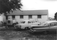
Dwellings on site affected by the construction of Interstate 26 (I-26). See previous seven photographs. Lane's Dry Cleaners and Laundry at left of photo. Surveyor notations on back of photo: "Dkt.: 10.471. Property owner: Palmetto Flower Corp. Tract: 143. Station: 5480+00 Lt. Date: Aug. 23, 1960. Panoramic view. In R/W - Bought." [See collection description for explanation of surveyor notations.]
Portaro's Pizza Spaghetti Restaurant on site affected by the construction of Interstate 26 (I-26). Surveyor notations on back of photo: "Dkt.: 10.471. Property owner: Marko Moskas, et al. Tract: 144. Station: 5478+15 Lt. Date: Aug. 23, 1960. In R/W - Bought." [See collection description for explanation of surveyor notations.]
Portaro's Pizza Spaghetti Restaurant on site affected by the construction of Interstate 26 (I-26). Surveyor notations on back of photo: "Dkt.: 10.471. Property owner: Marko Moskas, et al. Tract: 144. Station: 5478+15 Lt. Date: Aug. 23, 1960. In R/W - Bought." [See collection description for explanation of surveyor notations.]
Letter from William Manigault Heyward to his mother. Heyward mentions a drought that has severely hurt his rice crop and writes about hunting, fishing and daily rides with his wife Susan. 4p. June 20th, 1816.
Francis Lynch, Cheraw, writes to his brother, Bishop Patrick Lynch in Charleston, about a recommendation the Bishop had given to a third party concerning a job applicant. He also discusses their family's health and the business woes of their brother, Hugh. September 21, 1858. 4p.
A letter written from Philadelphia, reacting to news of a serious illness in Anna Wilkinson's family. The writer wishes to come visit the Wilkinson family, but is concerned about the "severity of the laws".
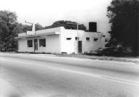
Rear view of building -- Simmons Garage -- on site affected by the construction of the Crosstown. Address: 76 Cooper Street or 78 Cooper Street. Surveyor notations on back of photo: "Dkt.: 10.518. Property owner: Helen Phillips Brown. Tract: 10. Station: 39+30 Rt. North Bound Route 17 Lane. Date: Mar. 6, 1963. In R/W - Bought. [See collection description for explanation of surveyor notations.]
Letter from Hetty Heyward to her mother-in-law, Mrs. Nathaniel Heyward. Hetty thanks her mother-in-law for various gifts and asks her to send flannel, candles and other sundry items. 4p.
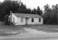
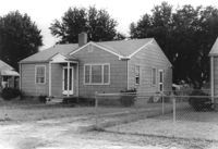
House on site affected by the construction of Interstate 26 (I-26). Surveyor notations on back of photo: "Dkt.: 10.471. Property owner: T.M. Evans. Tract: 145. Station: 5481+10 Lt. Date: Aug. 23, 1960. In R/W - Bought." [See collection description for explanation of surveyor notations.]
House on site affected by the construction of Interstate 26 (I-26). Surveyor notations on back of photo: "Dkt.: 10.471. Property owner: W.R. Wren. Tract: 148. Station: 5482+00 Lt. Date: Aug. 23, 1960. In R/W - Bought." [See collection description for explanation of surveyor notations.]
House on site affected by the construction of Interstate 26 (I-26). Surveyor notations on back of photo: "Dkt.: 10.471. Property owner: L. Pellatiro. Tract: 149. Station: 5282+60 Lt. Date: Aug. 23, 1960. In R/W - Bought." [See collection description for explanation of surveyor notations.]
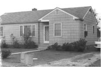
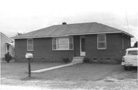
House on site affected by the construction of Interstate 26 (I-26). Building address number 13. Surveyor notations on back of photo: "Dkt.: 10.471. Property owner: N.B. Charles. Tract: 150. Station: 5483+20 Lt. Date: Aug. 23, 1960. In R/W - Bought." [See collection description for explanation of surveyor notations.]
House on site affected by the construction of Interstate 26 (I-26). Surveyor notations on back of photo: "Dkt.: 10.471. Property owner: Laura M. McGorty. Tract: 151. Station: 5483+80 Lt. Date: Aug. 23, 1960. In R/W - Bought." [See collection description for explanation of surveyor notations.]
House on site affected by the construction of Interstate 26 (I-26). Surveyor notations on back of photo: "Dkt.: 10.471. Property owner: T.M. Evans. Tract: 152. Station: 5484+40 Lt. Date: Aug. 23, 1960. In R/W - Bought." [See collection description for explanation of surveyor notations.]
House on site affected by the construction of Interstate 26 (I-26). Surveyor notations on back of photo: "Dkt.: 10.471. Property owner: T.M. Evans. Tract: 153. Station: 5485+00 Lt. Date: Aug. 23, 1960. In R/W - Bought." [See collection description for explanation of surveyor notations.]
House on site affected by the construction of Interstate 26 (I-26). Surveyor notations on back of photo: "Dkt.: 10.471. Property owner: Andrew J. Hovanec. Tract: 154. Station: 5485+50 Lt. Date: Aug. 23, 1960. Proximity." [See collection description for explanation of surveyor notations.]
House (rear view) on site affected by the construction of Interstate 26 (I-26). Surveyor notations on back of photo: "Dkt.: 10.471. Property owner: Andrew J. Hovanec. Tract: 154. Station: 5485+50 Lt. Date: Aug. 23, 1960. Proximity." [See collection description for explanation of surveyor notations.]
House (rear view) on site affected by the construction of Interstate 26 (I-26). Surveyor notations on back of photo: "Dkt.: 10.471. Property owner: Jacquelyne E. Kaylor. Tract: 156. Station: 5486+75 Lt. Date: Aug. 23, 1960. Proximity." [See collection description for explanation of surveyor notations.]
Letter from Mary Lynch Spann to her brother, Bishop Patrick Lynch, informing him of news of her family in Washington County, Texas. September 24, 1858. 4p.
In this letter, Emma apologizes for not keeping in touch with Anna since Emma's marriage, and reports that she has traveled frequently, from Beaufort to Charleston to Savannah and back. She also laments the damage done to Charleston by a fire, particularly the destruction of its two Methodist churches.
House (review view) on site affected by the construction of the Crosstown. Address: 76 Cooper Street. Surveyor notations on back of photo: "Dkt.: 10.518. Property owner: Lewis Rosen. Tract: 11. Station: 5965+10 CL Line 3, S.B. lane Route 17. Date: Mar. 6, 1963. In R/W - Bought. [See collection description for explanation of surveyor notations.]
Letter from Hetty Heyward to her mother-in-law, Mrs. Nathaniel Heyward. Hetty thanks her mother-in-law for various gifts sent via (Capt.?) Bythewood and corresponds with her about her children. 3p.
House on site affected by the construction of Interstate 26 (I-26). Surveyor notations on back of photo: "Dkt.: 10.471. Property owner: Jacquelyne E. Kaylor. Tract: 156. Station: 5486+75 Lt. Date: Aug. 23, 1960. Proximity." [See collection description for explanation of surveyor notations.]
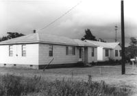
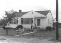
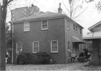
House on site affected by the construction of Interstate 26 (I-26). Address: 40 Enston Avenue [40 North Enston Avenue]. Surveyor notations on back of photo: "Dkt.: 10.503. Property owner: George Stamos, et al. Tract: 2. Station: 5891+35 Rt. Date: Feb. 19, 1963. In R/W - Bought." [See collection description for explanation of surveyor notations.]
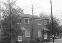
House (rear view) on site affected by the construction of Interstate 26 (I-26). Address: 40 Enston Avenue [40 North Enston Avenue[. Surveyor notations on back of photo: "Dkt.: 10.503. Property owner: George Stamos, et al. Tract: 2. Station: 5891+35 Rt. Date: Feb. 19, 1963. In R/W - Bought." [See collection description for explanation of surveyor notations.]
Dwelling (rear view) on site affected by the construction of Interstate 26 (I-26). Address: 39-43 Mount Pleasant Street. Surveyor notations on back of photo: "Dkt.: 10.503. Property owner: Joyce L. Darby, et al. Tract: 3. Station: 5891+00 Rt. Date: Feb. 19, 1963. Portion in R/W to be removed." [See collection description for explanation of surveyor notations.]
Dwelling on site affected by the construction of Interstate 26 (I-26). Address: 39-43 Mount Pleasant Street. Appears to be a duplex. Surveyor notations on back of photo: "Dkt.: 10.503. Property owner: Joyce L. Darby, et al. Tract: 3. Station: 5891+00 Rt. Date: Feb. 19, 1963. Portion in R/W to be removed." [See collection description for explanation of surveyor notations.]
Dwelling (rear view) on site affected by the construction of Interstate 26 (I-26). Address: 39-43 Mount Pleasant Street. Surveyor notations on back of photo: "Dkt.: 10.503. Property owner: Mary Ellen Long Way. Tract: 4. Station: 5891+80 Lt. Date: Feb. 19, 1963. In R/W - Bought." [See collection description for explanation of surveyor notations.]
Dwelling on site affected by the construction of Interstate 26 (I-26). Address: 39-43 Mount Pleasant Street. Appears to be a duplex. Surveyor notations on back of photo: "Dkt.: 10.503. Property owner: Mary Ellen Long Way. Tract: 4. Station: 5891+80 Lt. Date: Feb. 19, 1963. In R/W - Bought." [See collection description for explanation of surveyor notations.]
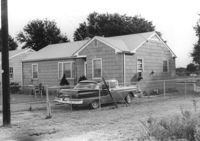
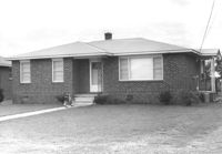
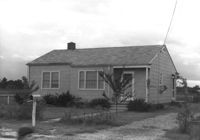
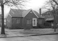
House on site affected by the construction of Interstate 26 (I-26). Address: 169 Laurel Avenue. Surveyor notations on back of photo: "Dkt.: 10.503. Property owner: Ernestine L. Captain. Tract: 5. Station: 5892+10 Rt. Date: Feb. 19, 1963. In R/W - Bought." [See collection description for explanation of surveyor notations.]
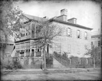
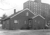
House (corner view, rear) on site affected by the construction of Interstate 26 (I-26).Address: 169 Laurel Avenue. Joseph Floyd Manor (Mount Pleasant Street and King Street) in background. Surveyor notations on back of photo: "Dkt.: 10.503. Property owner: Ernestine L. Captain. Tract: 5. Station: 5892+10 Rt. Date: Feb. 19, 1963. In R/W - Bought." [See collection description for explanation of surveyor notations.]
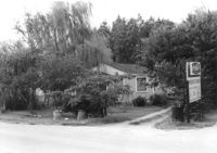
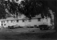
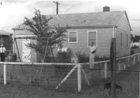
Backyard area and neighboring houses on site affected by the construction of Interstate 26 (I-26). Address: Laurel Avenue (?). Surveyor notations on back of photo: "Dkt.: 10.503. Property owner: Francis D. Guzzell. Tract: 7. Station: 5894+55 Rt. Date: Feb. 19, 1963. Proximity." [See collection description for explanation of surveyor notations.]
Madame Baptiste writes to Bishop Patrick Lynch about news at the Ursuline Convent in Columbia and that she is "glad to hear of our boxes, which we began to fear were gone to the fishes." September 29, 1858. 2p.
A letter from Dr. Willis Wilkinson to his daughter Anna. He discusses her upcoming visit, and talks about a nurse who may be available to work for Mary, if Mary prefers a white nurse.
House on site affected by the construction of the Crosstown. Address: 76 Cooper Street. Surveyor notations on back of photo: "Dkt.: 10.518. Property owner: Lewis Rosen. Tract: 11. Station: 5965+10 CL Line 3, S.B. lane Route 17. Date: Mar. 6, 1963. In R/W - Bought. [See collection description for explanation of surveyor notations.]
Nathaniel Heyward writes to his mother-in-law in Beaufort about purchasing a carriage for her in Charleston. He suggests that it would be wise to spend more money on a finely crafted one than one from an "inferior workman at a lower rate." He mentions news of his children and that his youngest, Nat, has been recently vaccinated. 3p.