Search
« Previous |
61 - 80 of 1,145
|
Next »
Search Results
- Description:
- "Parking in Business Areas," by Marjorie H. Walker.
- Description:
- List of labels for Public Housing Show, W.P.A., presented by the U.S. Housing Authority.
- Description:
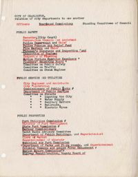
- List of City of Charleston city departments, indicating their relationship to one another.
- Description:
- A second version of "The Background of Traffic Congestion."
- Description:
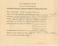
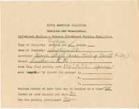
- Off-street parking facilities survey filled out for M.P. Headquarters with hand drawn map of parking on back.
- Description:
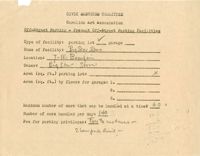
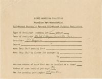
- Off-street parking facilities survey filled out for Market and Hayne Service Station Inc.
- Description:
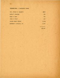
- List of underwriters for "Charleston Grows."
- Description:
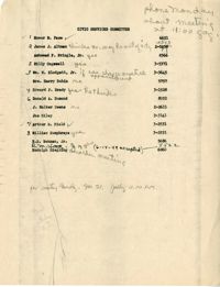
- Attendance list for a CSC meeting on Nov. 21, 1949.
- Description:
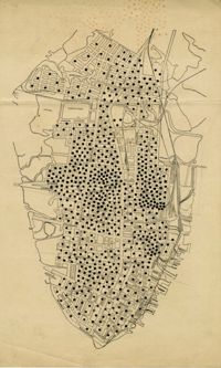
- Map of peninsula.
- Description:
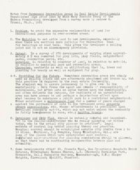
- Notes from "Permanent Recreation Areas in Real Estate Developments" by Mary Beattie Brady.
- Description:
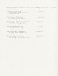
- Document listing foundations that have made grants for community and regional planning.
- Description:
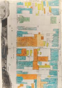
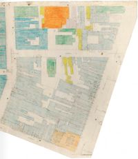
- Color-coded map of area between Meeting Street and King Street, bisected by Horlbeck Alley..
- Description:
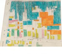
- Color-coded map of area around St. Philip Street at Calhoun Street near the Charleston Orphan House.
- Description:
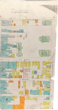
- Color-coded map of Archdale Street where Clifford Street, Beresford, and Princess intersect.
- Description:
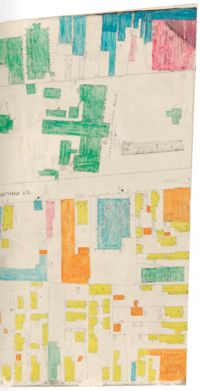
- Color-coded map of area bounded by Wentworth Street, Meeting Street, Market Street, and King Street.
- Description:
- Color-coded map of area around St. Philip Street near the Charleston Orphan House.
- Description:
- Off-street parking facilities survey filled out for Southern Railroad.
- Description:
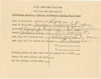
- Off-street parking facilities survey filled out for Big Star Store.
- Description:
- Off-street parking facilities survey filled out for Condon's Parking lot.
- Description:
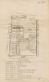
- Map of area bounded by George, King, Calhoun, and St. Philip Street.