This album is comprised of photographs, letters, newspaper clippings, and other documents from an expedition to French Equatorial Africa, in which Getrude Legendre participated. The expedition was sponsored by the American Museum of Natural History and the National Geographic Society, and collected plant and animal specimens, photographs of wildlife and people, and recordings of native dialects and music.
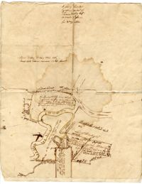
A hand-drawn map of land along the Waccamaw River and Wando Passo Thoroughfare in Georgetown, South Carolina, marking the owners of the surrounding land tracts The map also explains the sale of Sandy Island between the Pee Dee and Waccamaw Rivers from Thomas Waities to William Alston, Jr
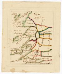
A hand-drawn map of land along the Pee Dee River which records the original land grants from 1711 The land of Thomas Diston and Lady Elizabeth Drake is marked, as well as swamp land and Tapsaw Plantation
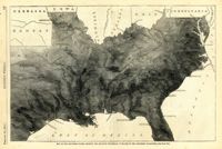
Caption: 'Map of the Southern states, showing the relative proportion of slaves in the different localities.--[see page 142.]' [full date February 28, 1863.]
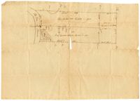
A hand drawn copy of a the Rose Hill Plantation plat "on the marsh side," which details the location of bodies of water (such as Heriot's Bay), types of tree, and amount of chains on the property.