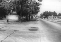
Site affected by the widening of State Road 13 (Remount Road). Surveyor notations on back of photo: "Dkt.: 10.562. Property owner: F.L. Parks, Jr. Tract: 3. Date: Jul. 12, 1967." [See collection description for explanation of surveyor notations.]
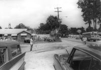
Site affected by the widening of State Road 13 (Remount Road). Esso gas Station: in background. Surveyor notations on back of photo: "Dkt.: 10.562. Property owner: Edna M. Tant. Tract: 5. Date: Jul. 12, 1967." [See collection description for explanation of surveyor notations.]
Site affected by the widening of State Road 13 (Remount Road). Surveyor notations on back of photo: "Dkt.: 10.562. Property owner: Barbara Pringle. Tract: 43. Date: Jul. 19, 1967." [See collection description for explanation of surveyor notations.]
Site affected by the widening of State Road 13 (Remount Road). A&P barely visible in background. Surveyor notations on back of photo: "Dkt.: 10.562. Property owner: E.H. Eickmeyer. Tract: 35. Date: Jul. 19, 1967." [See collection description for explanation of surveyor notations.]
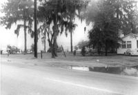
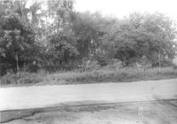
Site affected by the widening of State Road 13 (Remount Road). Surveyor notations on back of photo: "Dkt.: 10.562. Property owner: Elizabeth Gilmoor. Tract: 107. Date: Jul. 19, 1967." [See collection description for explanation of surveyor notations.]
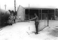
Site affected by the widening of State Road 13 (Remount Road). (Same as State Road 13 Photo 18.) Surveyor notations on back of photo: "Dkt.: 10.562. Property owner: A.G. Boone Co. Tract: 15. Date: Jul. 12, 1967." [See collection description for explanation of surveyor notations.]
Site affected by the widening of State Road 13 (Remount Road). (Same as State Road 13 Photo 18.) Surveyor notations on back of photo: "Dkt.: 10.562. Property owner: A.G. Boone Co. Tract: 15. Date: Jul. 12, 1967." [See collection description for explanation of surveyor notations.]
Site affected by the widening of State Road 13 (Remount Road). Surveyor notations on back of photo: "Dkt.: 10.562. Property owner: W.W. Walker, et al. Tract: 36-B. Date: Jul. 19, 1967." [See collection description for explanation of surveyor notations.]
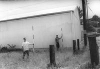
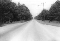
Site (affected by the widening of State Road 13 (Remount Road). Surveyor notations on back of photo: "Dkt.: 10.562. Property owner: West Virginia Pulp and Paper Co. Tract: 129. Date: Jul. 19, 1967." [See collection description for explanation of surveyor notations.]