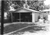
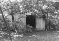
Garage at end of driveway, on site affected by the construction of Interstate 26 (I-26). Possibly on Rivers Avenue. Surveyor notations on back of photo: "Dkt.: 10.486. Property owner: M.V. & Beatrice Barrineau. Tract: 25-A. Station: 15+35 Rt. (Line C). Date: May 30, 1961. Bought." [See collection description for explanation of surveyor notations.]
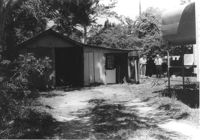
Garage of house on site affected by the construction of Interstate 26 (I-26). Building address number 33. Surveyor notations on back of photo: "Dkt.: 10.480. Property owner: Jesse L. Kennedy. Tract: 290. Station: 5738+85 Rt. (Line B). Date: May 30, 1961. In R/W - Bought." [See collection description for explanation of surveyor notations.]
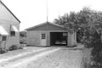
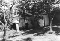
Garage on site affected by the construction of Interstate 26 (I-26). Surveyor notations on back of photo: "Dkt.: 10.480. Property owner: David W. Stone. Tract: 187. Station: 5686+00 Lt. (Line D). Date: May 31, 1961. In R/W - Bought." [See collection description for explanation of surveyor notations.]
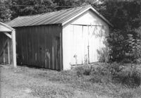
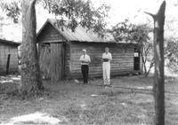
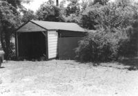
Garage or shed on site affected by the construction of Interstate 26 (I-26). Surveyor notations on back of photo: "Dkt.: 10.480. Property owner: William P. Nave. Tract: 189. Station: 5686+70 Lt. Date: May 31, 1961. In R/W - Bought." [See collection description for explanation of surveyor notations.]
Garage or shed on site affected by the construction of Interstate 26 (I-26). Surveyor notations on back of photo: "Dkt.: 10.480. Property owner: Leo J. Thigpen. Tract: 190. Station: 5686+50 Rt. Date: May 31, 1961. In R/W - Bought." [See collection description for explanation of surveyor notations.]
Garage/shed on site affected by the construction of Interstate 26 (I-26). Surveyor notations on back of photo: "Dkt.: 10.480. Property owner: O.H. Julian. Tract: 203. Station: 5690+45 Lt. Date: May 31, 1961. In R/W - Bought." [See collection description for explanation of surveyor notations.]
Garage/shed on site affected by the construction of Interstate 26 (I-26). Surveyor notations on back of photo: "Dkt.: 10.480. Property owner: Claude Henslee. Tract: 204. Station: 5690+75 Lt. Date: May 31, 1961. In R/W - Bought." [See collection description for explanation of surveyor notations.]
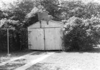
Garage or shed on site affected by the construction of Interstate 26 (I-26). Wood framing for another structure under construction and a motorboat and picnic table in photograph. Surveyor notations on back of photo: "Dkt.: 10.480. Property owner: James D. Smith. Tract: 233. Station: 5697+90 Lt. Date: May 31, 1961. In R/W - Bought." [See collection description for explanation of surveyor notations.]
Garage or shed on site affected by the construction of Interstate 26 (I-26). Surveyor notations on back of photo: "Dkt.: 10.480. Property owner: Charles E. Brewer. Tract: 235. Station: 5699+00 Lt. Date: May 31, 1961. In R/W - Bought." [See collection description for explanation of surveyor notations.]
Garage/shed on site affected by the construction of Interstate 26 (I-26). Surveyor notations on back of photo: "Dkt.: 10.480. Property owner: Florence K. Byfield. Tract: 248. Station: 5705+40 Lt. Date: May 31, 1961. In R/W - Bought." [See collection description for explanation of surveyor notations.]
Right of way--South Carolina--Charleston County, Highway planning--South Carolina--Charleston County, Vernacular architecture--South Carolina--Charleston County, Lost architecture--South Carolina--Charleston County, Dwellings--South Carolina--Charleston County, Garages--South Carolina--Charleston County✖[remove]10
Charleston County (S.C.)--Buildings, structures, etc.✖[remove]10