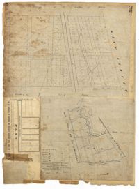
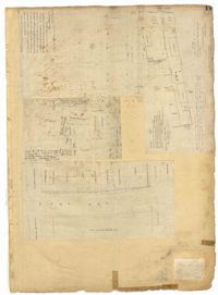
Page 98 of the City Engineer's Plat Book with three plats. Plat 1 shows lots between King Street and Meeting Street, including a stretch of railroad track and some marshlands. Plat 2 shows lots located near Rutledge Avenue. Plat 3 shows land located near a public road, showing a creek labelled "into Ashley," and stretches of marshland.
Page 21 of the City Engineer's Plat Book with six plats. Plat 1 shows land between Broad Street and Tradd Street, and Logan Street and New Street, including a sizable portion labelled "Middletons Lots." Plat 2 shows a lot on Broad Street and its buildings. Plat 3 shows lots located near Rutledge Street, Queen Street, Beaufain Street, and Smith Street, and some "City marshlands." Plat 4 shows plots located near Rutledge Street, Beaufain Street, Queen Street, and Smith Street. Plat 5 shows a lot and buildings located near the intersection of Queen Street and Mazyck Street. Plat 6 shows lots of land located on King Street, including one labelled "Unitarian Church."
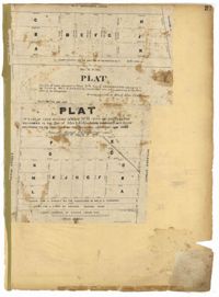
Page 22 of the City Engineer's Plat Book with five plats. Plat 1 shows lots located near the Charleston Harbor, Concord Street, Pinckney Street, and Pritchard Street. Plat 2 shows lots and structures located near the intersection of Concord Street and Pinckney Street, including a single-story building, a wharf, and a label reading "City property leased." Plat 3 shows a lot on Broad Street labelled "Lot of David McCredie." Plat 4 Shows lots located near Park Street, and between Shepherd Street and Line Street. Plat 5 shows lots near the intersection of Broad Street and Gadsden's Alley labelled with the names of banks.
Page 19 of the City Engineer's Plat Book with six plats. Plat 1 shows lots and buildings located near the intersection of Pitt Street and Bull Street. Plat 2 shows lots and buildings located near the intersection of Meeting Street and Reid Street. Plat 3 shows lots between King Street and Congress Street, also located near Grove Street and Moultrie Street. Plat 4 shows a lot on Amen Street labelled "Thomas N. Gadsen Esq." and noting multiple brick buildings. Plat 5 shows lots located on Cumberland Street. Plat 6 shows lots located on Amen Street and two two-story brick buildings.
Page 17 of the City Engineer's Plat Book with five plats. Plat 1 shows plots of land located on Logan Street. Plat 2 shows land on East Bay Street. Plat 3 shows a plot of land on the corner of East Bay Street and Gibbes Street. Plat 4 shows the "Old Exchange" located at the intersection of East Bay Street and Broad Street. Plat 5 shows lots located on East Bay Street between the intersections with Cumberland Street and Market Street, including a larger lot labelled "New Custom House Lot."
Page 30 of the City Engineer's Plat Book with one plat. The plat features the West Point Rice Mill on the Ashley River Channel. It shows numerous buildings and structures, a creek, and the nearby Bull Street, Montague Street, Barre Street, and Gadsden Street.
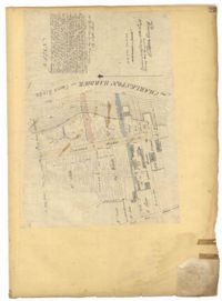
Page 23 of the City Engineer's Plat Book with one plat. The plat shows lots, buildings, shoals, and mud flats located near the Charleston Harbor on the Cooper River, Concord Street, Pinckney Street, and East Bay Street.
Page 31 of the City Engineer's Plat Book with two plats. Plat 1 shows lots located along a private street, between Mount Street and Congress Street. Plat 2 features lots located between Payne Street and Rutledge Street.
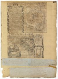
Page 207 of the City Engineer's Plat Book with two plats. Plat 1 is titled "The Plan of Charles Town With its Entrenchments and those made during the Siege by the English 1780," and shows Queen Street, Church Street, Tradd Street, King Street, Broad Street, the State House, the Market, the Arsenal, an "Old Church" and a "New Church." It also shows certain geographic features, including "Cummins Point," Cannons Point, and Hampstead Hill. Plat 2 has a label reading "This Map In every particular copied with a Pen from an Old Plat of Charles Town dated 1671 found in a Book of Plats of various parts of U.S.A. printed in London 1671." Plat 2 shows several geographic features such as rivers and islands, and features numerous illustrations. The largest illustration depicts two groups of people interacting from either side of a stream. Each group holds a single spear.
Page 205 of the City Engineer's Plat Book with two plats. Plat 1 shows "Lots in the Village of Rikersville," and shows Mechanics Street, 21 acres of marsh, a building labelled "Car Factory," a building labelled "Machinery," a building labelled "Wheat Mill," a canal, and a pond. Plat 2 shows lots and structures located between Pinckney Street and Market Street. Plat 2 also shows Hayne Street, Guignard Street, Church Street, Anson Street, Rafer's Alley, East Bay Street, a building labelled "Cotton Press," a park, and a building labelled "The Market."