Search Home
Search in
search for
Simple Search
Page Content Search
Title Search
Creator Search
Subject Search
Search
search icon
Search
Search Constraints
Start Over
You searched for:
Media Type
Maps
✖
Remove constraint Media Type: Maps
Date Range (beta)
1700
to
1749
✖
Remove constraint Date Range (beta): <span class="from" data-blrl-begin="1700">1700</span> to <span class="to" data-blrl-end="1749">1749</span>
« Previous
|
11
-
20
of
31
|
Next »
Sort
by Relevance
Relevance
Title
Date (Newest)
Date (Oldest)
Number of results to display per page
10
per page
10
per page
20
per page
50
per page
100
per page
View results as:
list icon
List
masonry icon
Masonry
Search Results
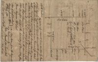
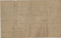
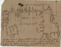
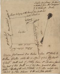
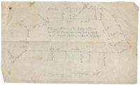
Plat in Goose Creek 1719
Colleton County Plat 1725
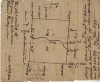
St. Peter's Parish Plat 1731
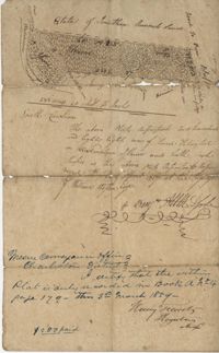
Ashepoo River Plat 1732
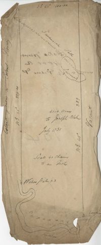
Plat in St. Bartholomew's Parish 1732
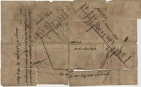
St. Bartholomew's Parish Plat 1732
Plat on Pon Pon River 1733
Horseshoe Creek Plat 1734
Ashley River Plat 1734
St. James Parish Plat 1734
« Previous
Next »
1
2
3
4
Limit your search
Collection
John McCrady Plats and Deeds Collection
31
Contributing Institution
South Carolina Historical Society
31
Media Type
Maps
✖
[remove]
31
Subject (Topic)
Conveyancing--South Carolina, Maps, Surveying--South Carolina
31
Subject (Geographic)
Ashepoo River (S.C.)
4
Edisto River (S.C.)
3
Pee Dee River (N.C. and S.C.)
2
Santee River (S.C.)
2
Ashley River (S.C.)
1
Beaufort District (S.C.)
1
Dorchester (S.C.)
1
Goose Creek (S.C.)
1
Johns Island (S.C.), Stono River (S.C.)
1
Johns Island (S.C.), Stono River (S.C.), Kiawah Island (S.C.)
1
more
Subject (Geographic)
»
Date
1735
4
1711
3
1705
2
1715
2
1732
2
1736
2
1706
1
1711-02-19
1
1714
1
1717
1
more
Date
»
Date Range (beta)
1700
to
1749
✖
[remove]
31
1700
to
1704
0
1705
to
1709
3
1710
to
1714
5
1715
to
1719
5
1720
to
1724
0
1725
to
1729
1
1730
to
1734
7
1735
to
1739
8
1740
to
1744
2
1745
to
1749
0
Current results range from
1705
to
1744
Date Range (beta) range begin
Date Range (beta) range end
View larger »