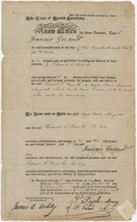
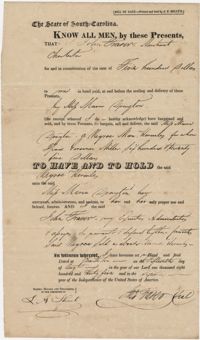
A bill of sale to Thomas S. Grimke for the purchase of a slave named August from Francis Giraud, who is described as "sound sober and no runaway." The back of the form includes a signed statement by attorney John Ward regarding the bill of sale.
Page 140 of the City Engineer's Plat Book with six plats. Plat 1 shows lots and structures located on and near Queen Street, between King Street and Meeting Street. Plat 2 shows lots located on Rutledge Street. Plat 3 shows lots located between George Street and Burns Lane, near where they intersect with Meeting Street. One lot is labelled "Property of Charleston High School." Plat 4 shows lots and structures located between Lynch Street and the Ashley River, near Broad Street and Beaufain Street. Plat 5 shows lots and structures located on the corner of King Street and Society Street. Plat 6 shows the same area as Plat 5, but with some changes to the structures.
Page 151 of the City Engineer's Plat Book with two plats. Plat 1 shows lots and structures located on and near Anson Street. Plat 2 shows lots and structures located between Coming Street and the Ashley River Channel, and between Elliott Street and Mill Creek. The plat also shows 50 acres of marsh, several bodies of water, Boundary Street, Pinckney Street, Cannon Street, and President Street.
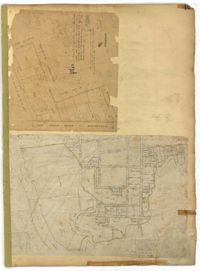
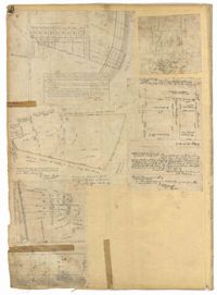
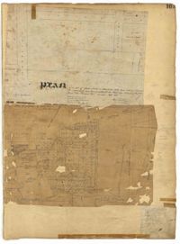
Page 16 of the City Engineer's Plat Book with five plats. Plat 1 shows lots close to the Ashley River located near Tradd Street and Gibbes Street, including a marsh flat labelled as "City Lands." Plat 2 shows lots located near the intersection of Tradd Street and Council Street, including "City marshlands." Plat 3 shows lots located near Gibbes Street and South Bay Street, and includes a dotted line labelled "Low Water Mark." Plat 4 shows land located between Ellery Street and Old Church Street, including a stretch of Raper Street. Plat 5 shows land near the intersection of South Bay Street and "Legare or Johnson Street," and close to the "Low Water" of the Ashley River.
Page 161 of the City Engineer's Plat Book with two plats. Plat 1 shows lots located near the intersection of South Street and Drake Street, and also shows America Street. Plat 2 shows a "Plan of Hampstead," which shows Meeting Street, a public square, Blake Street, Drake Street, Bay Street, Amherst Street, Reid Street, and Reid Street.
Page 24 of the City Engineer's Plat Book with three plats. Plat 1 shows lots located near King Street, Meeting Street, Wolf Street, March Lane, and Reid Street, including a portion of land labelled "Old fish pond low & broken land" and large label reading "Part of Hampstead." Plat 2 shows lots and features near the Charleston Harbor on the Cooper River, Boundary Street, Charlotte Street, Washington Street, and East Bay Street, and notes the "High Water Mark at Common Tides." Plat 3 shows lots located Meeting Street, Elizabeth Street, Ann Street, John Street, "Chapple Street," Alexander Street, and Washington Street, including a lot labelled "Tobacco Inspection."
Page 26 of the City Engineer's Plat Book with two plats. Plat 1 is a plan for a public square located near the intersection of Pinkney Street and Boundary Street, and shows a creek. Plat 2 features a lot located on the Ashley River channel and "Commings Creek," located near the intersections of Pinckney Street and Boundary Street, and Bull Street and Rutledge Street. Plat 2 also labels a pond, an island, and "Cannon's Point." Plat 3 shows lots located between Boundary Street and Bull Street, near the intersections with Barre Street, Gadsden Street, Lynch Street, Rutledge Street, Pitt Street, and "Comming Street."
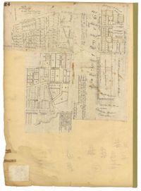
Page 34 of the City Engineer's Plat Book with four plats. Plat 1 shows lots located on South Bay Street. Plat 2 shows land located between Beaufain Street and Queen Street, near Smith Street, Wilson Street, and Franklin Street. Plat 3 shows lots located near Beaufain Street's intersections with Pitt Street and Wilson Street. Plat 4 features a lot and its buildings located on Meeting Street.
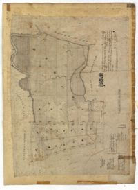
Page 225 of the City Engineer's Plat Book with one plat. The plat shows lots and marsh located east of King Street and north of Line Street. It also shows Meeting Street.