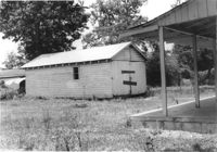
Structure (garage or shed) on site affected by the construction of Interstate 26 (I-26). Possibly on Rivers Avenue. Surveyor notations on back of photo: "Dkt.: 10.486. Property owner: Cleve G. Murray. Tract: 12. Station: 11+20 Lt. Date: May 30, 1961. In R/W - Bought." [See collection description for explanation of surveyor notations.]
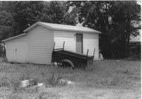
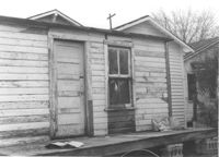
Structure (storage shed/garage) on site affected by the construction of Interstate 26 (I-26). Possibly on Rivers Avenue. Surveyor notations on back of photo: "Dkt.: 10.486. Property owner: Otis R. Burbage. Tract: 22 & 34. Station: 14+80 Rt. Date: May 30, 1961. In R/W to be moved." [See collection description for explanation of surveyor notations.]
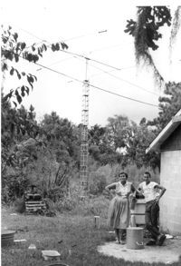
Lot with tall mast, on site affected by the construction of Interstate 26 (I-26). Surveyor notations on back of photo: "Dkt.: 10.471. Property owner: W.W. Gregory. Tract: 46. Station: 5330+00 Rt. Date: Aug. 23, 1960. Owner to move mast." [See collection description for explanation of surveyor notations.]
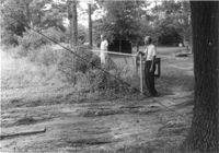
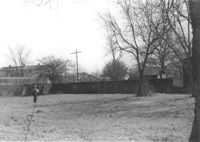
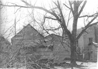
Property on site affected by the construction of Interstate 26 (I-26). Surveyor notations on back of photo: "Dkt.: 10.471. Property owner: Douglas E. Bohler, et al. Tract: 90. Station: 5374+20 to 5377+00 Lt. Date: Aug. 23, 1960. In R/W - Bought." [See collection description for explanation of surveyor notations.]
Lot on site affected by the construction of Interstate 26 (I-26). Address: 1204 King Street. Surveyor notations on back of photo: "Dkt.: 10.503. Property owner: Francis Hartnett. Tract: 24. Station: 5897+10 Rt. & Lt. Date: Feb. 19, 1963. In R/W - Bought." [See collection description for explanation of surveyor notations.]
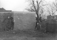
Part of a brick structure on lot, on site affected by the construction of Interstate 26 (I-26). Address: 1129 Meeting Street (rear). Surveyor notations on back of photo: "Dkt.: 10.503. Property owner: Coca Cola Bottling Co. Tract: 28. Station: 5899+05 Lt. Date: Feb. 19, 1963. Owner cleared R/W." [See collection description for explanation of surveyor notations.]
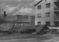
Construction debris and neighboring buildings on site affected by the construction of Interstate 26 (I-26). Address: 1220 King Street. Coca Cola Bottling Co. building (1129 Meeting Street) in background. Surveyor notations on back of photo: "Dkt.: 10.503. Property owner: House of God. Tract: 31. Station: 5900+30 Lt. Date: Feb. 19, 1963. In R/W - Bought." [See collection description for explanation of surveyor notations.]
Structure (shed?) on site affected by the construction of Interstate 26 (I-26). Address: within the range of 20-32 Brigade Street. Surveyor notations on back of photo: "Dkt.: 10.503. Property owner: Gussie Feldman. Tract: 41. Station: 5903+92 Lt. Date: Feb. 19, 1963. In R/W - Bought." [See collection description for explanation of surveyor notations.]
Structure on site affected by the construction of Interstate 26 (I-26). Address: 4 Maple Street. Surveyor notations on back of photo: "Dkt.: 10.503. Property owner: Frank Donnelly, et al. Tract: 48. Station: 5906+10 Lt. Date: Feb. 19, 1963. In R/W - Bought." [See collection description for explanation of surveyor notations.]
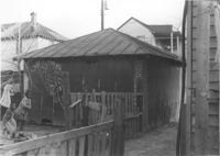
Structures (rear view) on site affected by the construction of Interstate 26 (I-26). Address: 18 Addison Street. Surveyor notations on back of photo: "Dkt.: 10.503. Property owner: Hessie Alston. Tract: 93. Station: 5918+75 Lt. Date: Feb. 20, 1963. In R/W - Bought." [See collection description for explanation of surveyor notations.]