House on site affected by the construction of the Crosstown. Address: 12 Todd Street. Surveyor notations on back of photo: "Dkt.: 10.524. Property owner: Buster Jones, et al. Tract: 123. Station: 88+65 CL Rt. Date: Dec. 2, 1964. In R/W - Bought." [See collection description for explanation of surveyor notations.]
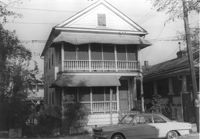
House on site affected by the construction of the Crosstown. Address: 128 Sheppard Street. Surveyor notations on back of photo: "Dkt.: 10.524. Property owner: Kawarsuan, Inc. Tract: 133. Station: 16+40 Lt. S.B. lane. Date: Dec. 2, 1964. Condemned." [See collection description for explanation of surveyor notations.]
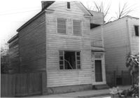
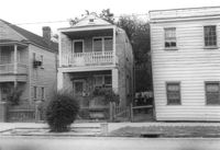
House on site affected by the construction of the Crosstown. Address: 14 Todd Street. Surveyor notations on back of photo: "Dkt.: 10.524. Property owner: Mable E. Brown. Tract: 124. Station: 88+80 Lt. Date: Dec. 2, 1964. In R/W - Bought." [See collection description for explanation of surveyor notations.]
House on site affected by the construction of the Crosstown. Address: 14 Todd Street. Surveyor notations on back of photo: "Dkt.: 10.524. Property owner: Mable E. Brown. Tract: 124. Station: 88+80 Lt. Date: Dec. 2, 1964. In R/W - Bought." [See collection description for explanation of surveyor notations.]
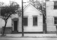
House (freedman's cottage) on site affected by the construction of the Crosstown. Address: 261 Ashley Avenue. Surveyor notations on back of photo: "Dkt.: 10.524. Property owner: Frank H. McGill, Estate. Tract: 77. Station: 78+40 Rt. Date: Oct. 14, 1964. In R/W - Bought." [See collection description for explanation of surveyor notations.]
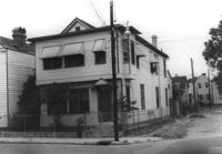
Corner view of house on site affected by the construction of the Crosstown. Address: 112 Bogard Street. View of street corner. Surveyor notations on back of photo: "Dkt.: 10.524. Property owner: Susan D. Butler, Est. Tract: 65. Station: 76+00 CL Rt. Date: Oct. 14, 1964. In R/W - Bought." [See collection description for explanation of surveyor notations.]
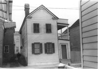
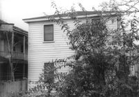
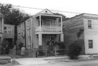
House (rear view) on site affected by the construction of the Crosstown. Address: 118C Bogard Street [118 Bogard Street]. Surveyor notations on back of photo: "Dkt.: 10.524. Property owner: Irvin S. Duffy. Tract: 60. Station: 74+55 Lt. Date: Oct. 14, 1964. In R/W - Bought." [See collection description for explanation of surveyor notations.]
House on site affected by the construction of the Crosstown. Address: 118C Bogard Street [118 Bogard Street]. Surveyor notations on back of photo: "Dkt.: 10.524. Property owner: Irvin S. Duffy. Tract: 60. Station: 74+55 Lt. Date: Oct. 14, 1964. In R/W - Bought." [See collection description for explanation of surveyor notations.]
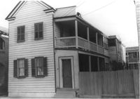
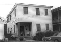
House on site affected by the construction of the Crosstown. Address: 164 President Street. Surveyor notations on back of photo: "Dkt.: 10.524. Property owner: Sarah G. Jenkins. Tract: 41. Station: 70+75 Lt. Date: Oct. 14, 1964. Corner in R/W." [See collection description for explanation of surveyor notations.]
House on site affected by the construction of the Crosstown. Address: 164 President Street. Surveyor notations on back of photo: "Dkt.: 10.524. Property owner: Sarah G. Jenkins. Tract: 41. Station: 70+75 Lt. Date: Oct. 14, 1964. Corner in R/W." [See collection description for explanation of surveyor notations.]