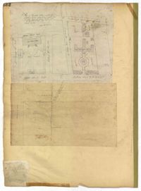
Page 132 of the City Engineer's Plat Book with two plats. Plat 1 features a plan for the College of Charleston, showing buildings labelled "Charleston College," "Library," "Lodge," and "Charleston Orphan House." Streets on this plat include George Street, Smith Street, College Street, Calhoun Street, St. Philips Street, and Vanderhorst Street. Plat 2 shows lots located near the intersection of Montague Street and Lynch Street.
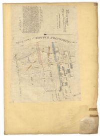
Page 23 of the City Engineer's Plat Book with one plat. The plat shows lots, buildings, shoals, and mud flats located near the Charleston Harbor on the Cooper River, Concord Street, Pinckney Street, and East Bay Street.
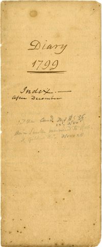
This plantation diary includes day-to-day management of Drayton plantations, (particularly Drayton Hall and Jehossee), focusing on crops, livestock, labor, and the movement of these between estates. Includes details on the unsatisfactory work of overseers, marriage of Charlotte Drayton, building of a new barn and slave houses, slave deaths from snake/spider bites and lightning strikes.
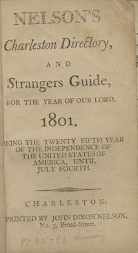
Published in 1801, the city directory for Charleston includes wharfage of vessels, goods and merchandise, the revenue system of the United States, the yearly almanac calendar, the court system of the United States, a list of U.S. towns, the postal and military service of the U.S., a list of duties, and listings of residents with occupations and addresses. The directory is 125 pages with pages 95 and 96 missing from this printing.
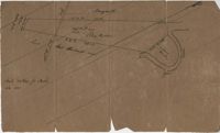
Copy of a plat of 200 acres in St. George’s Parish. The property lines and various trees located on them are the only details included. Names associated with this plat are Benjamin Cattell, Richard Bedon, and Edward North. Notable geographic locations are St. George's Parish and Cypress.
Copy of a plan annexed to a deed for 177 acres given by Ebenezer Simmons to the John's Island Society lying adjoining the church on Johns Island. Names associated with this plat are Johns Island Society, Ebenezer Simmons, James Lawson, Robert Gibbes, William Boone, John Freer, George Scott, Thomas Smith, Daniel Doyley, Joshua Ward, John Hanyon, John Moultrie, Isaac Wraught, and John Stanyarn.
Plat of land on Goose Creek belonging to Dr. Charles Drayton. Details include an area of marsh and the location of Goose Creek. Names associated with this plat are Dr. Charles Drayton, Michau, Manigault and Richards.
An inventory of the enslaved persons belonging to the estate of Col. Benjamin Garden at Richfield Plantation. The front of the document is a list of enslaved men, women, and children with their ages. The back side of the document lists enslaved women at Bluefield Plantation.
A typewritten transcription from Barnwell District of a deed of gift of young enslaved persons from Wilson Cook to his children. The names of the enslaved children are Abram, Henry, Nell and Sal.
Latin Inscription and Translation of Charles Louis (Lewis) D'Arsac de Ternay's Memorial in Newport, Rhode Island. The inscription identifies him as a "knight of the holy order of Jerusalem," a descendant of the Americans, an admiral of the kings fleet and his experiences during the Seven Year's War and the American Revolution.