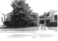
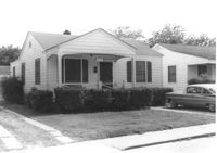
House on site affected by the construction of Interstate 26 (I-26).Address: 2133 Montford Avenue. Front of house almost completely obscured by trees. Surveyor notations on back of photo: "Dkt.: 10.490. Property owner: Floyd R. Wohnig. Tract: 181. Station: 5885+55 Rt. Date: May 15, 1962. In R/W - Bought." [See collection description for explanation of surveyor notations.]
House (corner view, rear) on site affected by the construction of Interstate 26 (I-26). Address: 2133 Montford Avenue. Surveyor notations on back of photo: "Dkt.: 10.490. Property owner: Floyd R. Wohnig. Tract: 181. Station: 5885+55 Rt. Date: May 15, 1962. In R/W - Bought." [See collection description for explanation of surveyor notations.]
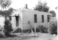
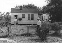
House (rear view) on site affected by the construction of Interstate 26 (I-26). Address: 2135 Montford Avenue. Surveyor notations on back of photo: "Dkt.: 10.490. Property owner: Paul E. West. Tract: 182. Station: 60'Rt. Sta. 5885+50. Date: May 15, 1962. In R/W - Bought." [See collection description for explanation of surveyor notations.]
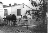
House on site affected by the construction of Interstate 26 (I-26). Address: 2135 Montford Avenue. Surveyor notations on back of photo: "Dkt.: 10.490. Property owner: Paul E. West. Tract: 182. Station: 60'Rt. Sta. 5885+50. Date: May 15, 1962. In R/W - Bought. Storage house to be retained by owner." [See collection description for explanation of surveyor notations.]
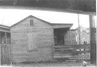
House (freedman's cottage) on site affected by the construction of the Crosstown. Address: 2 Lee Street. Surveyor notations on back of photo: "Dkt.: 10.518. Property owner: Kate R. Rosen. Tract: 71. Station: 30+00 Rt. Lee St. survey. Date: Mar. 7, 1963. In R/W - Bought." [See collection description for explanation of surveyor notations.]
House on site affected by the construction of Interstate 26 (I-26). Address: 2135 Montford Avenue. Surveyor notations on back of photo: "Dkt.: 10.490. Property owner: Paul E. West. Tract: 182. Station: 60'Rt. Sta. 5885+50. Date: May 15, 1962. In R/W - Bought. Storage house to be retained by owner." [See collection description for explanation of surveyor notations.]
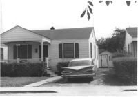
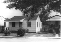
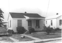
House on site affected by the construction of Interstate 26 (I-26). Address: 2137 Montford Avenue. Surveyor notations on back of photo: "Dkt.: 10.490. Property owner: Joseph E. Aldret. Tract: 183. Station: 100' Rt. Sta. 5885+30. Date: May 15, 1962. In R/W - Bought." [See collection description for explanation of surveyor notations.]
House (rear view) on site affected by the construction of Interstate 26 (I-26). Address: 2137 Montford Avenue. Surveyor notations on back of photo: "Dkt.: 10.490. Property owner: Joseph E. Aldret. Tract: 183. Station: 100' Rt. Sta. 5885+30. Date: May 15, 1962. In R/W - Bought." [See collection description for explanation of surveyor notations.]
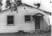
House (rear view) on site affected by the construction of Interstate 26 (I-26). Address: 2132 Weaver Avenue. Surveyor notations on back of photo: "Dkt.: 10.490. Property owner: Alvin C. Jervey. Tract: 184. Station: 120' Rt. Sta. 5886+50. Date: May 15, 1962. Proximity." [See collection description for explanation of surveyor notations.]
House on site affected by the construction of Interstate 26 (I-26). Address: 2132 Weaver Avenue. Surveyor notations on back of photo: "Dkt.: 10.490. Property owner: Alvin C. Jervey. Tract: 184. Station: 120' Rt. Sta. 5886+50. Date: May 15, 1962. Proximity." [See collection description for explanation of surveyor notations.]