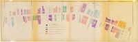
One of four maps of King Street building footprints, hand-colored to designate status. This map illustrates the historical significance of buildings on King Street from Calhoun Street to Queen Street.
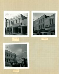
Three B&W photographs of buildings on the west side of King Street: Top left (337-339): 337 King Street (King's Restaurant) and 339 King Street (Fox Hi-Fi); Top right (331-335): 331 King Street, 333 King Street, and 335 King Street (Lesser-Tanenbaum); Bottom left (327-329): 327 King Street (Barton's Candy Card & Gift Shop) and 329 (Gloria Theater).
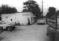
Avondale Laundry and Dry Cleaners, on site affected by the widening of State Road 13 (Remount Road). Trailer park in background. Surveyor notations on back of photo: "Dkt.: 10.562. Property owner: Edwards Realty Co. Tract: 4. Date: Jul. 12, 1967." [See collection description for explanation of surveyor notations.]
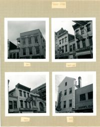
Four B&W photographs of buildings on the west side of King Street: Top left: 381 King Street (Felder's Rexall Drugs); Top right (367-369): 367 (Convertino's One Hour Cleaning) and 369 King Street (Lesser's Credit Jewelers); Bottom left (369-371): 369 King Street (Lesser's Credit Jewelers) and upper left portion of 371 King Street; Bottom right (341-343): 341 King Street (C.W. Kessler's) and 343 King Street (Askew's Clothiers).
Site affected by the widening of State Road 13 (Remount Road). Esso gas Station: in background. Surveyor notations on back of photo: "Dkt.: 10.562. Property owner: Edna M. Tant. Tract: 5. Date: Jul. 12, 1967." [See collection description for explanation of surveyor notations.]
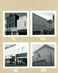
Four B&W photographs of buildings on the east side of King Street: Top left (340-342): 340 King Street (Charlie Gilik Tailor Shop) and 342 King Street (Dior's Wigs); Top right (334-338): 334 King Street (Elza's), 336 King Street, and 338 King Street; Bottom left (330-334): 330-332 King Street (Clement Furniture Co.) and 334 King Street (Elza's); Bottom right: 330-332 King Street (Clement Furniture Company).
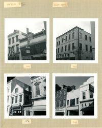
Four B&W photographs of buildings on the east side of King Street: Top left (368-370): 368 King Street (Club 400) (demolished for parking lot) and 270 King Street (World Finance Corp.); Top right: 362-364 King Street (Kaybee); Bottom left (354-356): 354 King Street and 356 King Street (White House Grocery); Bottom right (344-348): 344 King Street (Clark Clothier), 346 King Street, and 348 King Street (American Arcade - American Mortgage Co.)
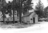
Mike's (possibly a garage), on site affected by the widening of State Road 13 (Remount Road). Trailer park in background. Surveyor notations on back of photo: "Dkt.: 10.562. Property owner: Edwards Realty Co. Tract: 5. Date: Jul. 12, 1967." [See collection description for explanation of surveyor notations.]
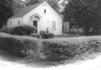
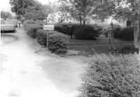
House on site affected by the widening of State Road 13 (Remount Road). 1548 Remount Road. Surveyor notations on back of photo: "Dkt.: 10.562. Property owner: Harry R. Parkinson, et al. Tract: 61. Date: Jul. 19, 1967." [See collection description for explanation of surveyor notations.]
House on site affected by the widening of State Road 13 (Remount Road). 1552 Remount Road. Surveyor notations on back of photo: "Dkt.: 10.562. Property owner: Robert W. Kimbel. Tract: 60. Date: Jul. 19, 1967." [See collection description for explanation of surveyor notations.]