156 acres laid out to John Bayly and granted to the said John Bayly in 1698 in Colleton County. Names associated with this plat are George Mitchell, John Bayly, and John Andrews.
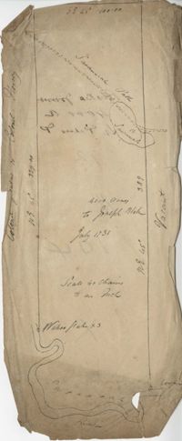
Plat consists of 4,000 acres in St. Peter’s Parish belongs to Joseph Blake granted July 1731. Names associated with this plat are Joseph Blake, Horrey and Stevens. Notable locations include St. Peter's Parish, Savannah River and Savannah Path.
1100 acres of land belonging to Thomas Woodward on the east and west side of Fish Pond Creek known as Ashepoo River. Names associated with this plat are Thomas Woodward, Elizabeth Woodward, James St. John, Billinger, and Blaky, and William. Notable geographic locations include Ashepoo River and Fish Pond Creek.
650 acres belonging to Thomas Cordes on eastwest side of Fishpond Creek/ Ashepoo River bounding northwest on Elizabeth Woodward and south by Captain John Gibbes. Names associated with this plat are Thomas Cordes, Elizabeth Woodward, Captain John Gibbes, and Robert Johnson. Notable geographic locations include Fishpond Creek, the Ashepoo River and St. Bartholomew's Parish.
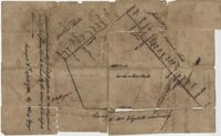
Plat contains 700 acres in Colleton County on the north side of Round O Savannah. Grant dated September 30, 1736. Names associated with this plat are Robert Bath, James St. John, James Ferguson and Peter Bremar. Notable geographic locations include Colleton County and St. Bartholomew's Parish.
Copy of plat of 230 acres granted to Bryan Presly in Colleton County on Pon Pon River. Names associated with this plat are Bryan Presly, and John Bull, and Hendrich. Notable geographic locations include Pon Pon River and Colleton County.
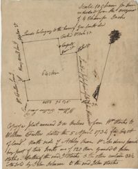
64 acre plot of land on the north side of the Ashley River, notes on the plat include some notes about stocks, shows surrounding tracts of lands, no land type or detail. Names associated with this plat are William Fuller, John Johnson, James Simmons, Stocks, William Fuller, George Smith, Henry Wood and John Hewson.
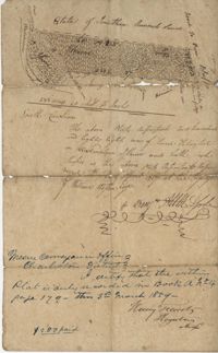
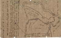
340 acres of land laid out to George Mitchell on the east side of a branch of Ashepoo River called the Horseshoe Creek. Names associated with this plat are George Mitchell, James St. John, Thomas Broughton and John Andrews. Notable geographic locations include the Ashepoo River and Horseshoe Creek.
Elias Horry's 454 acre plot in the St. James parish near the Santee River, shows property boundaries, no details on the property or type of land. Names associated with this plat include Elias Horry, Daniel Horry and A. Bonneau.
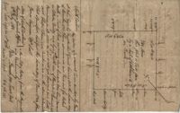
960 acres of land situated lying and being in Colleton County, butting and bounding to the north on part of John Seabrook's land to the east on Ashepoo River to the South on land of Captain Thomas Flemming and part of John Dears’ Land. Names associated with this plat are Benjamin Whitaker, Thomas Pinckney, Captain Thomas Flemming, John Seabrook, John Dear, Richard Woodward, John Hutchinson, John Godfrey, Samuel Larrington, James St. John, Godfrey, Elizabeth Woodward, William McPherson, Thomas M. Pinckney, and James M. Pinckney. Notable geographic locations are Ashepoo River, Dear's Creek and Colleton County.