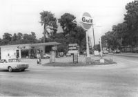
Gulf gas Station [Berkeley Gulf Service], on site affected by the widening of State Road 13 (Remount Road), with directional signs for Yeaman's Hall and Hanahan Baptist Church. Surveyor notations on back of photo: "Dkt.: 10.562. Property owner: C.D. Hoffecker Estate. Tract: 24. Date: Jul. 12, 1967." [See collection description for explanation of surveyor notations.]
Kayo gas station, on site affected by the widening of State Road 13 (Remount Road). Surveyor notations on back of photo: "Dkt.: 10.562. Property owner: S.R. Hill - K.O. Station. Tract: 66. Date: Jul. 19, 1967." [See collection description for explanation of surveyor notations.]
Bowers Hardware, on site affected by the widening of State Road 13 (Remount Road). Surveyor notations on back of photo: "Dkt.: 10.562. Property owner: J.R. Herrin. Tract: 82. Date: Jul. 19, 1967." [See collection description for explanation of surveyor notations.]
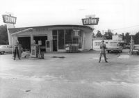
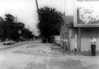
Crown gas station, on site affected by the widening of State Road 13 (Remount Road). Possibly the corner of North Rhett Avenue and Remount Road. Surveyor notations on back of photo: "Dkt.: 10.562. Property owner: Corco Realty Co. (Crown). Tract: 142. Date: Jul. 19, 1967." [See collection description for explanation of surveyor notations.]
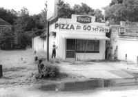
Little Italy pizza restaurant, next door to Remount Repair & Salvage, on site affected by the widening of State Road 13 (Remount Road). Surveyor notations on back of photo: "Dkt.: 10.562. Property owner: George Constantino. Tract: 116. Date: Jul. 19, 1967." [See collection description for explanation of surveyor notations.]
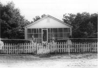
House on site affected by the widening of State Road 13 (Remount Road). (1488 Remount Road.) Surveyor notations on back of photo: "Dkt.: 10.562. Property owner: Mrs. J.L. McFadyen. Tract: 69. Date: Jul. 19, 1967." [See collection description for explanation of surveyor notations.]
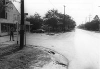
Building on site affected by the widening of State Road 13 (Remount Road). Corner view of building in State Road 13 Photo 34, corner of S-10-798 and Remount Road. View of street corner. Sign for the A&P across the street. Surveyor notations on back of photo: "Dkt.: 10.562. Property owner: Fannie Lou Owens. Tract: 32. Date: Jul. 12, 1967." [See collection description for explanation of surveyor notations.]
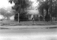
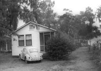
House on site affected by the widening of State Road 13 (Remount Road). Surveyor notations on back of photo: "Dkt.: 10.562. Property owner: Charles R. Roberson. Tract: 36. Date: Jul. 19, 1967." [See collection description for explanation of surveyor notations.]
House on site affected by the widening of State Road 13 (Remount Road). Surveyor notations on back of photo: "Dkt.: 10.562. Property owner: Charles R. Roberson. Tract: 36-A. Date: Jul. 19, 1967." [See collection description for explanation of surveyor notations.]
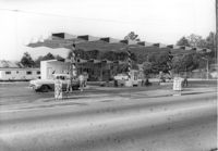
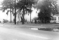
Site affected by the widening of State Road 13 (Remount Road). A&P barely visible in background. Surveyor notations on back of photo: "Dkt.: 10.562. Property owner: E.H. Eickmeyer. Tract: 35. Date: Jul. 19, 1967." [See collection description for explanation of surveyor notations.]