About the Collection
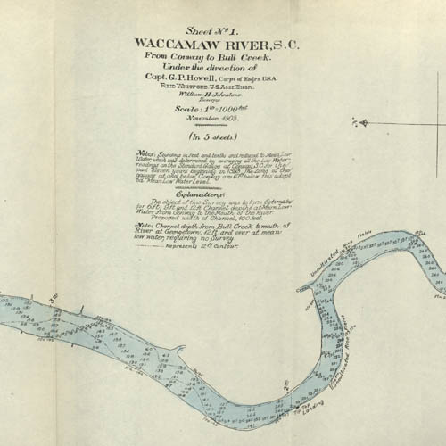
This collection contains five maps of the Waccamaw River in Horry County, S.C. from Conway to Bull Creek dated November 1903. The surveys were performed under the direction of Captain G. P. Howell, Corps of Engineers U.S.A. and Reid Whitford, U.S. Assistant Engineer. The surveyor was William H. Johnstone. These five maps show the soundings and some of the place names along the river. Also shown are proposed “cuts” that would straighten out parts of the river where extreme twists and turns made navigation by larger vessels difficult. The total distance shown by way of the river is approximately 26.5 miles.