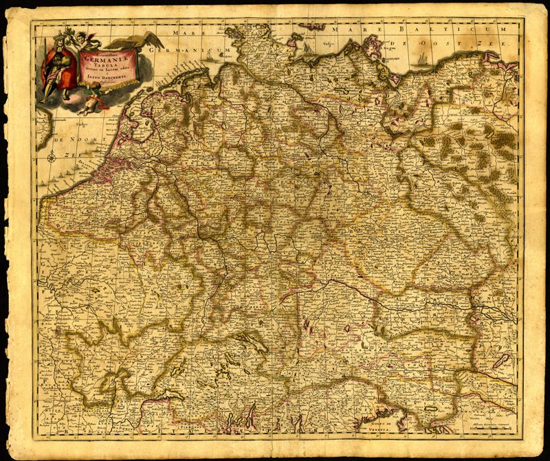
23. Accuratissima Germaniae Tabula Denuo in lucem edita
Close Viewer
Title:
23. Accuratissima Germaniae Tabula Denuo in lucem edita
Date:
1690
Creator (Personal):
Danckerts, Justus, 1635-1701
Description:
Map of central Europe by Justus Danckerts (1635-1701). Map extends from France in the west to Poland in the east and from Croatia and Italy in the south to the Netherlands in the north. The Hapsburg eagle holds the title banner in the upper left cartouche. Amsterdam. 52 x 62cm.