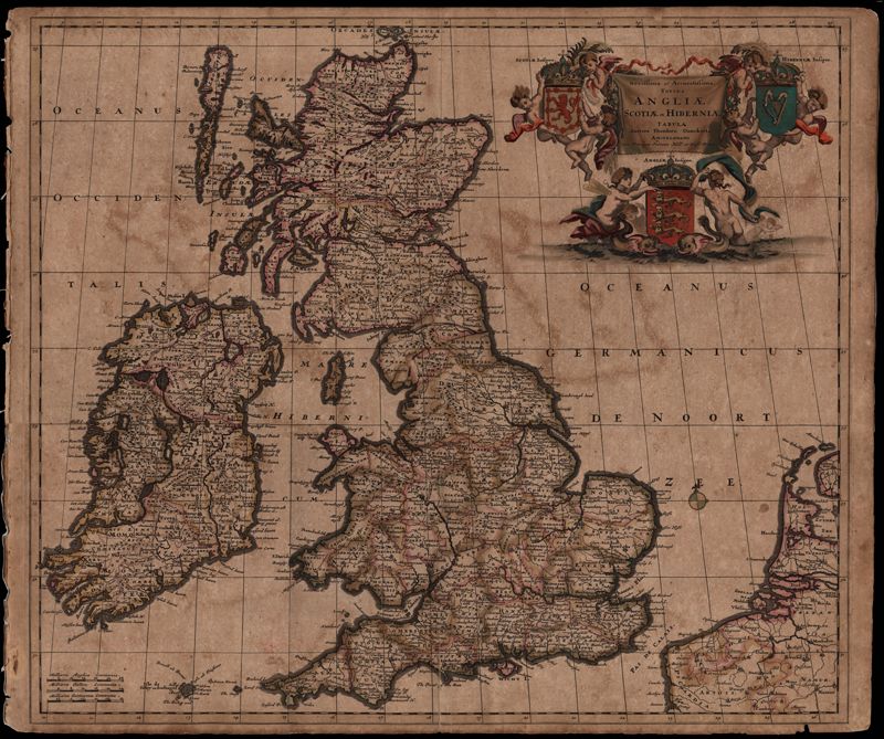
08. Novissima et Accuratissima Totius Angliae Scotiae et Hiberniae Tabula
Close Viewer
Title:
08. Novissima et Accuratissima Totius Angliae Scotiae et Hiberniae Tabula
Date:
1684
Creator (Personal):
Danckerts, Theodore, 1663-1727
Description:
Map of the British Isles by Theodore Danckerts (1663-1727) also includes part of the European coast. The decorative title cartouche is in the upper right corner with putti supporting the shields of Scotland, Ireland and England; the mileage scale is given in the lower left corner. Amsterdam. 52 x 62cm.