City Engineers's Plat Book, 1671-1951, Page 198
Close Viewer
- Title:
- City Engineers's Plat Book, 1671-1951, Page 198
- Date:
- 1885
- Description:
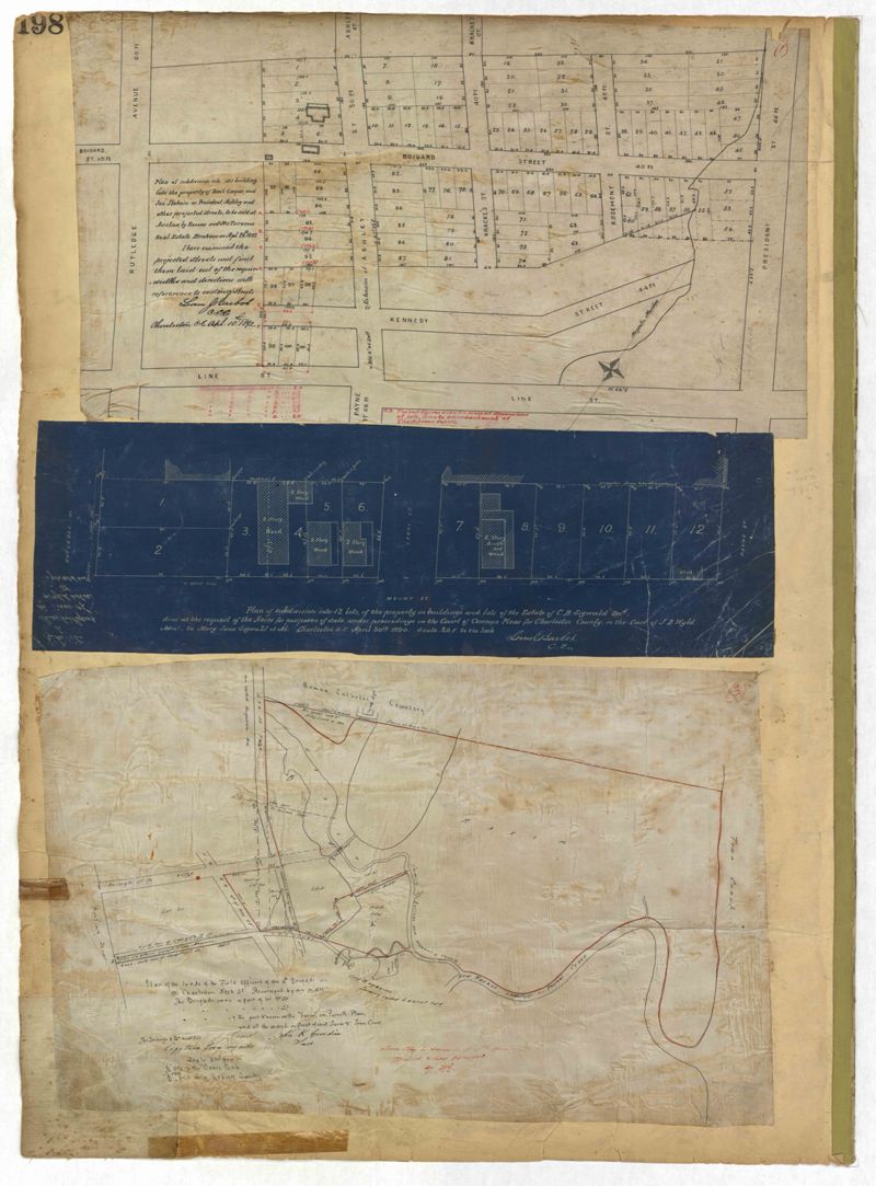
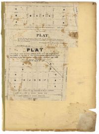
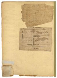
- Page 198 of the City Engineer's Plat Book with three plats. Plat 1 shows land between President Street and Rutledge Street, and also shows Ashley Street, Boignard Street, Kennedy Street, Payne Street, Rosemont Street, and Krackes Street. Plat 2 shows lots along Mount Street, between Rutledge Street and Payne Street. Plat 3 shows land between "Town Creek" and Meeting Street, and also shows some marshland and a lot labelled "Roman Catholic Cemetery."
- Collection Title:
- City Engineers's Plat Book, 1671-1951
- Contributing Institution:
- The Charleston Archive at CCPL and City of Charleston
- Media Type:
- Maps
- Personal or Corporate Subject:
- Barbot, Louis J.
Gourdin, John R. - Topical Subject:
- Cadastral maps and Surveys
- Geographic Subject:
- Charleston (S.C.)
- S.C. County:
- Charleston County (S.C.)
- Language:
- English
- Date Digital:
- 2023
- Digitization Specifications:
- 300 dpi, 24-bit depth, color, i2S SupraScan Quartz A0. Archival masters are tiffs.
- Format:
- image/jpeg
- Copyright Status Statement:
- Public domain.
- Access Information:
- This City of Charleston has placed this collection on permanent loan with the Charleston County Public Library. For more information and reuse requirements contact The Charleston Archive at Charleston County Public Library, 68 Calhoun Street, Charleston, SC 29411.
- Admin ID:
- 296731
Permalink