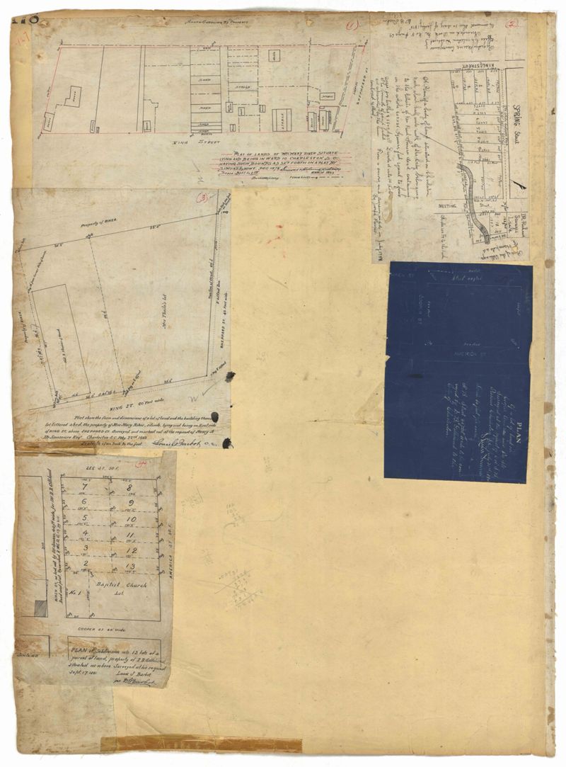
Page 178 of the City Engineer's Plat Book with five plats. Plat 1 shows lots and structures located on and near King Street, near the intersection with "Shepheard" Street. Plat 2 shows lots located on and near Spring Street, King Street, and Meeting Street. Plat 3 shows lots and a building located near the intersection of King Street and Sheppard Street. Plat 4 shows lots located on a city block between Cooper Street and Lee Street, and between Aiken Street and America Street. One lot is labelled "Baptist Church Lot." Plat 5 shows Cooper Street, Aiken Street, Lee Street, and America Street.
This City of Charleston has placed this collection on permanent loan with the Charleston County Public Library. For more information and reuse requirements contact The Charleston Archive at Charleston County Public Library, 68 Calhoun Street, Charleston, SC 29411.