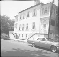
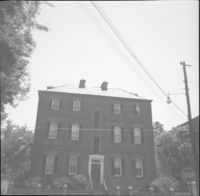
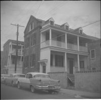
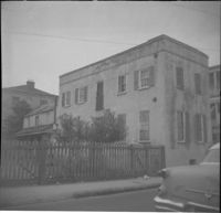
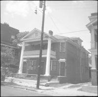
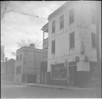
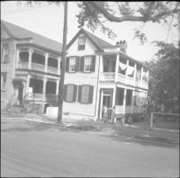
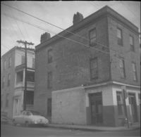
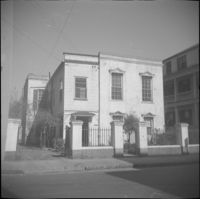
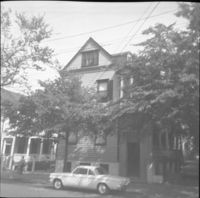
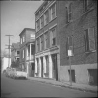
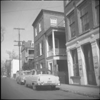
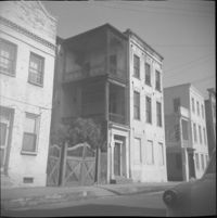
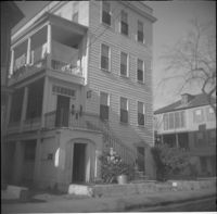
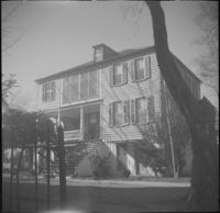
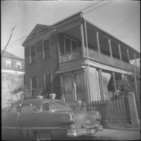
56 Society Street (Dr. Joseph Johnson House). Also in view to the right of 56 Society are 54 Society Street (George Black House) and 52 Society Street (James M. Stocker House).
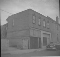
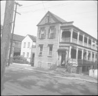
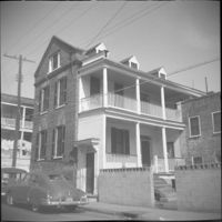
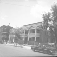
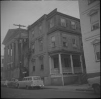
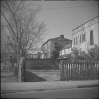
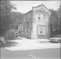
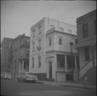
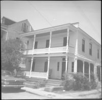
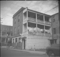
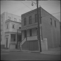
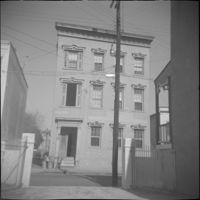
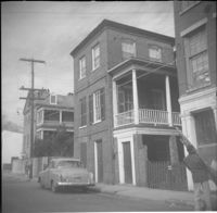
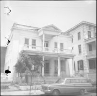
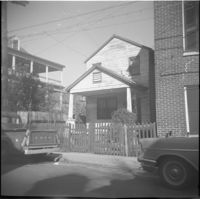
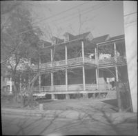
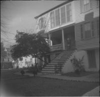
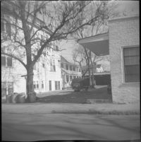
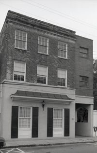
57 Society Street (William McElheran House), flanked by 55 Society Street (High School of Charleston) (left) and partial view of 59 Society Street (right).
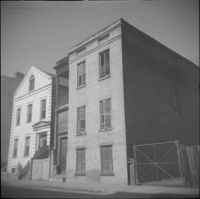
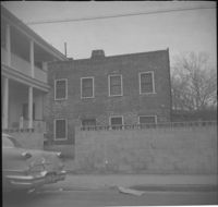
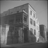
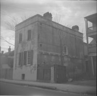
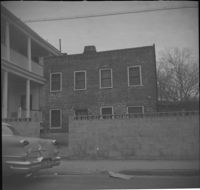
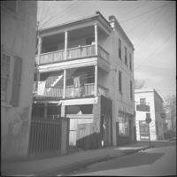
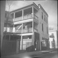
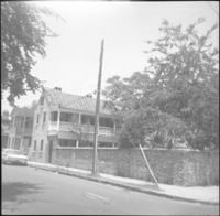
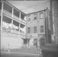
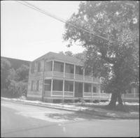
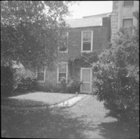
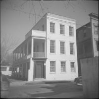
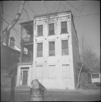
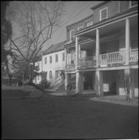
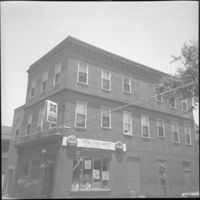
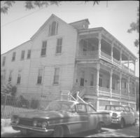
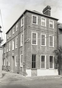
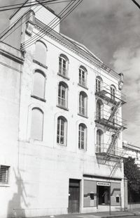
59 Society Street, flanked to its left by 55 Society Street (High School of Charleston) and 57 Society Street (William McElheran House), and to its right by 61 Society Street.
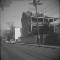
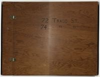
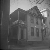
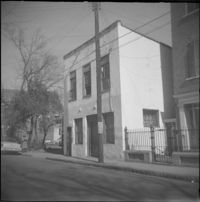
Compilation of original deeds, titles, and other documents related to the transfer, sale, and ownership of the double tenement at 72-74 Tradd Street, known as the Fotheringham-McNeil Tenements. Documents span from 1765 to 1961, likely representing the entire history of the ownership of the double tenement throughout that time period. Also includes blueprints and photographs. (NOTE: Fotheringham has also been spelled Fotheringham.)
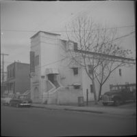
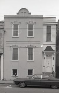
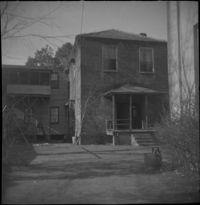
Black-and-white photograph of 83 Hasell Street, street (front) elevation, conjoined with the north elevation of 235 Meeting Street. (Currently the site adjacent to the Hasell Street entrance to Charleston Place.)
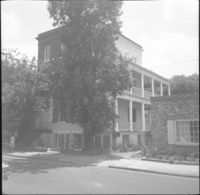
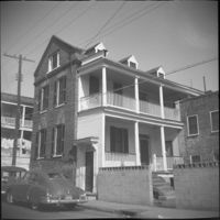
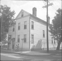
Right to left: 84 Anson Street before demolition and 86 Anson Street (Mary Smith House) before its relocation to its current address (82 Anson Street).
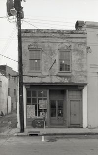
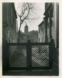
Black-and-white photograph of 87 Hasell Street (Original Art by Local Artists), street (front) elevation showing alleyway and buildings to the east, now the Hasell Street entry to Charleston Place and its parking garage.
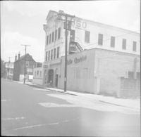
Black-and-white photograph of 92 Hasell Street [also known as 94 Hasell Street], the side entrance to Kerrison's Department Store, street (front) elevation. (The Kerrison's Building is an L-shaped building at 260 King).
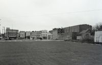
Black-and-white photograph of the east side of the 240 block of Meeting Street, from a parking lot at the corner of Meeting and Hasell Streets and showing 246 Meeting Street (Anderson Electric Co.). 248 Meeting, 250 Meeting, and 252 Meeting. Southwest elevations of 66 Hasell Street and 64 Hasell Street visible at right. (246-250 Meeting is currently a parking lot.)
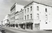
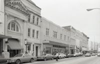
Black-and-white photograph of the east side of the 250 block of King Street, looking north from Hasell Street, starting at 254 King Street, showing 256 King Street, 258 King Street, 260 King Street, and beyond.
Black-and-white photograph of the west side of the 250 block of King Street, looking north, starting at 253 King Street, and showing 255 King Street, 257 King Street, 259 King Street, 265 King Street, and beyond.
This collection of gelatin silver photographs by Kenneth Clark consists of the original prints that were reproduced in three issues of the White Pine Series of Architectural Monographs, published by Russell F. Whitehead. The series was intended to provide 'intimate treatises of the architecture of the American colonies of the early Republic presented with well ordered completeness, to further a broader understanding and to create a permanent record of Early American architecture.'
In 1928, five issues highlighted Charleston architecture. The photographs feature Charleston buildings, street scenes, views, and architectural details. They appeared in three of the five Charleston issues: 'The Charm of Charleston: A New World City of Old World Memories' (vol. XIV, no. 2), 'Some Charleston Mansions' (vol. XIV, no. 4), and 'The Edwards-Smyth House' (vol. XIV, no.6).
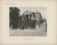
The folio, Examples of Colonial Architecture in Charleston, S.C. and Savannah, Ga., features photographic plates of some of the most important houses and buildings in Charleston and Savannah. Photographs include exterior views of the buildings, gates, and entrances, as well as interior views of fireplaces, mantels, doors, rooms, and ceilings. Compiled and photographed by Edward A. Crane and E.E. Soderholtz. Published in 1895 by the Boston Architectural Club (Boston, Mass.).
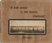
Guide for a walking tour of Charleston, containing a brief history of Charleston; descriptions of each location on the tour; and photographs of notable buildings. Published by Lanneau's Art Store (Charleston, S.C.). [6] p., [24] leaves : ill. ; 27 x 32 cm.
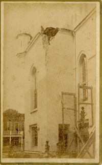
Caption: 'Cook's Earthquake Views of Charleston and Vicinity. Taken after the 31st of August, 1886. No.117, Citadel Square Baptist Church.' Also, handwritten at bottom, front: 'Charleston Earthquake scene - Citadel Square Baptist Church.'
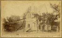
Caption: 'Cook's Earthquake Views of Charleston and Vicinity. Taken after the 31st of August, 1886. No.76, First Baptist Church, front.' Handwritten at bottom, front: 'Charleston Earthquake scene - First Baptist Church, Church Street.'
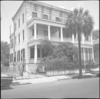
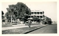
Looking north on East Battery Street from near the bend at White Point Gardens. Pedestrian is walking by White Point Gardens. Louis Desaussure House (1 East Battery) at center; Missroon House (40 East Bay Street) in the distance.
Black-and-white photograph of the view west across what was the location of Belk Department Store (232 King Street) and parking lot, now the site of Charleston Place (formerly known as Charleston Center). Shows the buildings on the west side of King Street on the 225 block: Riviera Theater (225 King), 229 King, 231 King, 233 King, 235 King, 237 King, and 239 King. Southeast elevation of 238-242 King Street at mid-right of photo.
Black-and-white photograph of the view east from the corner of King Street and Market Street toward Meeting Street, across what was the location of Belk Department Store and parking lot, now the site of Charleston Place (formerly known as Charleston Center). Also in view are the rear elevations of Meeting Street buildings and the Meeting Street elevation of the Arnold-Hornik Building (112 North Market).
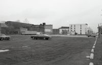
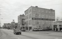
Black-and-white photograph of the view south across what was the location of Belk Department Store and parking lot, now the site of Charleston Place (formerly known as Charleston Center), to the south side of Market Street. Shows the cornier of Meeting Street and Market, Parson's Gulf Station (181-183 Meeting), Madren Paint Company (177 Meeting), and First Citizens Bank (182 Meeting).
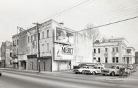
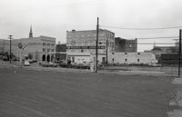
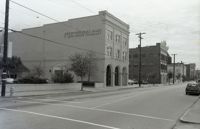
Black-and-white photograph of the west side of the 170 block of Meeting Street, looking south from the corner of Market Street. Shows Parson's Gulf Station (181-183 Meeting), Madren Paint Company (177 Meeting Street, 173 Meeting Street, and the Golden Eagle Motor Inn. (Currently the site of the Wells Fargo Banking Center.)
Black-and-white photograph of the view of the east side of King Street, looking south from Market Street, from 220 King Street to about 186 King Street. Shows 220 King, 218 King, 216 King, 214 King, 212 King, 210 King, 208 King, 206 King, 204 King, 202 King, 200 King, 188 King, 186 King.
Black-and-white photograph of the east side of Meeting Street looking south to from Market Street down to Cumberland Street. Shows 182 Meeting Street (First Citizens Bank), 172 Meeting Street, and other buildings since demolished.
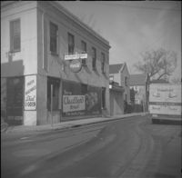
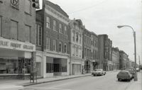
Black-and-white photograph of the west side of King Street below Market Street, starting from the southwest corner of King Street and Market Street. South Carolina Federal Savings & Loan (221 King Street) in foreground. Also shown are 219 King Street, 217 King Street, 215 King Street, and 213 King Street. (Currently the site of Majestic Square.)
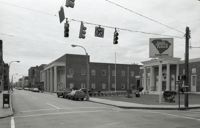
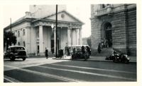
View of the intersection of Broad and Meeting Streets, featuring the Federal Courthouse and Post Office and St. Michael's Church. A car, motorcycle, and bus are on the street the street. Also shows pedestrian activity.