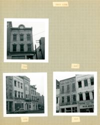
Three B&W photographs of buildings on the west side of King Street, demolished for the construction of Majestic Square: Top left: 223 King Street (Ocean Grill); Top right: 221 King Street (photograph is missing); Bottom left (219-223): 219 King Street (Rice Bros.), 221 King Street, and 223 King Street (Ocean Grill); Bottom right (217-219): 217 King Street and 219 King Street (Rice Bros.).
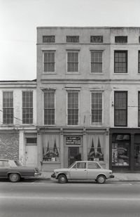
Black-and-white photograph of 219 Meeting Street (Mari Anne [restaurant]), 221 Meeting Street, street (front) elevation. Portions of adjacent buildings on either side, 217 Meeting Street (Wolper Shoe Co.) and 223 Meeting Street (Clair's Lucky Dollar Grocery Store) also in view.
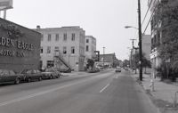
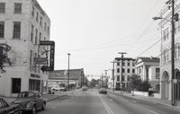
Black-and-white photograph of the view north on Meeting Street toward Market Street, from the Golden Eagle Motor Inn. Madren Paint Co. (177 Meeting) also in view.
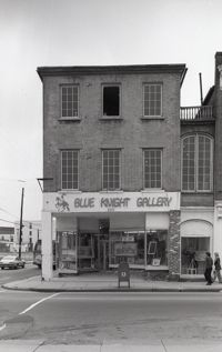
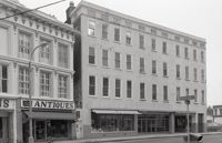
Black-and-white photograph of 220 King Street (Nathan Hart Building), street (front) elevation, with signage for Blue Knight Gallery. Also shows view of street corner (Market Street and King Street).
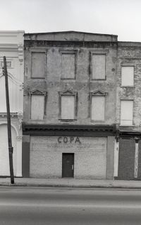
Two B&W photographs of buildings on the east side of King Street, both demolished for the construction of Charleston Place: Left (224-226): 224 King Street and 226 King Street (Ritz Hotel); Right: 222 King Street (Copa Lounge) (northeast corner of King and Market).
Four B&W photographs of buildings on the east side of King Street, including some that were demolished for the construction of Charleston Place: Top left (244-246): 244 Coastal Finance Loans and 246 King Street (The Linen Shop) demolished; Top right: 238-242 King Street (J.C. Penney Company) ? demolished; Bottom left (226-230): 226 King Street (Ritz [Hotel]), 228 King Street (Little Town), and 230 King Street demolished; Bottom right: 316 King Street (Rosalie Meyers) [labeled 318 on album page].
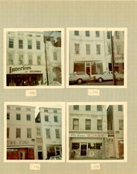
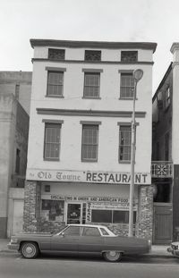
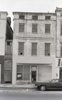
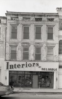
Four color photographs of buildings on the west side of King Street: Top left: 235 King Street (Interiors); Top right: 233 King Street; Bottom left: 231 King Street (The Tiki); Bottom right: 229 King Street (Old Towne Restaurant)
Black-and-white photograph of the view north from the intersection of Meeting Street and Market Street. Madren Paint Co. (177 Meeting) at left; First Citizens Bank (182 Meeting), Market Hall, and 112 North Market at right.
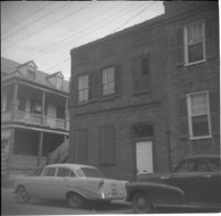
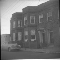
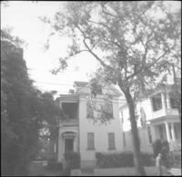
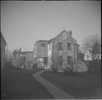
Left to right: 23 Society Street and 25 Society Street, later demolished. The houses were at the southwest corner of Society Street and East Bay Street.
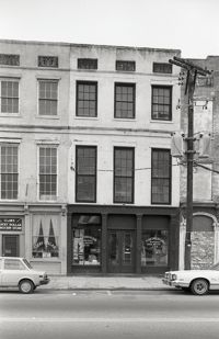
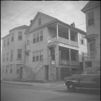
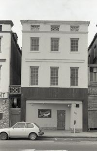
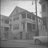
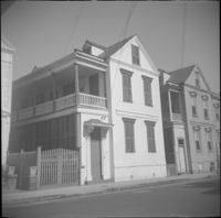
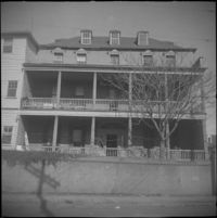
Black-and-white photograph 231 Meeting Street (Copa), 233 Meeting Street, and 235 Meeting Street, street (front) elevation. Shows the southwest corner of Meeting Street and Hasell Street, Kerrison's building in background.
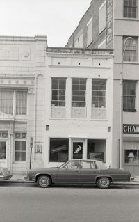
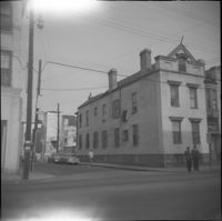
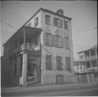
Black-and-white photograph of 232 Meeting Street (Western Union), located at the southeast corner of Meeting Street and Hasell Street. (Currently the site of FIG restaurant.)
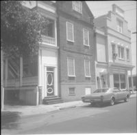
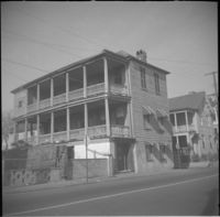
Black-and-white photograph of the northwest elevation of 235 Meeting Street. Shows the corner of Meeting and Hasell Streets and the north elevation of the building that extends west on Hasell Street. "Picture Framing" signage over window. Also shows neighboring buildings to the south in the view down Meeting. (Currently the site of Sticky Fingers Restaurant.)
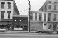
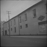
Black-and-white photograph of 238-242 King Street (previously the Hotel Calhoun) and 244 King Street (Annette Sandburg Antiques), street (front) elevation. Now the site of Charleston Place. Street sign for the intersection of Beaufain and King in foreground.
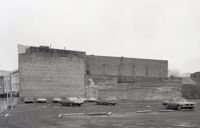
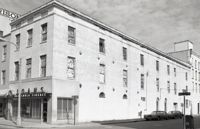
Black-and-white photograph of the view looking north across what was the location of Belk Department Store and parking lot (232 King Street), now the site of Charleston Place (formerly known as Charleston Center). Shows the southeast elevation of 238-242 King Street.
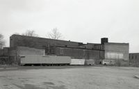
One of three black-and-white photographs of the structures at the rear of 238-242 King Street up to the rear of the buildings at about 199-203 Meeting Street, bordering what was the northern boundary of the Belk parking lot, and on the site where Charleston Center would be constructed.
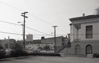
Black-and-white photograph of the view from the parking lot of First Citizens Bank (182 Meeting) to the northwest corner of Meeting and Market. South elevation of Market Hall at right.
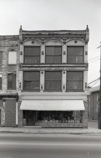
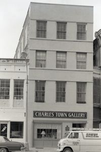
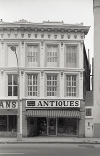
Black-and-white photograph of 243 (Siegling Music House), showing the corner of King Street and Beaufain Street. Signage on building for "Books" and "Book Basement."
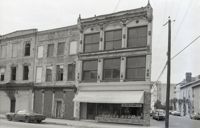
Four B&W photographs of buildings on the west side of King Street: Top left: 273 King Street (Mary Jane Shoe Store); Top right (263-267): 263 King Street (Legerton's), 265 King Street (Scottie Stores), and 267 King Street (Warner's); Bottom left (251-253): 251 King Street (Adams and Ortmann) and -253 King Street; Bottom right (243-245): 243 King Street (Siegling's) and 245 King Street (Silver 5 & 10 & 1.00 Store).
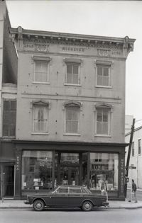
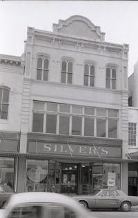
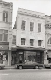
Black-and-white photograph of 245-247 King Street, street (front) elevation, showing the northwest corner of King Street and Beaufain Street, Silver's 5 & 10 & 1.00 Store.
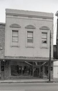
Black-and-white photograph of 248 King Street, street (front) elevation. Appears to be part of C.B. Prentiss Carpets Draperies Linoleum next door (250 King), formerly My Shop women's clothing store.
Black-and-white photograph of the view northwest from the corner of Market and Meeting Streets to the northwest corner of Meeting and Market. Columns and stairs to Market Hall in foreground.
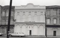
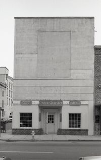
Black-and-white photograph of 252 King Street, street (front) elevation, showing the southeast corner of King Street and Hasell Street. Signage on building for The Connoisseur Shop Interior Design Antiques.
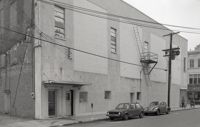
Black-and-white photograph of 252 King Street, north elevation on Hasell Street, showing the northeast corner of King and Hasell Streets. Portion of 249 King at right.
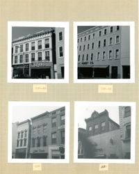
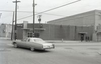
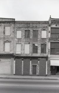
Four B&W photographs of buildings on the east side of King Street: Top left: 270-274 (Walgreens); Top right: 268 (McIntosh's); Bottom left (256-258): 256 King Street (Daisy Bogin) and 258 King Street (Snelgrove's); Bottom right: 254 King Street (Household Finance Co.)
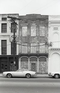
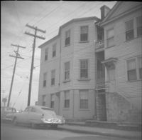
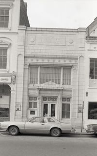
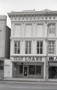
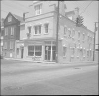
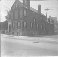
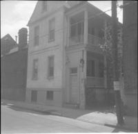
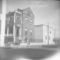
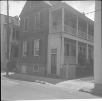
Black-and-white photograph of 254 King Street (Moses Levy Building), southwest corner of building. Signage on building for HFC Loans / Household Finance. Located at the northeast corner of Meeting Street and Hasell Street.
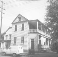
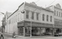
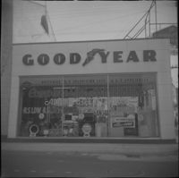
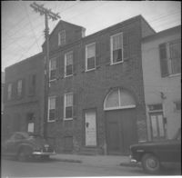
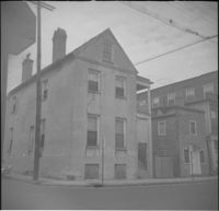
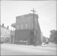
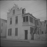
256 Meeting Street (William Gayer Carriage Factory) as a Goodyear Tire service center, before rehabilitation with a reconstructed façade. Located at the southeast corner of Meeting Street and Wentworth Street.
Wentworth Street façade of 256 Meeting Street (William Gayer Carriage Factory) when it was a Goodyear Tire service center. Located at the southeast corner of Meeting Street and Wentworth Street.
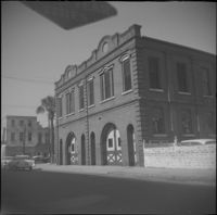
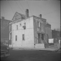
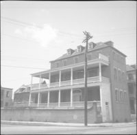
Wentworth Street elevation of the Central Fire Station (260-264 Meeting Street), located at the northeast corner of Meeting Street and Wentworth Street.
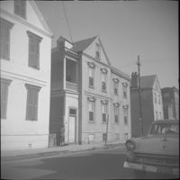
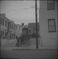
Society Street elevation of 272 Meeting Street, conjoined with 66½ Society Street, located at the northeast corner of Meeting Street and Society Street.
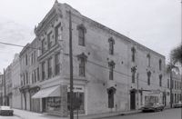
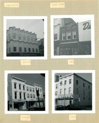
Four photographs of buildings on the east side of King Street (both color and B&W): Top left: 290 King Street (Annette's Blue Gown) (color photograph); Top right: 286 King Street (Hunley's Drugs) (color photograph); Bottom left (282-284): 282 King Street (Raley's Cafeteria) and 284 King Street (Citizens & Southern National Bank) (B&W photograph); Bottom right: 278 King Street (French Boot Shop) (B&W photograph).
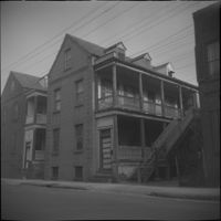
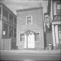
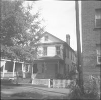
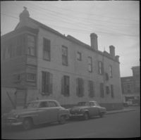
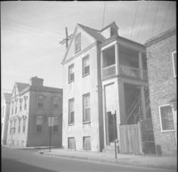
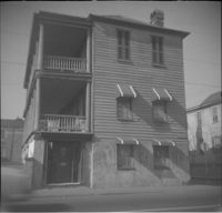
28 Wentworth Street, located at the northeast corner of Wentworth Street and Anson Street. Also features 26 Wentworth Street (right edge) and 53 Anson Street (William Thompson Tenement) (at left). Note, the Wentworth Street elevation of 53 Anson Street is 30 Anson Street.
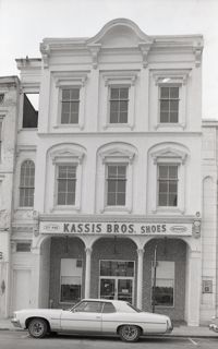
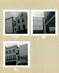
Three B&W photographs of buildings on the west side of King Street: Top left (295-297) 295 King Street (Friedman's) and 297 King Street (National Shirt Shop); Top right: 293 King Street (Hanover); Bottom left (285-287): 285 King Street (Charles Kerrison & Co.) and 287 King Street (Butler's Shoes).
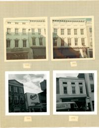
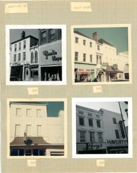
Four photographs of buildings on the east side of King Street (both color and B&W): Top left (316-320): 316 King Street (316-Rosalie Meyers) and 320 King Street (Evelyn Rubin); Top right (304-308): 304 King Street (Leroy's Jewelry Co.), 306 King Street (China Hall) and 308 King Street (Croghan's Jewel Box/The New Shoe Factory) (color photograph); Bottom left: 306 King Street (China Hall) (color photograph); Bottom right (294-296): 294 King Street (Haverty's) and 296 King Street (Levy's) (B&W photograph).
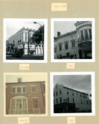
Three B&W photographs and one color photograph of buildings on the west side of King Street: Top left (319-325): 319 King Street (Bob Ellis Shoe Store), 321 King Street, 323 King Street (LeRoy's Jewelry Co.), and 325 King Street (Thom McAn); Top right: 315 King Street (Jean Meyers); Bottom left: 309-311 King Street (color photograph); Bottom right: 297 King Street (National Shirt Shop) (Arcade Theater sign on corner of building).
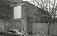
One of three black-and-white photographs of the side elevations of (possibly) 87 Hasell Street and its neighbor to the east at the time, 85 Hasell Street (gone). (87 Hasell Street currently borders the Hasell Street entry to Charleston Place and its parking garage.)
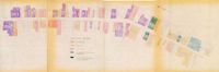
One of four maps of King Street building footprints, hand-colored to designate status. This map illustrates proposed reuses of buildings on King Street from Calhoun Street to Queen Street.
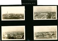
Four aerial views of Charleston looking across the peninsula. Top left: Looking northeast, possibly from City Hall. Landmarks include the rear dormitory apartments of the Confederate Home, St. Philip's Church, and the U.S. Customhouse. Top right: Looking north on Meeting Street, possibly from St. Michael’s Church, and showing the view west of Meeting Street. Vehicles, including a trolley car, can be seen on the street. Landmarks include the Timrod Hotel, Mills House Hotel, Fireproof Building, Circular Church, and Francis Marion Hotel (in the distance). Bottom left: Looking east on Calhoun Street, possibly from the Francis Marion Hotel, and showing the view east and west of Calhoun Street. Vehicles can be seen on the street. Landmarks include the Calhoun Monument in Marion Square, Citadel Square Baptist Church, and Emanuel A.M.E. Church. Bottom right: Looking north possibly from St. Michael’s Church. Landmarks include St. John's Lutheran Church, Unitarian Church, Grace Episcopal Church, and the Charleston Orphan House (in the distance at right).
309 East Bay Street (Watson's Grocery), located at the southwest corner of East Bay and Laurens Street, before demolition. (The house at 116 Anson Street was moved to this site with the current address 39 Laurens Street.)