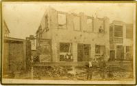
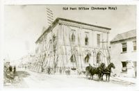
Caption: 'Cook's Earthquake Views of Charleston and Vicinity. Taken after the 31st of August, 1886. No.60, J.M. Wilson, Meeting St.' Charleston city directory for 1886 shows James M. Wilson at 39 Meeting Street.
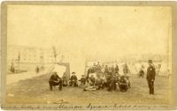
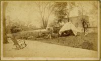
Handwritten at bottom, front: 'Charleston Earthquake scene - Marion Square - Citadel Academy in rear.' Tent village populated primarily by African-Americans. Policeman standing to the right.
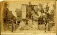
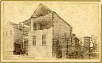
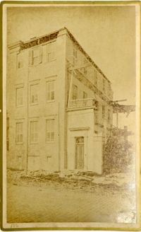
Caption: 'Cook's Earthquake Views of Charleston and Vicinity. Taken after the 31st of August, 1886. No.70, E.B. Hume, Legare Street.' Charleston city directory for 1886 shows Errington B. Hume at 17 Legare Street.
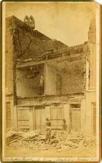
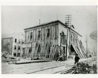
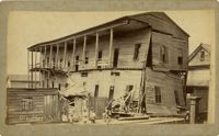
Charleston Earthquake scene. Labeled 'Old Hospital' in lower left corner, with 'Trapman Street' handwritten at bottom, front. Additional note on reverse: 'See Cook No.189 [from Series 2, which is captioned as 'Ruins of Colored hospital.']
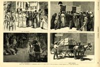
Caption: 'After The Earthquake At Charleston.--drawn by W.A. Rogers and W.P. Snyder from sketches by Frederic Remington and A.J. Gustin.--[see page 610.]' Individual captions: (top left): 'Open air preaching.' (top right): Subsistence committee.' (bottom left): 'Negro prayer-meeting.' (bottom right): 'Relief committee.' [full date September 18, 1886.]
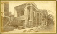
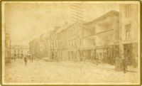
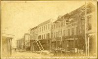
Caption: 'Cook's Earthquake Views of Charleston and Vicinity. Taken after the 31st of August, 1886. No.21, Broad Street, south side.' Sign on building, at right, reads: 'Cigars & Tobacco' and 'W.W. Smith, 27.' Charleston city directory for 1886 lists William M. Smith, seal, stencil and stamp works, at 29 Broad Street.
Caption: 'Cook's Earthquake Views of Charleston and Vicinity. Taken after the 31st of August, 1886. No.25, Vendue Range.' Written on front, at bottom: 'Charleston Earthquake scene - Vendue Range, foot of Queen St. near the wharf.' Sign for John Werner visible. Charleston city directory for 1886 shows business at 27 Vendue Range.