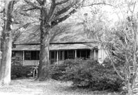
Battery Thomson, 2013 I'on Avenue. View of North (Front) elevation, looking West. Sullivans Island, S.C.;6.5" x 10" B/W photo. Box 16, Folder 2-13-7. One copy.
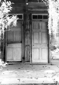
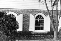
William Cain House - Main House. Detail View of Front Doors, North (Front) elevation. Pinopolis Historic District North. Pinopolis, S.C.;9.5" x 6.5" B/W photo. Box 4, Folder 1-10-1 (III). Two copies.
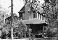
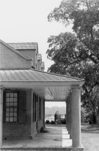
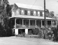
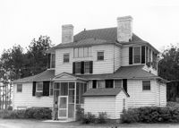
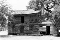
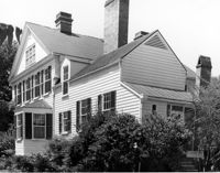
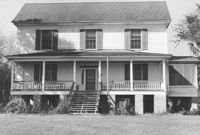
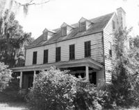
William Cain House - Main House. View of NE (Side and Front) elevation. Pinopolis Historic District North. Pinopolis, S.C.;6.5" x 9.5" B/W photo. Box 4, Folder 1-10-1 (III). Two copies.
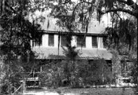
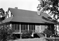
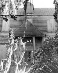
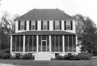
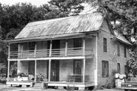
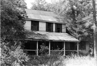
William Cain House - Main House. View of North (Front) elevation. Pinopolis Historic District North. Pinopolis, S.C.;6.5" x 9.5" B/W photo. Box 4, Folder 1-10-1 (III). Two copies.
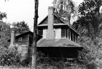
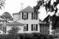
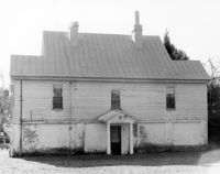
William Cain House - Main House. View of East (Side) elevation. Pinopolis Historic District North. Pinopolis, S.C.;6.5" x 9.5" B/W photo. Box 4, Folder 1-10-1 (III). One copy.
Isaac Porcher House, ca. 1844 - Pivotal to Historic District. View of North (Front) elevation. Pinopolis Historic District North. Pinopolis, S.C.;5" x 7" B/W photo. Box 3, Folder 1-10-1 (II). One copy.
Charles Stevens House, ca. 1854 - Pivotal to Historic District. View of Front and Side elevations. Pinopolis, S.C.;5" x 7" B/W photo. Box 3, Folder 1-10-1 (II). One copy.
W.J. Dennis House, ca. 1889 - Pivotal to Historic District. View of Side and Front elevations. Pinopolis, S.C.;5" x 7" B/W photo. Box 3, Folder 1-10-1 (II). One copy.
Henry L. Stevens House, ca. 1854 - Pivotal to Historic District. View of Front elevation. Pinopolis, S.C.;5" x 7" B/W photo. Box 3, Folder 1-10-1 (II). One copy.
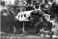
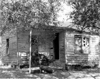
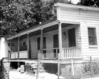
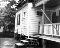
Unidentified House, ca. 1970 - Non-contributory to Historic District. Front elevation. Pinopolis, S.C.;5" x 7" B/W photo. Box 3, Folder 1-10-1 (II). One copy.
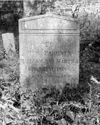
Colonel William Washington Cemetery. Tombstone of William and Martha Washington (1830). Ravenel, S.C.;10" x 8" B/W photo. Box 16, Folder 2-11-11. One copy.
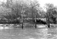
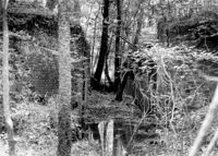
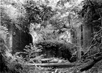
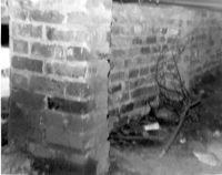
White Oak Lock. Lock #2 - Interior View of gate position. Tailrace Canal, Old Santee Canal Park. Berkeley, SC.;6.5" x 9.5" B/W photo. Box 3, Folder 1-9-2. One copy.
White Oak Lock. Lock #2 - View of flood gate pintel. Tailrace Canal, Old Santee Canal Park. Berkeley, SC.;6.5" x 9.5" B/W photo. Box 3, Folder 1-9-2. One copy.
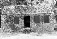
Boone Hall Plantation, Oak Avenue. Slave Cabin - View of SW (Side and Rear) elevation. Mount Pleasant, S.C.;8" x 10" B/W photo. Box 10, Folder 2-2-5. One copy.
Boone Hall Plantation, Oak Avenue. Gin House - View of NE (Front) elevation, looking East. Mount Pleasant, S.C.;6.5" x 10" B/W photo. Box 10, Folder 2-2-5. One copy.
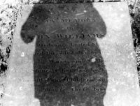
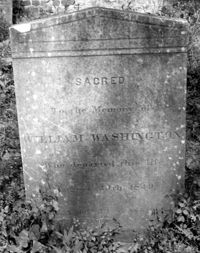
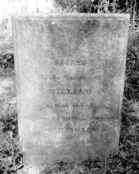
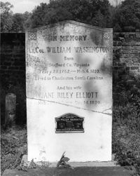
Colonel William Washington Cemetery. Tombstone of Colonel William Washington (1810) and Jane Riley Elliott - View of Front. Ravenel, S.C.;10" x 8" B/W photo. Box 16, Folder 2-11-11. Two copies.
Boone Hall Plantation, Oak Avenue. Smoke House - View of NW (Front and Side) elevation. Mount Pleasant, S.C.;10" x 8" B/W photo. Box 10, Folder 2-2-5. One copy.
Boone Hall Plantation, Oak Avenue. Slave Cabin - View of North (Front) elevation. Mount Pleasant, S.C.;6.5" x 10" B/W photo. Box 10, Folder 2-2-5. One copy.
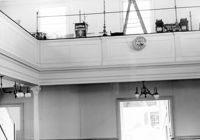
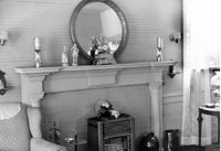
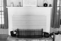
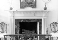
Old Rectory (Gourdin House). Interior View - Detail of Mantle on West Side. WNW elevation. Pineville Historic District. St. Stephen, SC.;6.5" x 9.5" B/W photo. Box 3, Folder 1-9-1 (I). Three copies.
Mary Lesesne House (B.C. Cox House), ca. 1790. Interior View - 1st Floor, Central Room. Detail of Mantel. Cainhoy, S.C.;6.5" x 9.5" B/W photo. Box 4, Folder 1-12-3. One copy.
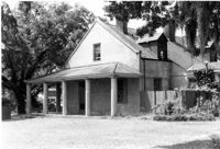
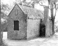
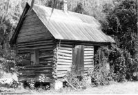
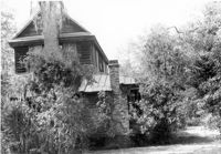
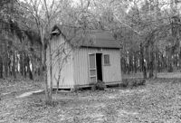
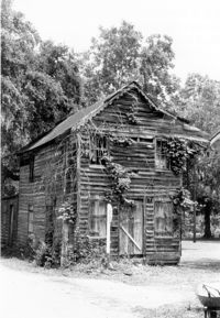
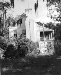
William Cain House - Slave Cabin. View of NE (Side and Front) elevation. Pinopolis Historic District North. Pinopolis, S.C.;6.5" x 9.5" B/W photo. Box 4, Folder 1-10-1 (III). Two copies.
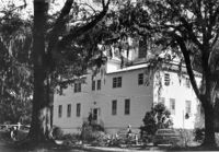
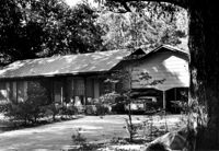
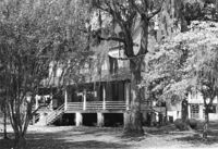
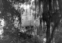
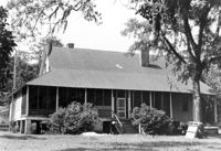
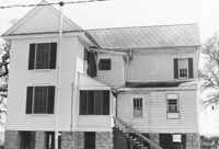
William Robertson House - Main House (Wampee Plantation Summer House). View of West (Rear) elevation. Pinopolis, S.C.;6.5" x 9.5" B/W photo. Box 4, Folder 1-10-1 (III). Two copies.
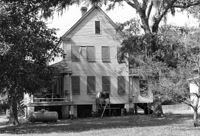
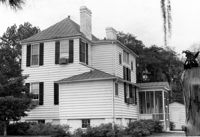
William Cain House - Main House. View of SE (Side and Rear) elevation. Pinopolis Historic District North. Pinopolis, S.C.;6.5" x 9.5" B/W photo. Box 4, Folder 1-10-1 (III). Two copies.
William Cain House - Main House. View of West (Side) elevation. Pinopolis Historic District North. Pinopolis, S.C.;6.5" x 9.5" B/W photo. Box 4, Folder 1-10-1 (III). Two copies.
Rockville Historic District - W.E. Jenkins House (James LaRoche House), Maybank Highway. View of South (Front) elevation. Wadmalaw Island, S.C.;6.5" x 10" (and 8" x 10") B/W photo. Box 17, Folder 2-14-15. Two copies.
Arnoldus Vander Horst House (Kiawah House), Mansion Court. Detail View of Entrance. South (Front) elevation. Kiawah Island, S.C.;10" x 8" B/W photo. Box 12, Folder 2-6-1. One copy.
Arnoldus Vander Horst House (Kiawah House), Mansion Court. View of North (Rear) elevation. Kiawah Island, S.C.;8" x 10" B/W photo. Box 12, Folder 2-6-1. One copy.
Arnoldus Vander Horst House (Kiawah House), Mansion Court. View of South (Front) elevation. Kiawah Island, S.C.;6.5" x 10" B/W photo. Box 12, Folder 2-6-1. One copy.
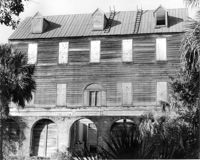
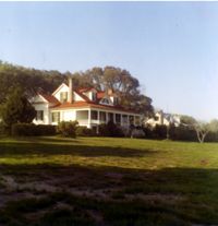
Wampee Plantation - Main House, Chicora Drive. View of SE (Rear and Side) elevation. Pinopolis, S.C.;6.5" x 9.5" B/W photo. Box 4, Folder 1-10-2. One copy.
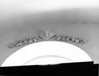
St. Andrews Episcopal Church (Old St. Andrews Parish Church), 2604 Ashley River Road. Interior View - Detail of plasterwork above Altar Window. East elevation. Charleston, S.C.;8" x 10" B/W photo. Box 14, Folder 2-9-7. One copy.
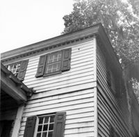
William Cain House - Main House. Detail View of Rear Windows, South (Rear) elevation, looking West. Pinopolis Historic District North. Pinopolis, S.C.;6.5" x 9.5" B/W photo. Box 4, Folder 1-10-1 (III). Two copies.
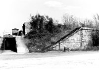
Quarter House Fort & Tavern Site, Success Street (between Meeting Street Road and Rivers Avenue). View of SE elevation. North Charleston, S.C.;6.5" x 10" B/W photo. Box 5, Folder 2-1-10. One copy.
Quarter House Fort & Tavern Site, Success Street (between Meeting Street Road and Rivers Avenue). View of SE elevation. North Charleston, S.C.;6.5" x 10" B/W photo. Box 5, Folder 2-1-10. One copy.
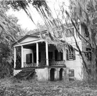
Isaac Porcher House - Main House. View of NW (Front and Side) elevation. Pinopolis Historic District North. Pinopolis, S.C.;6.5" x 9.5" B/W photo. Box 4, Folder 1-10-1 (III). One copy.
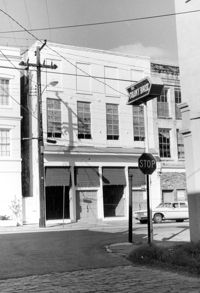
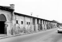
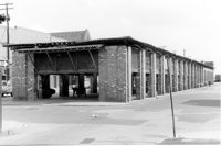
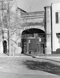
City Market - Market Hall and First Section of Sheds. View of South (Side) elevation, looking East. Charleston, S.C.;6.5" x 10" B/W photo. Box 6, Folder 2-1-14. One copy.
City Market - Market Hall and First Section of Sheds. View of South (Side) elevation, looking East. Charleston, S.C.;6.5" x 10" B/W photo. Box 6, Folder 2-1-14. One copy.
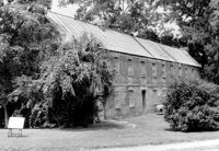
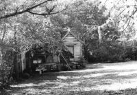
Village Store and Blacksmith Shop, ca. 1873. View of NW (Front and Side) elevation. Cainhoy, S.C.;10" x 6.5" B/W photo. Box 4, Folder 1-12-3. One copy.
McLeod Plantation, 325 Country Club Drive. Laundry Building - View of NW (Front and Side) elevation. Charleston, S.C.;8" x 10" B/W photo. Box 12, Folder 2-4-5. One copy.
McCrady's Tavern and Long Room, 153 East Bay Street. View of SW (Side and Front) elevation. Charleston, S.C.;6.5" x 10" B/W photo. Box 6, Folder 2-1-31. One copy.
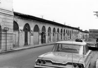
City Market - Market Hall and Fourth Section of Sheds. View of SW (Front and Side) elevation. Charleston, S.C.;6.5" x 10" B/W photo. Box 6, Folder 2-1-14. One copy.
Secessionville Manor (Secessionville Plantation), Battallion Drive. View of South (Front) elevation. Charleston, S.C.;3" x 3" Color photo. Box 12, Folder 2-4-6. One copy.
Rockville Historic District - Ladson Webb House (Exchange Plantation House), Sea Island Yacht Club Road. View of North (Front) elevation. Wadmalaw Island, S.C.;6.5" x 10" B/W photo. Box 17, Folder 2-14-8. One copy.
Rockville Historic District - Ladson Webb House (Exchange Plantation House), Sea Island Yacht Club Road. View of South (Rear) elevation. Wadmalaw Island, S.C.;6.5" x 10" B/W photo. Box 17, Folder 2-14-8. One copy.
Old Carroll House (Carroll Place), Junction of Quaker and Wire Roads. Contact Sheet 12 - Multiple Views. St. George, S.C.;10" x 5" B/W photo. Box 20, Folder: Miscellaneous Photos: Scanned Contact Sheets. One copy.
Bailey's House (Sandiford Holmes House), Point of Pines Road. View of NW (Front and Side) elevation. Edisto Island, S.C.;8" x 10" B/W photo. Box 10, Folder 2-3-1. One copy.
Bleak Hall Plantation, S.C. Hwy. 174. Tractor Shed - View of SW (Side and Rear) elevation. Edisto Island, S.C.;8" x 10" B/W photo. Box 10, Folder 2-3-2. One copy.
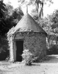
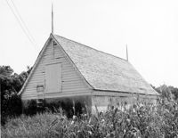
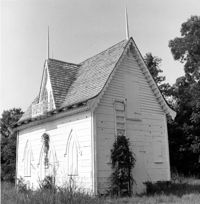
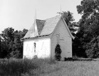
Bleak Hall Plantation, S.C. Hwy. 174. Ice House - View of NE (Front and Side) elevation. Edisto Island, S.C.;8" x 8" B/W photo. Box 10, Folder 2-3-2. One copy.
Bleak Hall Plantation, S.C. Hwy. 174. Ice House - View of NE (Front and Side) elevation. Edisto Island, S.C.;8" x 10" B/W photo. Box 10, Folder 2-3-2. One copy.
Bailey's House (Sandiford Holmes House), Point of Pines Road. View of West (Side) elevation. Edisto Island, S.C.;10" x 8" B/W photo. Box 10, Folder 2-3-1. One copy.
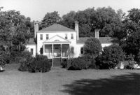
Dodge Plantation - Main House (William Seabrook House). View of North (Front) elevation. Edisto Island, S.C.;8" x 10" B/W photo. Box 10, Folder 2-3-5. Two copies.
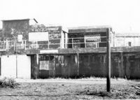
Folly Island Staging Area (Battery Green, U.S. Coast Guard Loran Station, Folly North Site), Address restricted. View facing North. Folly Beach, S.C.;8" x 10" B/W photo. Box 17, Folder 2-16-1. One copy.
Rockville Historic District - Welch's Lane House (Welches Lane House), Sea Island Yacht Club Road. View of South (Front) elevation. Wadmalaw Island, S.C.;6.5" x 10" (and 8" x 10") B/W photo. Box 17, Folder 2-14-24. Two copies.
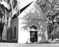
White Church (St. Thomas Church, The Brick Church), Off of Cainhoy Road. Main Building - View of Front and Side elevation. Cainhoy, S.C.;8" x 10" B/W photo. Box 4, Folder 1-12-2. One copy.
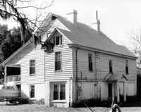
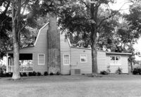
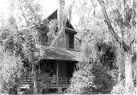
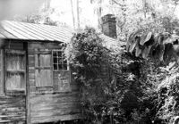
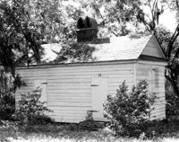
Dean Hall Plantation - Overseers House. View of NNW (Rear and Side) elevation. Oakley, SC. NOTE: Property relocated to Moncks Corner, S.C.;8" x 10" B/W photo. Box 2, Folder 1-8-9. One copy.