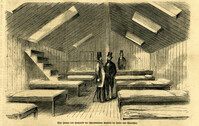
Caption (in German): 'Das Innere des Hospitals der schwimmenden Batterie im hafen von Charleston.' {Interior of the hospital of the Floating Battery in Charleston Harbor}
Caption: 'The Richland Rifles enjoying the "after-dinner hour," at their quarters on Sullivan's Island, Charleston Harbor, S.C. From a sketch taken on the spot by our Special Artist now in Charleston.' [full date March 2, 1861.]
Caption: 'Night after the fight--the iron clads at anchor off Fort Sumter.--sketched by our Special Artist, Mr. W.T. Crane.--see page 81.' [full date May 2, 1863.]
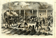
Caption: 'Scene on the Floating Battery in Charleston Harbor, S.C., during the bombardment of Fort Sumpter (sic).--from a sketch by an Officer.--see page 355.' [full date April 27, 1861.]
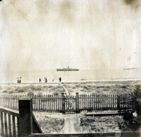
View of steamship on water, taken from porch of house on Sullivans Island. Includes ladies and gentlemen on the beach. Page 13, Photo 1 of collection. 3.5" x 3.5" B/W photograph.
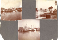
Three photographs on page. Top left and bottom: View from the Cooper River of the piers and boats on the Charleston waterfront behind the U.S. Customhouse. The Customhouse can be seen in the background as well as Market Street buildings. Top right: Unidentified beach scene, possibly Isle of Palms.
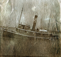
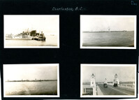
Four photographs on the page. Top left: Tugboat and other ships in a floating dry dock in the Charleston Harbor (possibly Charleston Shipbuilding). Top right: View of the Charleston waterfront from the Ashley River. Some of the landmark buildings visible in the background include St. Matthew's Church, Francis Marion Hotel, St. John's Lutheran Church, Unitarian Church, St. Philip's Church, People's Building, St. Michael's Church, and West Point Rice Mill. Bottom left: View of the Charleston waterfront from the Cooper River. Some of the landmark buildings visible in the background include Fort Sumter Hotel, St. Michael's Church, St. Philip's Church, U.S. Customhouse, and several wharves. Bottom right: Two cars on the Ashley River Bridge, one heading east and one heading west. View of the Charleston waterfront in the background.
[Color image.] Caption at top: 'The harbor of Charleston, S.C.--From sketches by our special artist.--Fort Moultrie, on Sullivan's Island.' Caption at middle: 'Fort Pinckney, Charleston, S.C.' Caption at bottom: 'Fort Sumter, Charleston, S.C.' [full date Dec. 1, 1860.]
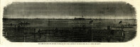
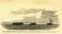
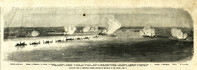
Caption: 'Panoramic view of Charleston Harbor--advance of iron-clads to the attack, April 7. Union--A. Keokuk. B. Nahunt. C. Nantucket. D. Catskill. E. Ironsides. F. Patapsco. G. Montauk. H. Passaie. K. Weehawken. Rebel--1. Morris Island sand battery. 2. Fort Wagner. 3. Battery Bee, on Cummings Point. 4. [Fort] Johnson. 5. Fort Ripley. 6. Sumter. 7. Charleston City. 8. Castle Pinckney. 9. Fort Redan. 10. Fort Moultrie. 11. Moultrie House. 12. Fort Beauregard. 13. Harbor obstructions. 14. Cooper River. 15. Ashley River.' [full date May 2, 1863.]
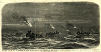
Caption: 'The night guard of boats on Charleston Bar during the first of the bombardment of Fort Sumpter (sic), to prevent reinforcements being sent to Major Anderson, April 12th, 1861.--from a sketch by our artist on Morris Island.'
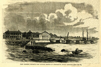
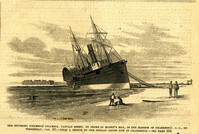
Caption: 'The Southern steamship Columbia. Captain Berry, on shore in Maffit's Bay, in the harbor of Charleston, S.C., on Wednesday, Jan. 23.--from a sketch by our Special Artist in Charleston.--see page 194.' [full date February 16, 1861.]