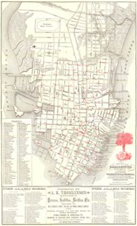
Map of the Charleston peninsula. Revised in 1879; published by Walker, Evans & Cogswell. Features locations of fire alarm boxes and public buildings, with indexes to each. Presented by A.R. Thomlinson, manufacturer of harness, saddles, bridles, etc., located at 137 Meeting Street. Measures 21.875" x 13.625"
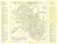
Map of the Charleston peninsula with historic points of interest identified and noted. Includes a welcome to visitors by Mayor Burnet R. Maybank and a map of "The Garden Club Walk" route. "Released by the Office of Port Development." Measures 16" x 22".