Search
« Previous |
301 - 400 of 1,584
|
Next »
Search Results
Date:
1977-1983
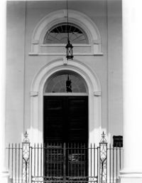
Description:
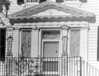
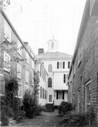
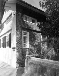
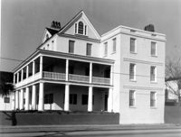
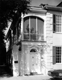
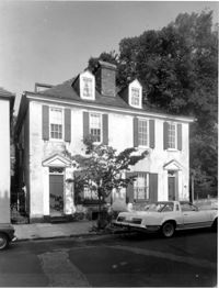
64 South Battery, William Gibbes House, ca. 1772. Main House - Detail View of 1st Floor entry, South (Front) elevation. 4" x 5" B/W photo.
Date:
1977-1983
Description:
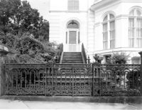
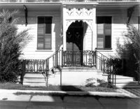
34 Smith Street, Robertson-Pickens House, ca. 1855. Detail View of entry and iron gate, West (Front) elevation. 4" x 5" B/W photo.
Date:
1861
Description:
Caption: 'General McGowan addressing the Abbeville Volunteers in front of the Charleston Hotel--from a sketch by our Special Artist now in Charleston.' [full date February 23, 1861.]
Date:
1977-1983
Description:
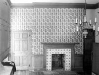
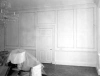
6 Glebe Street, St. Philip's Parsonage House (Bishop Robert Smith House), ca. 1770. Interior View. 1st Floor - NE Room, South wall. 4" x 5" B/W photo.
Date:
1977-1983
Description:
6 Glebe Street, St. Philip's Parsonage House (Bishop Robert Smith House), ca. 1770. Interior View. 1st Floor - SW Room, East wall. 4" x 5" B/W photo.
Date:
1977-1983
Description:
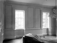
6 Glebe Street, St. Philip's Parsonage House (Bishop Robert Smith House), ca. 1770. Interior View. 1st Floor - SW Room, West wall. 4" x 5" B/W photo.
Date:
1977-1983
Description:
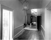
6 Glebe Street, St. Philip's Parsonage House (Bishop Robert Smith House), ca. 1770. Interior View. 1st Floor - Hall, looking North. 4" x 5" B/W photo.
Date:
1860
Description:
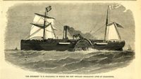
Caption: 'The steamship "S.R. Spaulding," in which the New England Delegation lives at Charleston.' [full date April 28, 1860.]
Date:
1977-1983
Description:
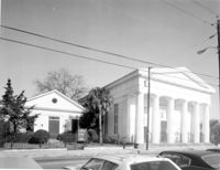
275 Meeting Street, Trinity Methodist Church, ca. 1848. Detail View of window, South (Side) elevation. 4" x 5" B/W photo.
Date:
1977-1983
Description:
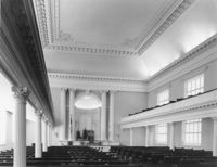
275 Meeting Street, Trinity Methodist Church, ca. 1848. Interior View - Nave, East elevation. 4" x 5" B/W photo.
Date:
1977-1983
Description:
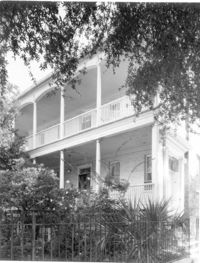
56 South Battery, Osborn-McCrady House, ca. 1770. Detail View of entry, South (Front) elevation. 4" x 5" B/W photo.
Date:
1977-1983
Description:
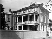
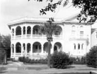
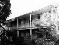
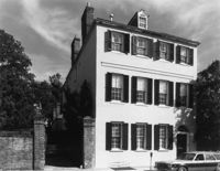
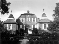
20 South Battery, Stevens-Lathers House, ca. 1843. Main House - View of SE (Front and Side) elevation. 4" x 5" B/W photo.
Date:
1977-1983
Description:
32 South Battery, Colonel John Ashe House, ca. 1762. Main House - View of North (Rear) elevation. 4" x 5" B/W photo.
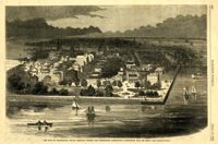
Date:
1860
Description:
Caption: 'The city of Charleston, South Carolina, where the Democratic Nominating Convention will be held.--[see preceding page.]' [full date April 21, 1860.]
Date:
1977-1983
Description:
60 Wentworth Street, Centenary Methodist Church, ca. 1842. View of SW (Front and Side) elevation. 4" x 5" B/W photo.
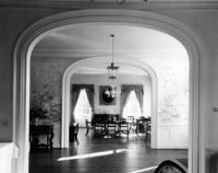
Date:
1977-1983
Description:
Charleston County, Oak Island Plantation, ca. 1830. Interior View. 1st Floor - SW Room, looking West through Hall to SE Room. 4" x 5" B/W photo.
Date:
1977-1983
Description:
Charleston County, Oak Island Plantation, ca. 1830. Interior View. 1st Floor - SW Room. Detail of Mantle, North wall. 4" x 5" B/W photo.
Date:
1860
Description:
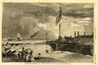
Caption: 'Fort Moultrie (Sullivan's Island). Charleston, South Carolina, in the distance.--[see preceding page.]' [full date November 17, 1860.]
Date:
1863
Description:
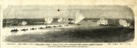
Caption: 'Panoramic view of Charleston Harbor--advance of iron-clads to the attack, April 7. Union--A. Keokuk. B. Nahunt. C. Nantucket. D. Catskill. E. Ironsides. F. Patapsco. G. Montauk. H. Passaie. K. Weehawken. Rebel--1. Morris Island sand battery. 2. Fort Wagner. 3. Battery Bee, on Cummings Point. 4. [Fort] Johnson. 5. Fort Ripley. 6. Sumter. 7. Charleston City. 8. Castle Pinckney. 9. Fort Redan. 10. Fort Moultrie. 11. Moultrie House. 12. Fort Beauregard. 13. Harbor obstructions. 14. Cooper River. 15. Ashley River.' [full date May 2, 1863.]
Date:
1977-1983
Description:
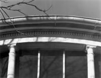
342 Meeting Street, Second Presbyterian Church, ca. 1811. Detail View of windows in tower base, North elevation. 4" x 5" B/W photo.
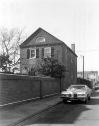
Date:
1977-1983
Description:
60 Montague Street, Gaillard-Bennett House, ca. 1800. Carriage House - Detail view of SW (Side and Front) elevation. 4" x 5" B/W photo.
Date:
1977-1983
Description:
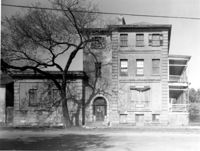
48 Elizabeth Street, Aiken-Rhett House, ca.1818. Courtyard - View of South elevation from North side of Main House. 4" x 5" B/W photo.
Date:
1977-1983
Description:
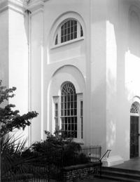
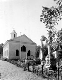
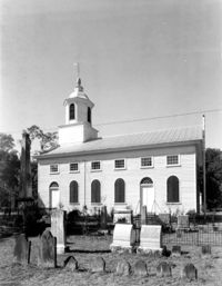
Charleston County, Edisto Island Presbyterian Church, ca. 1831. Church - View of North (Rear) elevation. 4" x 5" B/W photo.
Date:
1977-1983
Description:
Charleston County, Edisto Island Presbyterian Church, ca. 1831. Church - View of East (Side) elevation. 4" x 5" B/W photo.
Date:
1977-1983
Description:
635 East Bay Street, Faber-Ward House, ca. 1832. Main House and Complex - View of North (Side) elevation 4" x 5" B/W photo.
Date:
1977-1983
Description:
31 Legare Street, Hannah Heyward House, ca. 1789. Main House - View of NE (Rear and Side) elevation. 4" x 5" B/W photo.
Date:
1977-1983
Description:
31 Legare Street, Hannah Heyward House, ca. 1789. Main House - View of East (Front) elevation. 4" x 5" B/W photo.
Date:
1977-1983
Description:
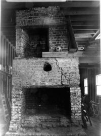
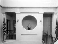
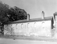
126 Tradd street, Dr. Peter Fayssoux House, ca. 1732. Kitchen House - Interior View. Detail of South fireplace without plaster. 4" x 5" B/W photo.
Date:
1977-1983
Description:
100 Meeting Street, Fireproof Building, ca. 1822. Interior View - 2nd Floor. Stair Hall - West corridor, East elevation. 4" x 5" B/W photo.
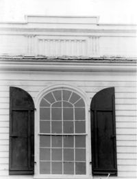
Date:
1977-1983
Description:
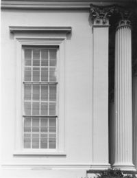
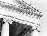
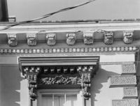
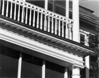
172 Rutledge Avenue, Ashley Hall, ca. 1802. Main House - Detail View of portico, cornice, and column cap, South (Front) elevation. 4" x 5" B/W photo.
Date:
1977-1983
Description:
2 - 4 Court House Square, Daniel Blake Tenements, ca. 1760. Interior View - 2nd Floor. SW Room, North elevation. 4" x 5" B/W photo.
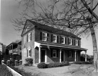
Date:
1977-1983
Description:
2 Amherst Street, Christopher Belser House, ca. 1804. View of East (Side) elevation. 4" x 5" B/W photo.
Date:
1977-1983
Description:
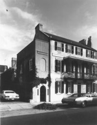
106 Tradd Street, Colonel John Stuart House, ca. 1772. Main House - View of SW (Side and Front) elevation. 4" x 5" B/W photo.
Date:
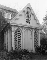
1977-1983
Description:
31 Meeting Street, James Ladson House, ca. 1792. Gazebo, ca. 1848. View of NW (Front and Side) corner. 4" x 5" B/W photo.
Date:
1977-1983
Description:
34 Meeting Street, Daniel Elliott Huger House, ca. 1759. Main House - View of East (Rear) elevation. 4" x 5" B/W photo.
Date:
1977-1983
Description:
34 Meeting Street, Daniel Elliott Huger House, ca. 1759. Privy - View of SW corner. 4" x 5" B/W photo.
Date:
1977-1983
Description:
100 Meeting Street, Fireproof Building, ca. 1822. Interior View - Ground Floor. NW Room, SE elevation. 4" x 5" B/W photo.
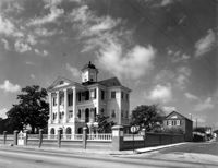
Date:
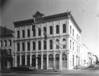
1977-1983
Description:
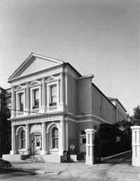
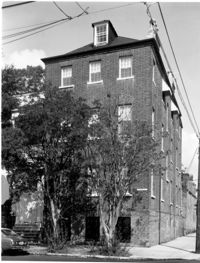
141 Meeting Street, Charleston Gas Light Company, ca. 1876. View of NE (Front and Side) elevation. 4" x 5" B/W photo.
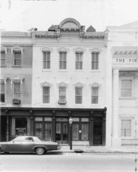
Date:
1977-1983
Description:
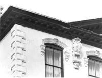
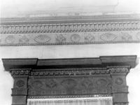
21 King Street, Patrick O'Donnell House, ca. 1852. Detail View of 3rd Floor window cornice, building cornice, and quoining, East (Front) elevation. 4" x 5" B/W photo.
Date:
1977-1983
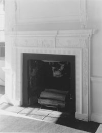
Description:
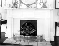
100 Meeting Street, Fireproof Building, ca. 1822. Interior View - 1st Floor. NW Room - Detail of mantle. 4" x 5" B/W photo.
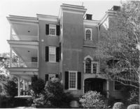
Date:
1977-1983
Description:
26 South Battery, Colonel John Algernon Sydney Ashe House, ca. 1853. Main House - South (Front) elevation. 4" x 5" B/W photo.
Date:
1977-1983
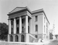
Description:
100 Meeting Street, Fireproof Building, ca. 1822. View of NW (Front and Side) elevation 4" x 5" B/W photo.
Date:
1977-1983
Description:
2 - 4 Court House Square, Daniel Blake Tenements, ca. 1760. Interior View - 2nd Floor. SW Room, Detail of mantle. 4" x 5" B/W photo.
Date:
1977-1983
Description:
2 - 4 Court House Square, Daniel Blake Tenements, ca. 1760. Interior View - 2nd Floor. SE Room, West elevation. 4" x 5" B/W photo.
Date:
1977-1983
Description:
2 - 4 Court House Square, Daniel Blake Tenements, ca. 1760. Interior View - 2nd Floor. NE Room, East elevation. 4" x 5" B/W photo.
Date:
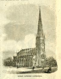
1861
Description:
Caption: 'Roman Catholic Cathedral [Charleston, SC].' [full date December 28, 1861.]
Date:
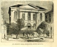
1861
Description:
Caption: 'St. Andrew's Hall, Charleston, South Carolina.' [full date December 28, 1861.]
Date:
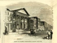
1861
Description:
Caption: 'Group of banks, Charleston, South Carolina.' [full date December 28, 1861.]
Date:
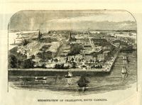
1861
Description:
Caption: 'Birdseye-view of Charleston, South Carolina.' [full date December 28, 1861.]
Date:
1977-1983
Description:
635 East Bay Street, Faber-Ward House, ca. 1832. Main House and Complex - View of NE (Front and Side) elevation 4" x 5" B/W photo.
Date:
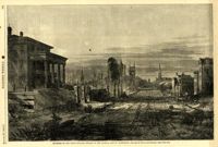
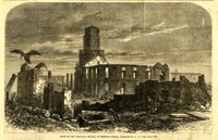
1865
Description:
Caption: 'Ruins in the heart of Charleston--view from King Street.--[photographed by George N. Barnard.]' [full date July 8, 1865.]
Date:
1977-1983
Description:
635 East Bay Street, Faber-Ward House, ca. 1832. North Dependency - View SE (Front and Side) elevation. 4" x 5" B/W photo.
Date:
1977-1983
Description:
635 East Bay Street, Faber-Ward House, ca. 1832. North Dependency - View NE (Rear and Side) elevation. 4" x 5" B/W photo.
Date:
1864
Description:
Caption: 'Quarters of the Union officers exposed to the Federal fire in Charleston.--sketched by one of the Officers.--[see page 550.]' [full date August 27, 1864.]
Date:
1977-1983
Description:
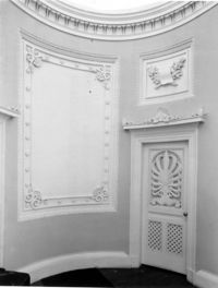
48 Elizabeth Street, Aiken-Rhett House, ca.1818. Main House - Interior View. 1st Floor - East Room. Detail of cornice and over mantle mirror frame. 4" x 5" B/W photo.
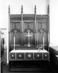
Date:
1977-1983
Description:
126 Coming Street, Cathedral Church of St. Luke and St. Paul, ca. 1816. Interior View - Detail view of altar from original St. Luke's Church (see #CNB_342 - CNB_344). 4" x 5" B/W photo.
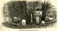
Date:
1865
Description:
Caption: 'The French Huguenot Churchyard, Church Street, Charleston, S.C.' [full April 1, 1865.]
Date:
1977-1983
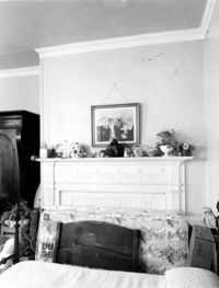
Description:
Berkley County, Loch Dhu, ca. 1812. Main House - Interior View. 1st Floor - NE Room, Detail of chimneypiece and mantel. 4" x 5" B/W photo.
Date:
1977-1983
Description:
20 Montague Street, Cobia-Moultrie House, ca. 1808. Main House - View of West (Side) elevation. 4" x 5" B/W photo.
Date:
1977-1983
Description:
20 Montague Street, Cobia-Moultrie House, ca. 1808. Main House - View of South (Front) elevation. 4" x 5" B/W photo.
Date:
1977-1983
Description:
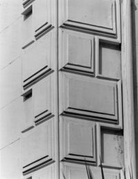
116 Broad Street, John Rutledge House, ca. 1763. Main House - Detail View of sheet metal quoining, SW (Front and Side) corner. 4" x 5" B/W photo.
Date:
1977-1983
Description:
116 Broad Street, John Rutledge House, ca. 1763. Main House - Detail View of cornice and windows, SW (Front and Side) elevation. 4" x 5" B/W photo.
Date:
1977-1983
Description:
6 Gibbes Street, Parker-Drayton House, ca.1806. Detail View of 1st Floor cornice, South (Front) elevation. 4" x 5" B/W photo.
Date:
1977-1983
Description:
69 Church Street, Capers-Motte House, ca. 1745. View of Kitchen and Slave Quarters, South (Front) elevation. 4" x 5" B/W photo.
Date:
1977-1983
Description:
6 Gibbes Street, Parker-Drayton House, ca.1806. Detail View of Roof cornice, South (Front) elevation. 4" x 5" B/W photo.
Date:
1977-1983
Description:
59 Church Street, Thomas Rose House, ca. 1735. Detail View of entry, East (Front) elevation. 4" x 5" B/W photo.
Date:
1977-1983
Description:
86 Church Street, Isaac Mazyck House, ca. 1783. View of NW (Front and Side) elevation. 4" x 5" B/W photo.
Date:
1977-1983
Description:
78 Church Street, ca. 1785. View of SE (Front and Side) elevation. 4" x 5" B/W photo.
Date:
1977-1983
Description:
48 Elizabeth Street, Aiken-Rhett House, ca.1818. Main House - Interior View. 1st Floor - SE Room. Looking NW to SW Room. 4" x 5" B/W photo.
Date:
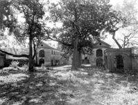
1977-1983
Description:
Berkley County, Mulberry Plantation, ca. 1714. Main House - View of East (Side) elevation, showing main core and corner pavilions. 4" x 5" B/W photo.
Date:
1977-1983
Description:
Berkley County, Lawson's Pond, ca. 1823. Interior View. 1st Floor - NW Room, Detail of window entablature and room cornice. 4" x 5" B/W photo.
Date:
1977-1983
Description:
Charleston County, Edisto Island Presbyterian Church, ca. 1831. Church - Detail View of front entry with Venetian window, South (Front) elevation. 4" x 5" B/W photo.
Date:
1977-1983
Description:
275 Meeting Street, Trinity Methodist Church, ca. 1848. Interior View - Detail of chancel. 4" x 5" B/W photo.
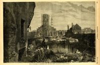
Date:
1866
Description:
Caption: 'Ruins of the Circular Church, on Meeting Street, Charleston, S.C.--see page 312.' [full date February 2, 1866.]
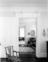
Date:
1977-1983
Description:
18 Bull Street, William Blacklock House, ca. 1800. Main House - Interior View. 1st Floor - SW Room, showing arches. 4" x 5" B/W photo.
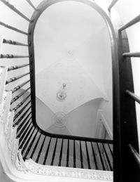
Date:
1977-1983
Description:
18 Bull Street, William Blacklock House, ca. 1800. Main House - Interior View. 1st Floor - Stair Hall, looking Up. 4" x 5" B/W photo.
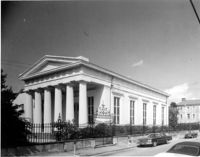
Date:
1977-1983
Description:
90 Hasell Street, Synagogue of Kahal Kadosh Beth Elohim, ca. 1840. View of SW (Front and Side) elevation. 4" x 5" B/W photo.
Date:
1977-1983
Description:
Charleston County, Oak Island Plantation, ca. 1830. Detail View of stair window and parapet wall, North (Rear) elevation. 4" x 5" B/W photo.
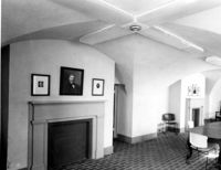
Date:
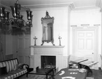
1977-1983
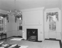
Description:
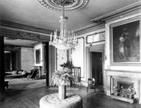
21 East Battery, Edmonston-Alston House, ca. 1828. Main House - Interior View. 1st Floor - West Drawing Room, North wall. 4" x 5" B/W photo.
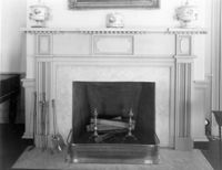
Date:
1977-1983
Description:
21 East Battery, Edmonston-Alston House, ca. 1828. Main House - Interior View. 1st Floor - East Drawing Room, Detail of mantle. 4" x 5" B/W photo.
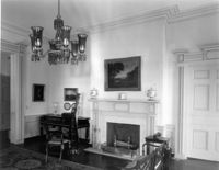
Date:
1977-1983
Description:
21 East Battery, Edmonston-Alston House, ca. 1828. Main House - Interior View. 1st Floor - East Drawing Room, North wall. 4" x 5" B/W photo.
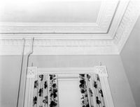
Date:
1977-1983
Description:
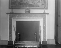
69 Barre Street, Gov. Thomas Bennett House, ca. 1822. Main House - Interior View. 2nd Floor - SE Room; Detail of window architrave and cornice. 4" x 5" B/W photo.
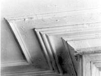
Date:
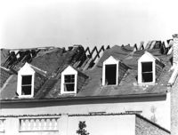
1977-1983
Description:
85 - 87 Broad Street, Josiah Smith Tenement, ca. 1795. Detail View of roof showing 1978 fire damage, South (Rear) elevation. 4" x 5" B/W photo.
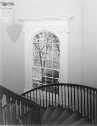
Date:
1977-1983
Description:
69 Barre Street, Gov. Thomas Bennett House, ca. 1822. Main House - Interior View. 2nd Floor - Stairwell; Detail of window. 4" x 5" B/W photo.
Date:
1977-1983
Description:
77 Church Street, Louis Danjou House (Brewton's Corner), ca. 1810. View of NE (Front and Side) elevation. 4" x 5" B/W photo.
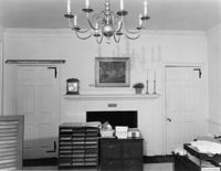
Date:
1977-1983
Description:
4 Orange Street, Samuel Carne House, ca. 1770. Main House - Interior View. 1st Floor - East Room, NW wall. 4" x 5" B/W photo.
Date:
1977-1983
Description:
143 - 145 Church Street, Alexander Perronneau Tenements, ca. 1740. View of East (Front) elevation. 4" x 5" B/W photo.
Date:
1977-1983
Description:
48 Elizabeth Street, Aiken-Rhett House, ca.1818. Courtyard - View of South elevation from North side of Main House. 4" x 5" B/W photo.
Date:
1977-1983
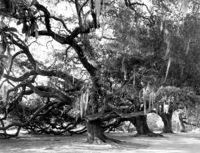
Description:
Berkley County, Mulberry Plantation, ca. 1714. Driveway - View of Live Oak trees. 4" x 5" B/W photo.
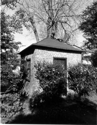
Date:
1977-1983
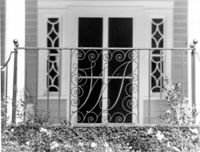
Description:
Charleston County, William Seabrook-Dodge Plantation, ca. 1810. Detail View of monogrammed iron railing, 1st Floor portico, South (Front) elevation. 4" x 5" B/W photo.
Date:
1977-1983
Description:
126 Coming Street, Cathedral Church of St. Luke and St. Paul, ca. 1816. Detail View of center entry door, West (Front) elevation. 4" x 5" B/W photo.
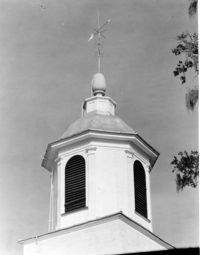
Date:
1977-1983
Description:
Charleston County, Edisto Island Presbyterian Church, ca. 1831. Church - Detail View of cupola. 4" x 5" B/W photo.
Date:
1977-1983
Description:
Camden Depot of the S.C.R.R., ca. 1845; South side of Ann Street between Meeting and King Streets. Attributed to E.B. White, architect. View of entry from the NW. 4" x 5" B/W photo.
Date:
1977-1983
Description:
49 Broad Street, Benjamin Smith Building, ca. 1740. View of North (Front) elevation. 4" x 5" B/W photo.
Date:
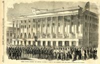
1860
Description:
Caption: 'The Charleston Convention--interior of Douglas's headquarters, Hibernia (sic) Hall, Charleston, S.C.--from a sketch by our special artist.--see page 360.' [May 5, 1860.]
Date:
1977-1983
Description:
48 Elizabeth Street, Aiken-Rhett House, ca.1818. Main House - View of West (Side) elevation. 4" x 5" B/W photo.
Date:
1977-1983
Description:
43, 45, 47 Broad Street, ca. 1855. View of NW (Front and Side) elevation. 4" x 5" B/W photo.
Date:
1977-1983
Description:
36 Broad Street, ca. 1803. View of North (Front) elevation. 4" x 5" B/W photo.
Date:
1977-1983
Description:
38 Broad Street, ca. 1801. View of South (Front) elevation. 4" x 5" B/W photo.
Date:
1977-1983
Description:
37 Broad Street, ca. 1794. View of North (Front) elevation. 4" x 5" B/W photo.