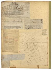
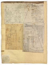
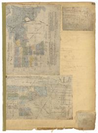
Page 145 of the City Engineer's Plat Book with seven plats. Plat 1 shows lots located on Chapel Street, near where they intersect with Alexander Street. Plat 2 shows lots and structures located on South Street, near where it intersects with another street. Plat 3 shows lots located along Anson Street, near where it intersects with Calhoun Street. Plat 4 features lots located on the "Eastern end of Wraggs" Street. Plat 4 shows lots and structures located between Concord Street and Wharf Street, near where they intersect with Inspection Street. Plat 5 features a strip of land belonging to the Charleston Gas Light Company, located near Concord Street. It also shows a "Train-way" and a building labelled "Gas Works." Plat 7 shows lots and structures located between Line Street and Sheppard Street.
Page 141 of the City Engineer's Plat Book with four plats. Plat 1 features a lot and structures located between Lynch Steet and the Ashley River, near Broad Street. It also shows Comings Creek, a pond, and a lot labelled "Clark & Steinmeyer." Plat 2 shows lots and structures located near the intersection of College Street and Calhoun Street. Plat 3 shows a lot and structures in "the City of Charleston in Ward No. 9." Plat 4 shows lots on and near Society Street, between Meeting Street and King Street.
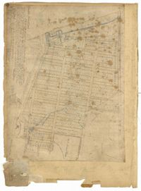
Page 144 of the City Engineer's Plat Book with five plats. Plat 1 shows lots on and near the Cooper River channel, near Boundary Street, Charlotte Street, Washington Street, and Alexander Street. Plat 1 also shows a creek and a stretch of marshland. Plat 2 shows lots located near the intersection of South Street and America Street. Plat 3 features structures located on the intersection of South Street and America Street. Plat 4 shows lots and structures located at the intersection of President Street and Cannon's Court. Plat 5 shows lots located between Drake Street, America Street, and Alexander Street.
Page 142 of the City Engineer's Plat Book with four plats. Plat 1 shows lots and structures located on the corner of Meeting Street and Burns Lane, with one lot labeled "Property of Charleston High School." Plat 2 shows lots located on Pitt Street. Plat 3 shows lots and structures located on Pitt Street. Plat 4 shows land located between Broad Street and Wentworth Street, and between Lynch Street and the Ashley River. Plat 4 also shows a line labelled "Low Water Mark of Ashley River," Comings Creek, and a "City Mud Flat, lying North of Creek."
Page 147 of the City Engineer's Plat Book with three plats. Plat 1 shows lots located between King Street and land owned by the South Carolina Railroad Company. Plat 2 shows lots and structures located between Charlotte Street and Calhoun Street, and between Washington Street and Meeting Street. It also shows Alexander Street, Elizabeth Street, and Henrietta Street. Plat 3 shows lots and structures located on and near the intersection of President Street and Cannon's Court.
Page 146 of the City Engineer's Plat Book with three plats. Plat 1 shows lands located on and near the intersection of East Bay Street and Hasell Street. Plat 2 features a lot located on the north side of John Street, between Meeting Street and King Street. It also shows a lot labelled "So. Ca. RR. Co." Plat 4 shows a park and buildings located between King Street and Meeting Street, and between Calhoun Street and Hutson Street.
Page 143 of the City Engineer's Plat Book with two plats. Plat 1 shows land located near the intersection of Washington Street and Chapel Street, with two wharfs and the "site of the creek in 1801." Plat 2 shows lots and structures located on the west side of Washington Street.
Page 134 of the City Engineer's Plat Book with eleven plats. Plat 1 shows lots and structures located on Lynch Street. Plat 2 shows a lot located on Wentworth Street, with a building labelled "Charleston Engine House." Plat 3 shows lots located near the intersection of Calhoun Street and Ogier Street. Plat 4 shows lots located on Ogier Street. Plat 5 shows lots located on Ogier Street, near its intersection with Calhoun Street. Plat 6 shows lots located along Clifford Alley, near where it intersects with Archdale Street. Plat 7 shows lots located near the intersection of Calhoun Street and Ogier Street. Plat 8 shows lots located near the intersection of Vanderhorst Street and Ogier Street. Plat 9 shows lots located near the intersection of Calhoun Street and Ogier Street. Plat 10 shows lots located on and near Boundary Street, near where it intersects with St. Philips Street. Plat 11 features a lot owned by "The Unitarian Church," located on the intersection of Archdale Street and Clifford Alley.
Page 140 of the City Engineer's Plat Book with six plats. Plat 1 shows lots and structures located on and near Queen Street, between King Street and Meeting Street. Plat 2 shows lots located on Rutledge Street. Plat 3 shows lots located between George Street and Burns Lane, near where they intersect with Meeting Street. One lot is labelled "Property of Charleston High School." Plat 4 shows lots and structures located between Lynch Street and the Ashley River, near Broad Street and Beaufain Street. Plat 5 shows lots and structures located on the corner of King Street and Society Street. Plat 6 shows the same area as Plat 5, but with some changes to the structures.
Page 136 of the City Engineer's Plat Book with seven plats. Plat 1 shows lots and structures located on and near the intersection of Liberty Street and St. Philips Street. Plat 2 shows lots located on Archdale Street, near Bennett's Mill Pond. Plat 3 shows lots and structures located on and near the intersection of Rutledge Street and Montague Street. Plat 4 shows lots and structures located on Archdale Street, including a building labelled "Hope Engine House." Plat 5 shows a lot located along Clifford Alley, near a lot labelled "Unitarian Church." Plat 6 shows lots located along King Street. Plat 7 shows lots located on and near Calhoun Street, located between Smith Street and Rutledge Street.
Page 139 of the City Engineer's Plat Book with five plats. Plat 1 shows a lot and structures located at the corner of Calhoun Street and Alexander Street. Plat 2 shows lots located on Queen Street, near where it intersects with Back Street. Plat 3 shows lots located on and near Mazyck Street, near its intersection with Magazine Street. Plat 3 also shows lots labelled "Roper Hospital Lot," and "City Lot." Plat 4 shows lots located between Vanderhorst Street and Boundary Street, and between Coming Street and Pitt Street.
Page 135 of the City Engineer's Plat Book with seven plats. Plat 1 shows lots on a city block located between Bennett Street and Calhoun Street, and between Rutledge Street and Lynch Street. Plat 2 shows a lot labelled "Cannon's Mall," located on the intersection of Calhoun Street and Rutledge Street. Plat 3 shows lots located on Meeting Street. Plat 4 shows the same lot as Plat 2. Plat 5 shows a lot located on King Street. Plat 6 shows lots and structures located on King Street, including a graveyard, a Meeting House, and a kitchen.
Page 137 of the City Engineer's Plat Book with six plats. Plat 1 shows lots located on and near Mazyck Street, between Short Street and King Street. Plat 2 shows lots located on and near the intersection of Pitt Street and Montague Street. Plat 3 features a lot located on the intersection of Archdale Street and Berresford Street. Plat 4 features a lot located at the intersection of Queen Street and Meeting Street. Plat 5 shows a lot located at the intersection of Queen Street and King Street. Plat 6 shows lots located on and near the intersection of Mazyck Street and Magazine Street, including one labelled "Roper Hospital Lot."
Page 138 of the City Engineer's Plat Book with three plats. Plat 1 features a lot located on Hasell Street, with a large building labelled "St. Mary's Church." Plat 2 shows lots and structures located between Rutledge Street and Trapmann Street, and between Queen Street and Broad Street. Plat 3 features a lot located on Radcliffe Street, between Rutledge Street and Smith Street.
Page 129 of the City Engineer's Plat Book with four plats. Plat 1 shows lots between Hayne Street and Market Street, near where they intersect with Meeting Street. Plat 2 features a lot and structures located along Meeting Street, between Hayne Street and Market Street. Plat 3 features a lot located on the "Charleston Harbour on Cooper River." Plat 3 also shows a wharf and other structures. Plat 4 shows the same area as Plat 3.
Page 132 of the City Engineer's Plat Book with two plats. Plat 1 features a plan for the College of Charleston, showing buildings labelled "Charleston College," "Library," "Lodge," and "Charleston Orphan House." Streets on this plat include George Street, Smith Street, College Street, Calhoun Street, St. Philips Street, and Vanderhorst Street. Plat 2 shows lots located near the intersection of Montague Street and Lynch Street.
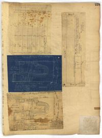
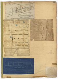
Page 127 of the City Engineer's Plat Book with four plats. Plat 1 shows lots and wharves, including Accommodation Wharf and Brown's Wharf. Plat 2 shows structures on Anson Street. Plat 3 shows lots located near the intersection of Pinckney Street and Anson Street. Plat 4 shows lots located on and near Gadsden Street, between Pinckney Street and King Street.
Page 130 of the City Engineer's Plat Book with three plats. Plat 1 shows lots located on a city block between Meeting Street and Scarborough Street and between Boundary Street and George Street. Plat 2 shows lots and structures located on East Bay Street. Plat 3 shows lots located on the Cooper River channel of the Charleston Harbor, near Concord Street and Wharf Street.
Page 128 of the City Engineer's Plat Book with one plat. The plat shows a city block between Meeting Street and Church Street, and between Cumberland Street and Market Street. A label reads "Champion Cotton Press Co. Lots," and another reads "Tudor Ice House."
Page 131 of the City Engineer's Plat Book with three plats. Plat 1 shows lots and structures located on George Street. Plat 2 features a lot on Rutledge Street. Plat 3 shows lots located on King Street, near its intersection with Clifford Alley.
Page 133 of the City Engineer's Plat Book with one plat. The plat features Colonial Lake, located between Broad Street and Beaufain Street, and between Rutledge Street and Lynch Street.
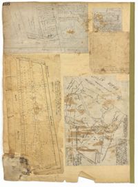
Page 125 of the City Engineer's Plat Book with seven plats. Plat 1 shows several measurements for a structure. Plat 2 shows the line of division between St. Mary's Church Yard and the "Property of Mrs. Anna D. Fleming." Plat 3 shows two wharves. Plat 4 shows lots and structures near wharf street. Plat 5 shows lots near the intersection of Washington Street and Laurens Street. Plat 6 shows lots between Rose Lane and Market Street, near where they intersect with East Bay Street. Plat 7 shows lots between Congress Street and Race Street, near Rutledge Street.
Page 120 of the City Engineer's Plat Book with five plats, labelled two through six. Plat 2 shows lots and buildings located near Cumberland Street, between Church Street and Philadelphia Street. Plat 3 shows lots located near the intersection Pinckney Street and Anson Street. Plat 4 shows lots and structures located on Hasell Street. Plat 5 shows lots and buildings along East Bay Street. Plat 6 shows lots and structures located between wharf street and the Cooper River.
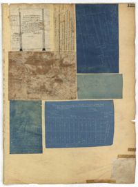
Page 123 of the City Engineer's Plat Book with six plats. Plat 1 shows lots and structures located on and near Calhoun Street, between Anson Street and Meeting Street. Plat 2 shows lots and structures located between East Bay Street and Cooper River. Plat 3 shows lots and buildings located near Meeting Street. Plat 4 shows lots near a road, and has a large hole in the middle. Plat 5 shows lots and buildings located on Beaufain Street. Plat 5 shows lots located near an intersection, and has several holes in the paper.
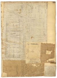
Page 121 of the City Engineer's Plat Book with six plats. Plat 1 shows lots located near the intersection of Washington Street and Society Street. Plat 2 shows lots located on East Bay Street. Plat 3 shows lots and structures located near the intersection of Wall Street and Minority Street. Plat 4 shows lots located between Concord Street and Wharf Street. Plat 5 shows lots and buildings on Cumberland Street. Plat 6 shows lots and structures located on and near Broad Street.
Page 126 of the City Engineer's Plat Book with three plats. Plat 1 shows lots and structures located between George Street and Boundary Street, and between Meeting Street and Scarborough Street. Plat 2 shows lots on Anson Street, with one building labelled "Palmetto Engine House." Plat 3 shows a large swathe of land, including marshes and streams. One stream is labelled "Vardells CK," and a line towards the right of the plat is labelled "North Eastern Rail Road." The streets on this plat include King Street, Hampton Street, Moultrie Street, Meeting Street, America Street, Bay Street, Stewart Street, Cooper Street, and Line Street.
Page 122 of the City Engineer's Plat Book with three plats. Plat 1 shows lots and structures on Meeting Street. Plat 2 shows lots and structures located near the intersection of Anson Street and Laurens Street. Plat 3 shows lots located between Moultrie Street and Huger Street, near Rutledge Avenue.
Page 124 of the City Engineer's Plat Book with one plat. The plat features several lots and structures located on and near King Street, with one labelled "Theatre Lot."
Page 114 of the City Engineer's Plat Book with elven plats. Plat 1 features lots located at the corner of King Street and Queen Street. Plat 2 shows a strip of land on the west side of King Street. Plat 3 shows lots along King Street. Plat 4 shows lots located near the intersection of Savage Street and Tradd Street. Plat 5 shows lots located on King Street. Plat 6 shows lots located near the intersection of King Street and Queen Street. Plat 7 shows lots located on King Street. Plat 8 shows a lot located on King Street. Plat 9 shows lots located near the intersection of South Bay Street and Legare Street. Plat 10 shows a lot on King Street. Plat 11 shows lots located near the intersection of Council Street and Gibbes Street.
Page 119 of the City Engineer's Plat Book with five plats. Plat 1 shows land located between East Bay Street and the Cooper River. Plat 1 also shows Trott Street, Hasell Street, Concord Street, and Pinckney Street. Plat 2 features Bennett's Rice and Lumber Mills, near East Bay Street. Plat 3 features a plot on East Bay Street. Plat 4 features lots and structures located near Church Street and Market Street, and shows a lot labelled "Gas Company." Plat 5 shows lots located near the intersection of East Bay Street and Lodge Alley.
Page 116 of the City Engineer's Plat Book with three plats. Plat 1 shows lots and structures located near the intersection of Meeting Street and Ladson's Court. Plat 2 features a proposed extension of Ladson's Court. Plat 3 shows lots located south of Tradd Street. Plat 3 also shows Gibbes Street, Council Street, a line marking the low water, and a line marking the edge of the channel.
Page 113 of the City Engineer's Plat Book with two plats. Plat 1 features "Shoal and Channel lots" located south of Tradd Street. Plat 1 also shows Gibbes Street, Council Street, two labels reading "ASHLEY RIVER EMBANKMENT," a line marking the edge of high land, a line marking the low water, and a line marking the edge of the channel. Plat 2 shows lots along New Street.
Page 118 of the City Engineer's Plat Book with four plats. Plat 1 shows lots and structures on East Bay Street. Plat 2 shows lots along Meeting Street. Plat 3 shows lots located near the intersection of Inspection Street and Marsh Street. Plat 4 shows lots and structures along Anson Street, between George Street and Boundary Street.
Page 115 of the City Engineer's Plat Book with four plats. Plat 1 shows land located near Broad Street, Short Street, Franklin Street, and Queen Street. Plat 2 shows lots and structures located on King Street. Plat 3 shows lots and structures located on Franklin Street. Plat 4 shows lots and structures located on Queen Street.
Page 117 of the City Engineer's Plat Book with two plats. Plat 1 shows lots located near the Cooper River. Plat 2 shows marshlands, bodies of water, and lots located near the Ashley River.
Page 106 of the City Engineer's Plat Book with ten plats. Plat 1 features a lot and its buildings located near the intersection of King Street and Tradd Street. Plat 2 features a lot and buildings located between Church Street and Water Street, near where the latter intersects with East Bay Street. Plat 3 shows lots located near the intersection of King Street and Grove Street. Plat 4 features a plat and building located on Church Street. Plat 5 features a lot located on the intersection of East Bay Street and Elliott Street. Plat 6 shows a lot located between two streets leading to wharves. Plat 7 shows lots, wharves, and docks located near the intersection of Market Street and East Bay Street. Plat 8 features a wharf and lot located near the intersection of Legare Street and South Bay Street. Plat 9 shows lots located on and near the intersection of Broad Street and East Bay Street. Plat 10 shows lots and some structures located on East Bay Street.
Page 108 of the City Engineer's Plat Book with five plats. Plat 1 features lots and some structures located near South Bay Street's intersections with Meeting Street and Church Street. It also shows a lot labelled "Battery Garden." Plat 2 shows lots located near East Bay Street. Plat 3 features White Point Garden, also known as Battery Park, located south of South Battery Street, near the Church Street and Meeting Street. Plat 4 shows a lot located near the intersection of Meeting Street and Broad Street. Plat 5 shows land located between Broad Road and the Ashley River, and includes labels marking salt marshes, cleared lands, a fish pond.
Page 109 of the City Engineer's Plat Book with six plats. Plat 1 shows lots located near the intersection of Exchange Street and Champney Street. Plat 2 shows lots and some buildings located on Church Street. Plat 3 shows lots located along Elliott Street, between East Bay and Church Street. Plat 4 shows lots and structures located near the corner of Church Street and Atlantic Street. Plat 5 shows lots and structures located near the corner of Church Street and Atlantic Street. Plat 6 shows lots and structures located near the intersection of East Bay Street and Guignard Street.
Page 110 of the City Engineer's Plat Book with three plats. Plat 1 shows lots located near the corner of Champney Street and Exchange Street, including labels for brick buildings, a label reading "EAST SHORE TERMINAL." Plat 2 shows lots and structures located near South Bay Street, between Church Street and Meeting Street. Plat 3 shows lots and some structures located near the intersection of Bogard Street and Percy Street.
Page 107 of the City Engineer's Plat Book with two plats, labelled 3 and 4. Plat 3 features a lot and buildings located on the intersection or Tradd Street and East Bay Street. Plat 4 shows lots located near Gibbes Street, Tradd Street, New Street, and Savage Street. Plat 4 also shows three lines, labelled "Edge of high land," "Low water by Parker," and "Edge of Channel by Purcell and Parker."
Page 112 of the City Engineer's Plat Book with five plats. Plat 1 shows lots and structures located on the north side of Tradd Street. Plat 2 shows lots located on the east side of Savage Street. Plat 3 shows lots located on King Street. Plat 4 shows lots located between Broad Street and Tradd Street, and between Lynch Street and the Ashley River. Plat 5 shows lots and structures located near the intersection of King Street and Broad Street.
Page 111 of the City Engineer's Plat Book with one plat. This plat shows lots located near the intersection of East Bay Street and Broad Street. It also shows a building labelled "EXCHANGE," and Gillon Street.
Page 105 of the City Engineer's Plat Book with seven plats. Plat 1 shows several lots located on Chalmers Street. Plat 2 shows lots located near the intersection of East Bay Street and Market Street, and several structures, including docs and wharves. Plat 3 features lots and structures located on Chalmers Street. Plat 4 features a lot located on the intersection of Church Street and Waters Street, and shows several structures. Plat 5 shows a lot and several structures located on Waters Street. Plat 6 features a lot and buildings located on Broad Street. Plat 7 features the profiles of streets where tidal drains will be built. The profiles include Calhoun Street, Mazyck Street, Logan Street, Tradd Street, Coming Street, Chesnut Street, Spring Street, and Meeting Street.
Page 100 of the City Engineer's Plat Book with four plats. Plat 1 features lots located near the intersection of Broad Street and Friend Street. Plat 2 shows lots and structures on Meeting Street. Plat 3 shows land located near the intersection of Drake Street and Cool Blow Street, including a stretch of the North Eastern Rail Road, a creek leading to the Cooper River, and some marshland. Plat 4 is affixed to the page so it folds in and out, and shows lots located near a stream, Pine Street, Alleyway Street, Norman Street, and Ashton Street.
Page 102 of the City Engineer's Plat Book with five plats. Plat 1 shows lots along a stretch of Rutledge Avenue from Grove Street to Sans Souci Street. Plat 2 features a projected extension of Rutledge Avenue from Mt. Pleasant Road to Heriot Street, and also shows a lot labelled "S.C. Agricultural Society." Plat 3 shows a projected extension Rutledge Avenue, extending from Sans Souci Street to Mt. Pleasant Road. Plat 4 shows a projected expansion of Rutledge Avenue through Heriot Street, and also shows a plot labelled "Agricultural Society." Plat 5 shows a projected extension of Rutledge Avenue from Grove Street to Simons Street, and also shows King Street.
Page 99 of the City Engineer's Plat Book with four plats. Plat 1 shows land located near Meeting Street, between Williams Street and Semmes Street. Plat 1 also shows Nassau Street, Romney Street, some marshland, and New Market Creek. Plat 2 shows a lot with two structures located on Laurel Street. Plat 3 features lots located between Congress Street and Gadsden Street, near Pinckney Street. Plat 4 features lots located along Mount Street, between President Street and Payne Street.
Page 97 of the City Engineer's Plat Book with three plats. Plat 1 shows a stretch of land extending from Cunnington Street to Columbus Street, with a projected rout for America Street. Plat 1 also shows Hampstead Mall, Meeting Street, several creeks, some city lands, and a stretch of King Street. Plat 2 shows land from near Line Street to Hudson Street, between King Street and Meeting Street. Plat 2 also features structures, including several freight depots. Plat 3 shows a lot labelled "Lands of Fourth Brigade," between Brigade Street and William Street.
Page 101 of the City Engineer's Plat Book with two plats. Plat 1 shows lots located between Washington Street and Wharf Street, and between Calhoun Street and Laurens Street. Plat 2 shows lots located near the intersection of Rutledge Avenue and Line Street, with several buildings labelled.
Page 103 of the City Engineer's Plat Book with three plats. Plat 1 shows lots located between President Street and Norman Street, near where they intersect with Spring Street. Plat 2 shows lots and some buildings along Bogard Street, between Laurel Street and Percy Street. Plat 3 shows a lot and several buildings located on Percy Street.
Page 98 of the City Engineer's Plat Book with three plats. Plat 1 shows lots between King Street and Meeting Street, including a stretch of railroad track and some marshlands. Plat 2 shows lots located near Rutledge Avenue. Plat 3 shows land located near a public road, showing a creek labelled "into Ashley," and stretches of marshland.
Page 104 of the City Engineer's Plat Book with one plat. The plat shows lots located between Moultrie Street and Cunnington Street. It also shows Lemon Street, Lee Street, Price Street, and Magnolia Street. It also shows a plat labelled "Artilery Society" and another plat labelled "Magnolia Cemetery."
Page 92 of the City Engineer's Plat Book with six plats. Plat 1 features a "Plan of the Citadel Square," located between King Street and Meeting Street, and between Calhoun Street and Hudson Street. Plat 1 also shows several buildings, including the Citadel, the "U.S. Gov. Stables," and the "U.S. Hospital." Plat 2 shows lots and several buildings located between Smith Street and Franklin Street. Plat 3 shows lots and structures located along Market Street, between Church Street and Meeting Street. Plat 4 shows lots and structures located near Calhoun Street. Plat 5 shows several lots and structures located on King Street. Plat 6 is affixed to the page so it folds out, and shows lots located near Spring Street, between Chesnut Street and President Street. Plat 6 also shows Pine Street, Cannons Court, and Bee Street.
Page 88 of the City Engineer's Plat Book with eight plats. Plat 1 shows a stream and marshland starting at the Ashley River. Plat 2 features land located near the Ashley River and Grove Street. It also features several structures, some marshland, and a creek. Plat 3 shows land located near Grove Street, including some structures, some marshland, and a stream. Plat 4 shows land located Grove Street, including some buildings, a creek, and marshland. Plat 5 shows lots located between a stretch of marsh and Rutledge Avenue. Plat 5 also shows Congress Street, Legare Street, Huger Street, Moultrie Street, and a race track. Plat 6 features Washington Race Course, located between Grove Street and Moultrie Street, and between Congress Street and an unlabeled Street. Plat 7 shows "34 acres of Marsh" located between the Ashley River and a public cemetery. Plat 8 shows marshland located on the Ashley River, near "new Spring Street" and a creek.
Page 86 of the City Engineer's Plat Book with four plats. Plat 1 shows land starting west of Legare Street and ending east of America Street. Plat 1 also includes Line Street, Pinckney Street, King Street, Meeting Street, America Street, a public square, and several marshes. Plat 2 shows a stretch of land starting west of Legare Street and ending at Drake Street. Plat 2 also shows Line Street, Sheppard Street, Coming Street, St. Phillips Street, King Street, Meeting Street, America Street, a lot labelled "Est of Nells Rope yard," and several marshes. Plat 3 shows 3 plots of land near a road, a marsh, and a pond. Plat 4 shows land near King Street, where it intersects with Huger Street and Charlotte Street.
Page 90 of the City Engineer's Plat Book with four plats. Plat 1 shows lots located between King Street and Russell Street, near Grove Street and Poinsett Street. Plat 2 shows lots located between Meeting Street and King Street, with a strip of land labelled "S.C.R.R.," a common acronym for the South Carolina Rail Road. Plat 3 features lots located near Boigard Street. Plat 4 features land located on the Ashley River, near Grove Street, shows a stream and several structures.
Page 91 of the City Engineer's Plat Book with five plats. Plat 1 shows lots located near Guinard Street. Plat 2 shows lots located between Nassau Street and Meeting Street, and between Johnson Street and Stuart Street. Plat 3 shows lots located along East Bay Street, between Guignard Street and Pinckney Street. Plat 4 features a lot and several structures located near the intersection of Logan Street and Broad Street. Plat 5 features a lot located near the intersection of Broad Street and Rose Lane.
Page 93 of the City Engineer's Plat Book with two plats. Plat 1 features the "U.S. Custom-House Premises," located between East Bay Street and the Cooper River, and Market Street and Gaillard Street. Plat 1 also shows several structures. Plat 2 features a lot near "Smith's Place" and a creek, and shows several structures, including one labelled "Saw and Planning Mill" and another labelled "Engine Boiler room."
Page 94 of the City Engineer's Plat Book with two plats. Plat 1 shows lots and marshlands located near Meeting Street, and also shows King Street. Plat 2 features lots located between Meeting Street and a strip labelled "South Carolina R.R. Company." Plat 2 also shows Romney Street and Poinsett Street.
Page 95 of the City Engineer's Plat Book with four plats. Plat 1 shows lots located between Mount Street and Congress Street, and between Rutledge Street and Payne Street. Plat 2 features lots near Meeting Street, and shows a stretch of low ground. Plat 3 shows lots located near Mount Street, Payne Street, and Lowndes Court. Plat 4 shows lots located on Fishburne Street.
Page 96 of the City Engineer's Plat Book with two plats. Plat 1 shows lots located between King Street and Congress Street, and also shows Pinckney Street, Huger Street, and Moultrie Street. Plat 2 shows lots located near the intersection of Payne Street and Line Street, and also shows Kennedy Street.
Page 81 of the City Engineer's Plat Book with five plats. Plat 1 shows lots between Cooper Street and Blake Street, near their intersections with Drake Street. Plat 2 features an extension of Columbus Street stretching from Bay Street to the Cooper River, and also shows lots belonging to a cotton factory, the Northeastern Railroad Company (N.E.R.R. Co.), and the South Carolina Railway Company (So. Ca. R. Way Co.). Plat 3 features lots on a city block between Blake Street, Cooper Street, Drake Street, and Bay Street. Plat 4 shows land near Boundary Street, Pinckney Street, Doughty Street, and "Commings Creek." It also shows an island, a mill pond, several lots in the area, Hutson Street, Thomas Street, and President Street. Plat 5 shows land located between Calhoun Street and Bull Street, and Lynch Street and Rutledge Street, including Cannon Park.
Page 78 of the City Engineer's Plat Book with five plats. Plat 1 features land and lots located near the Ashley River, including geographic features such as marshland, high land, and bodies of water. Plat 1 also shows Boundary Street, Hutson Street, Doughty Street, Bee Street, Elliot Street, Cannon Street, President Street, and Thomas Street. Plat 2 shows a city block between Doughty Street and Bee Street, and between President Street and Thomas Street, with some marsh labelled. Plat 3 features land and lots located near the Ashley River, with shoals and streams labelled. Plat 3 also shows Boundary Street, Pinckney Street, Cannon Street, Hutson Street, Doughty Street, and Bee Street. Plat 4 shows lots located near the intersection of Calhoun Street and Lucas Street, and shows several structures and a stretch of a creek. Plat 5 shows lots features lots located between Lucas Street and Ashley Street, and Mill Street and Doughty Street. Plat 5also shows Palmetto Street, President Street, and a lot labelled "U. S. Arsenal Square."
Page 77 of the City Engineer's Plat Book with seven plats, labelled 1 through 8 with Plat 3 missing. Plat 1 shows lots located between Smith Street and King Street, and between Morris Street and Radcliffe Street. Plat 1 also shows Coming Street and St. Philips Street, and a label reading "Bethlohim Congregation." Plat 2 shows lots and some structures near the intersection of King Street and Warren Street. Plat 4 shows lots between Smith Street and King Street, and north of Radcliffe Street. Plat 4 also shows Coming Street, St. Philips Street, Morris Street, and a lot labelled "Bethlehem Congregation." Plat 5 shows lots located near the intersection of Morris Street and St. Philips Street. Plat 6 shows lots located between Morris Street and "Hunter St now Line," and east of Coming Street. Plat 8 features a lot and structures located on the corner of St. Philips Street and Morris Street.
Page 83 of the City Engineer's Plat Book with eight plats. Plat 1 shows lots and some buildings located near Amherst Street, between Hanover Street and Nassau Street. Plat 2 shows lots located near the intersection of Mary Street and America Street, including a lot with structures including stables, a coach house, and a kitchen. Plat 3 shows lots located on Bay Street, near its intersections with North Street, Cooper Street, Drake Street, and Columbus Street. Plat 4 shows lots located along Drake Street, between Reid Street and Amherst Street. Plat 5 shows lots located on Meeting Street and Line Street. Plat 6 shows lots located near Line Street, between Meeting Street and Nassau Street. Plat 7 shows lots located near the intersection of Meeting Street and Columbus Street, and also shows a small Stretch of Spring Street. Plat 8 shows lots along Line Street, between Meeting Street and Aiken Street.
Page 79 of the City Engineer's Plat Book with six plats. Plat 1 shows a lots and some structures located between Doughty Street and Palmetto Street, and also shows Ashley Street and a structure labelled "United States Arsenal Wall." Plat 2 shows lots located near the intersection of Bee Street and President Street. Plat 3 shows lots located on Doughty Street, between Ashley Street and Rutledge Street. Plat 4 features lots and land located near the intersection of Bee Street and President Street. The plat also shows a mill pond and several structures. Plat 5 shows lots located between Doughty Street and Mill Street, and near Ashley Street. Plat 5 also shows Palmetto Street and a lot labelled U. S. Arsenal. Plat 6 shows lots located between Thomas Street and Pinckney Street, with several structures.
Page 82 of the City Engineer's Plat Book with five plats. Plat 1 shows lots located near the intersection of King Street with Sheppard Street. Plat 2 shows lots surrounding Hampstead Mall, between Bay Street and Meeting Street, and between Bull Street and South Street. Plat 2 also shows America Street, Amherst Street, Columbus Street, and a lot labelled "Medical Society." Plat 3 shows lots located on or near Spring Street, between King Street and Meeting Street. Plat 4 features lots near Hampstead Mall, near America Street, Aiken Street, and Columbus Street. Plat 5 features lots located on and near Meeting Street, between Woolfe Street and Columbus Street. Plat 5 also shows Nassau Street and a lot labelled "Tevole Garden."
Page 84 of the City Engineer's Plat Book with five plats. Plat 1 shows lots located near Meeting Street, between Sheppard Street and Line Street. Plat 2 shows lots located along Race Street, between Rutledge Street and King Street. Plat 3 shows lots located between King Street and Meeting Street, and shows a stretch of Russell Street. Plat 4 features a lot and several buildings located near the intersection of Line Street and Meeting Street. Plat 4 also shows a label reading "The Rail Road" and another reading "Rail Road Company." Plat 5 features a lot on Hanover Street, and also shows a lot labelled "Cemetery."
Page 85 of the City Engineer's Plat Book with three plats. Plat 1 shows the "Village of Hampstead," between Boundary Street and Mary Street, and between King Street and the Cooper River. The plat also shows City Lands, stretches of March, a stream, Wragg Square, the Mall, and Mazyckborough. Other streets shown include Washington Street, Alexander Street, Chapel Street, and Meeting Street. Plat 2 shows a similar stretch as Plat 1, but with different boundary lines for the lots. Plat 3 shows lots and structures located near King Street.
Page 80 of the City Engineer's Plat Book with one plat. The plat shows a plan for developing a stretch of land from the Ashley River towards President Street and Lucas Street, with a few lots and structures further east. The plat also shows a lot labelled "U. S. Arsenal Square," and a mill on the Ashley River.
1879, 1838, 1786, 1877, 1835, 1847, 1805, and 1807
Description:
Page 72 of the City Engineer's Plat Book with eight plats. Plat 1 is labelled as a "Plan of Mazyckborough" and shows land located near the intersections of Charlotte Street with Alexander Street and Washington Street. Plat 1 also shows marshlands, streams, and the Cooper River. Plat 2 features a lot and its structures located on Henrietta Street. Plat 3 shows lots located between Concord Street and the edge of the Cooper River Channel, and also shows Wharf Street. Plat 5 shows land and buildings located on Washington Street, and includes some marshland and a stream labelled "Creek to Cooper River." Plat 6 shows a "Plan of a Part of Wraggsborough" located between Elizabeth Street and the Cooper River Channel. The plat also labels some marshlands, part of a creek, Mazyckborough, the Village of Hampstead, "The Mall," Chapel Street, and Washington Street. Plat 7 shows a lot located near the intersection of King Street and Calhoun Street, and shows several structures including a kitchen. Plat 8 shows a plan for a market located on Boundary Street, near Water Street, Front Street, and Gadsden's Canal.
Page 71 of the City Engineer's Plat Book with eight plats. Plat 1 shows lots and structures on a city block between Rutledge Street and Smith Street, and between Beaufain Street and Wentworth Street. Plat 2 shows lots located near the intersection of Moore Street and Meeting Street. Plat 3 shows lots and structures located near the intersection of King Street and Beaufain Street. Plat 4 shows lots and structures located on the east side of Coming Street. Plat 5 shows lots located on King Street, including a lot labelled "Unitarian Church property" and a stretch labelled "Unitarian Church Cemetery." Plat 6 shows lots located on King Street, and shows the "Old line of street." Plat 7 shows plots located on King Street. Plat 8 features a lot and buildings located on Spring Street, and shows how Rosemont Street is projected to cross that property.
Page 73 of the City Engineer's Plat Book with six plats. Plat 1 shows lots and some buildings located near the intersection of Chapel Street and Alexander Street. Plat 2 shows lots located near King Street's intersections with Radcliffe Street, Vanderhorst Street, Hutson Street, John Street, and Ann Street. The plat also shows Meeting Street, the Mall, and a body of water. Plat 3 shows lots, structures, and marshland located near the intersection of Coming Street and Smith Street. Plat 4 shows lots and some buildings located near John Street, between King Street and a some "Rail Road Land." Plat 5 shows lots located near King Street, between Tobacco Street and Calhoun Street. Plat 6 features a stretch of land between King Street and Meeting Street, along John Street's north side and near Radcliffe Street. The plat also shows a feature labelled "Ravine."
Page 76 of the City Engineer's Plat Book with three plats. Plat 1 shows land roughly between the Ashley River and Coming Street, and roughly between Elliot Street and Comings Creek. Plat 1 also shows multiple streams, marshes, and islands. It also includes Boundary Street, Doughty Street, Bee Street, Cannon Street, Smith Street, Pinckney Street, and Thomas Street. Plat 2 shows lots and some buildings located between Spring Street and a marsh, along an road labelled "Court." Plat 3 features lots located between Morris Street and Radcliffe Street, near their intersections with Pitt Street, "Commings Street," St. Philips Street, and King Street. Plat 3 also shows some marshland. Plat 4 features lots located between Smith Street and Coming Street, and between Radcliffe Street and Vanderhorst Street. Plat 4 also shows the intersection of Warren Street and Thomas Street.
Page 69 of the City Engineer's Plat Book with eight plats. Plat 1 shows land located on either side of Burns Lane, and also shows George Street. Plat 2 features a lot and some buildings on George Street. Plat 3 features lots located on and near King Street, between Beaufain Street and Lynch Street. Plat 4 shows a city block located between Beaufain Street and Wentworth Street, and between Pitt Street and Kirkland Lane. Plat 5 shows lots and some buildings located near the intersection of Smith Street and Montague Street. Plat 6 shows lots on Coming Street, between Montague Street and Wentworth Street. Plat 8 shows lots and some buildings located on Pitt Street, including a lot labelled "The Brown Fellowship Society Cemetery."
Page 75 of the City Engineer's Plat Book with six plats. Plat 1 features lots located between Radcliffe Street and Calhoun Street, and between Smith Street and Rutledge Street. Plat 1 also shows Vanderhorst Street, Thomas Street, and Warren Street. Plat 2 shows lots located near Morris Street, between St. Philips Street and Coming Street. Plat 3 shows lots located near the intersection of Morris Street and Coming Street, including a lot labelled "Cemetery" and another lot labelled "Hebrew Cemetery." Plat 4 shows land located near Thomas Street, between Doughty Street and Hutson Street, and also labels a pond. Plat 5 shows lots located between Pine Street and Gadsden Creek. Plat 6 shows lots and some buildings located between Pinckney Street and Smith Street.
Page 68 of the City Engineer's Plat Book with eight plats. Plat 1 shows lots and some structures located near the intersection of Rutledge and Wentworth Street. Plat 2 features lots and some structures located near Bull Street, between Lynch Street and Gadsden Street, and has a label reading "Mill Pond." Plat 3 shows lots and buildings located near the intersection of Bull Street and Lynch Street. Plat 4 shows a city block between Wentworth Street and Beaufain Street, and Smith Street and Rutledge Street. Plat 5 shows lots located on Beaufain Street. Plat 6 features a lot located on "Comings Street," between Wentworth Street and Montague Street. Plat 7 shows a city block located between Wentworth Street and Montague Street, and Gadsden and Lynch Street. Plat 8 shows a city block located between Lynch Street and Rutledge Street, and Wentworth Street and Beaufain Street.
Page 74 of the City Engineer's Plat Book with four plats. Plat 1 shows lots and some buildings located near Line Street, between King Street and a "Rail Road Company Road." Plat 2 shows lots located along Amherst Street, including one labelled "Cemetery of the Evangelical German Lutheran Church." Plat 3 shows land located between Washington Street and the Charleston Harbor, and includes several structures, a pond, docks, a wharf, and a canal. Plat 4 shows lots and some structures located near the intersection of Smith Street and Calhoun Street.
Page 70 of the City Engineer's Plat Book with two plats. Plat 1 shows lots located near the intersection of "Broad Road" and George Street, with several buildings and bodies of water. Plat 2 shows a mill pond, marshlands, and structures located near the Ashley River.
Page 64 of the City Engineer's Plat Book with six plats. Plat 1 features wharves near Concord Street and shows several other structures. Plat 2 shows "Dock Street or Queen Street" located towards the south, a structures and a creek near the center, and a lot labelled "Capt. Balls Lot" towards the north. Plat 2 also has a large label reading "Cooper River." Plat 3 shows lots located near Cumberland Street between Church Street and Philadelphia Street, and shows several structures on the lots. Plat 4 shows wharves and several buildings located between East Bay Street and the Cooper River. Plat 5 shows a stretch of land between King Street and a body of water, and also shows a stretch of Hasell Street. Plat 6 shows lots on Queen Street, and includes a lot labelled "St. Philips Church Yard." Plat 7 shows lots located near Queen Street, and has a label reading "St. Philips Church Yard."
Page 66 of the City Engineer's Plat Book with fourteen plats. Plat 1 features buildings located near the intersection of King Street and Clifford Street. Plat 2 shows lots and structures located near the intersection of "Comings Street" and Wentworth Street. Plat 3 shows a lot and structures located on Pitt Street. Plat 4 shows lots located on a city block between Smith Street and Pitt Street, and between Montague Street and Wentworth Street. Plat 5 shows lots located on a city block between Montague Street and Wentworth Street, and between South Street and Rutledge Street. Plat 6 features a lot located near the intersection of "Comings Street" and Montague Street. Plat 7 shows lots and some structures located near the intersection of Bull Street and Coming Street. Plat 8 shows a lot and buildings located on Bull Street. Plat 9 Shows lots located near the intersection of Smith Street and Boundary Street. Plat 10 shows lots located on a city block between Lynch Street and Rutledge Street, and between Bull Street and Montague Street. Plat 11 shows lots and structures located near the intersection of Pitt Street and Bull Street. Plat 12 is features a lot located at the intersection of Pitt Street and Bull Street. Plat 13 Features lots located near the intersection of Bull Street and Lynch Street. Plat 14 shows lots located on Queen Street.
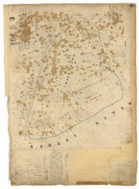
Page 62 of the City Engineer's Plat Book with eight plats. Plat 1 shows lots located near East Bay Street. Plat 2 shows a lot on Concord Street, including a wharf. Plat 3 shows three Wharf Lots on Wharf Street, near the intersection with Inspection Street. Plat 4 features a lot on Wharf Street with a dock and a brick building, across the street from a building labelled "Eagle Foundry." Plat 5 shows a lot with several buildings on East Bay Street. Plat 6 shows land near the intersection of East Bay Street and Cumberland Street, with a stretch labelled "Passage to what is now called Central Wharves." Plat 7 shows a wharf and yard on Concord Street, and a structure labelled "Cotton Shed on Brick Pillars." Plat 8 shows a lot located at the intersection of Anson Street and Calhoun Street.
Page 65 of the City Engineer's Plat Book with six plats. Plat 1 shows wharves and other structures located near the intersection of East Bay Street and Elliott Street, and also shows a building labelled "Old Post Office." Plat 2 features a wharf on the Cooper River, and shows several structures. Plat 3 shows wharves and brick storehouses located near the intersection of Prioleau Street and Queen Street. Plat 4 shows lots near the intersection of Bull Street and Smith Street. Plat 5 shows lots and structures located near the intersection of King Street and Morris Street. Plat 6 shows land located along a stretch of Coming Street, between Race Street and Sumter Street.
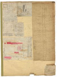
1862, 1885, 1850, 1815, 1866, 1873, 1830, 1833, and 1787
Description:
Page 60 of the City Engineer's Plat Book with eight plats. Plat 1 shows lots near East Bay Street, and the intersection of Washington Street and Inspection Street. Plat 2 shows lots and a building located near Market Street. Plat 3 shows lots located between Washington Street and Marsh Street, and between Inspection Street and Calhoun Street. Plat 4 shows plots located on Market Street with a dotted line labeled "Line of Street proposed by the City." Plat 5 shows plots and structures located near East Bay Street. Plat 6 shows lots located near the intersection of Concord Street and Inspection Street. Plat 7 shows lots located near the intersection of Pinckney Street and East Bay Street. Plat 8 shows a dock and wharf on the Cooper River.
Page 63 of the City Engineer's Plat Book with five plats. Plat 1 features wharves located near East Bay Street, and shows several docks and buildings. Plat 2 shows wharfs shows a wharf and several buildings located near East Bay Street. Plat 3 features a wharf located near East Bay Street and shows multiple buildings and docks. Plat 4 features a wharf located between East Bay Street and the Cooper River channel, and also shows several buildings. Plat 5 shows lots located on and near Market Street, between East Bay and Concord Street. Plat 6 features a wharf located between East Bay Street and the Cooper River, and also shows several buildings.
Page 61 of the City Engineer's Plat Book with four plats. Plat 1 features a lot and buildings located between East Bay Street and Concord Street, and between Pritchard Street and Hasell Street. Plat 2 shows lots between Pritchard Street and Hard Alley, near their intersections with East Bay Street. Plat 3 shows lots located on Pritchard Street, between East Bay Street and Concord Street, with some buildings labelled. Plat 4 shows lots located near the intersection of Meeting Street and Queen Street with some buildings and structures labelled.
Page 67 of the City Engineer's Plat Book with two plats. Plat 1 features three lots located on Meeting Street, with stores and yards labelled. Plat 2 shows a stretch of land near the Ashley River, and the intersection of Calhoun and Lucas Street. Plat 2 also shows a large building labelled "West Point Rice Mill" and a stretch labelled "Mill Pond."
Page 59 of the City Engineer's Plat Book with two plats. Plat 1 shows lots on East Bay Street, between Pritchard Street and Rose Lane. Plat 2 shows a lot and buildings belonging to the Charleston Gas Light Company, located on Church Street.
Page 52 of the City Engineer's Plat Book with seven plats. Plat 1 features a lot located on Queen Street. Plat 2 shows land between New Street and the Ashley River Channel, including stretches of Tradd Street, Broad Street, New Street, Savage Street, Rutledge Street, and Lynch Street. Plat 2 also shows some marshlands in the area. Plat 3 shows lots located along Greenhill Street, near the intersection with Tradd Street. Plat 4 shows an area similar to Plat 2, with certain buildings and marshlands labelled. Plat 5 shows a lot located on the intersection of Tradd Street and New Street, featuring several buildings and other structures. Plat 6 shows land located near Tradd Street, with marshes and shoals labelled. Plat 7 features lots between Tradd Street and Gibbes street, and has a label reading "City marshland." Plat 7 also shows New Street, Savage Street, and Council Street.
Page 51 of the City Engineer's Plat Book with seven plats. Plat 1 shows land located between Tradd Street and the Ashley River, and labels several features of geography such as a patch of marsh and some land labelled "Hard at low water." Plat 1 also shows a lot labelled "City Lands." Plat 2 shows lots and buildings located near the intersection of Tradd Street and Savage Street. Plat 3 shows land located on the west side of New Street. Plat 4 features a lot located at the intersection of New Street and Tradd Street. Plat 5 features lots located near the intersection of New Street and Tradd Street. Plat 6 shows lots located on and near Tradd Street. Plat 7 shows structures located near the intersection of New Street and Broad Street, including a building labelled "Theatre."
Page 54 of the City Engineer's Plat Book with six plats. Plat 1 shows lots located near the intersection of Broad Street and Friend Street. Plat 2 shows land between the Ashley River's low water mark and Smith Street, and between Beaufain Street and Broad Street. It also labels Comings Creek, and an "Edge of High Land." Other Streets on Plat 2 include "Barre Street," Gadsden Street, Beaufain Street, Lynch Street, Queen Street, and Rutledge Street. Plat 3 shows numerous city blocks, "School Land," and a large creek near the Ashley River. Other streets on Plat 3 include Beaufain Street, Wentworth Street, Montague Street, Bull Street, and Pitt Street. Plat 4 shows a similar stretch of land to Plat 3. Plat 5 shows features a lot on Beaufain Street. Plat 6 shows a lot and buildings located near the intersection of King Street and Hutson Street.
Page 58 of the City Engineer's Plat Book with six plats. Plat 1 shows lots between Broad Street and Short Street, near their intersections with Mazyck Street. Plat 2 features lots on Greenhill Street, Limehouse Street, and Tradd Street. Plat 2 also shows a line labelled "Edge of High Land." Plat 3 shows lots near Broad Street, including lots labelled "Hawens Square" and "Burying Ground." Plat 3 also shows structures labelled "Magazine" and "Work House." Plat 4 shows lots located on King Street. Plat 5 shows land located between Meeting Street and Lee Street, and a dotted line labelled "City Boundary." Plat 6 shows lots located between President Street and Norman Street.
Page 57 of the City Engineer's Plat Book with seven plats. Plat 1 shows buildings, wharves, and docks located near South Bay Street. Plat 2 shows lots located near the intersection of Church Street and Chalmer Street, including buildings labelled "Stable," "Kitchen," and "Carolina Hotel." Plat 3 features a lot and several buildings located near Broad Street. Plat 4 features a lot and buildings located on Broad Street. Plat 5 shows lots located near the intersection of Broad Street and Rutledge Street. Plat 6 shows lots located between Broad Street and "St. Michaels Alley." The last plat shows lots on East Bay Street, between Pinckney Street and Hasell Street.
Page 56 of the City Engineer's Plat Book with seven plats. Plat 1 shows lots between Savage Street and Tradd Street. Plat 2 shows lots and some buildings on South Bay Street. Plat 3 shows lots between Savage Street and Broad Street. Plat 4 shows a lot and several buildings at the intersection of Friend and Queen Street. Plat 5 shows land near the corner of Legare Street and Gibbes Street, and a few buildings. Plat 6 shows a lot on the west side of Friend Street. Plat 7 shows lots located between Broad Street and Tradd Street, and between Lynch Street and the Ashley River.
Page 50 of the City Engineer's Plat Book with seven plats. Plat 1 shows wharves and other structures located on East Bay Street. Plat 2 shows lots and buildings located on the intersection of Tradd Street and Meeting Street. Plat 3 shows lots located near the intersection of Broad Street and Rutledge Street. Plat 4 shows lots and buildings located near Gibbes Street. Plat 5 shows lots located near the intersection of Society Street and East Bay Street. Plat 6 shows lots and buildings near Broad Street. Plat 7 shows lots located between South Bay Street and the Ashley River, near Legare Street.
Page 53 of the City Engineer's Plat Book with five plats. Plat 1 shows shoals and marshlands located near the Ashley River Channel, Gibbes Street, and South Bay Street. Plat 2 features a lot and its buildings at the intersection of Broad Street and New Street. Plat 3 shows a lots and buildings located on Tradd Street. Plat 4 features lots and buildings located near the intersection of Broad Street and Tradd Street, including some stretches of marshland. Plat 5 shows lots located near Broad Street's and Tradd Street's intersections with New Street and Legare Street.
Page 55 of the City Engineer's Plat Book with five plats. Plat 1 shows lots near the intersection of Broad Street and Queen Street. Plat 2 shows lots and some buildings on Broad Street. Plat 3 shows land and buildings between Broad Street and Short Street, near their intersections with Mazyck Street. Plat 4 shows lots near Broad Street, Franklin Street, and Trapman Street. Plat 5 shows lots between Broad Street and Short Street, near their intersections Mayzck Street.
Page 45 of the City Engineer's Plat Book with nine plats. Plat 1 shows lots along New Street, located between Broad Street and Tradd Street, and shows an area labelled "City marshland." Plat 2 shows lots and buildings located between Queen Street and Cliffords Alley. Plat 3 shows land located near the intersection of Washington Street and Smith Street. Plat 4 shows lots and buildings located near the intersection of Green Street and "Comming Street." Plat 5 shows land located between "Boundary (Calhoun) Street" and George Street, and St. Phillip Street and "Comming Street," including a stretch of Green Street and College Street, and a lot labelled "College Lot." Plat 6 shows a lot located on the corner of Queen Street and King Street, and its buildings. Plat 7 shows lots located on Savage Street. Plat 8 shows lots located on Beaufain Street. Plat 9 shows lots near King Street, located between Boulevard Drive and South Bay Street.
Page 41 of the City Engineer's Plat Book with six plats. Plat 1 shows land between Mount Street and Congress Street, and between a private street and "CITY LANDS Potter's Field." Plat 2 shows lots near Chestnut Street and near Spring Street, Ashton Street, Always Street, Lilly Street, and Pine Street. It also shows a few bodies of water. Plat 3 shows lots near Meeting Street's intersections with Market Alley, and State House Alley. It also labels a court house, the Treasury and Guard House, and St. Michael's Church. Plat 4 shows a stretch of land near President Street, Logan Street, Pinckney Street, Fishburne Street, Mount Street, Congress Street, and shows bodies of water and highlands. Plat 5 shows lots and buildings near the intersection Church Street and Water Street.
Page 47 of the City Engineer's Plat Book with four plats. Plat 1 shows lots between America Street and Meeting Street, and between Moultrie Street and Line Street. Plat 1 also includes a stretch of Moultrie Street and Hampton Street extending from Meeting Street to King Street. Plat 2 shows the plan of a wharf and channel located on East Bay Street, and includes several planned buildings and structures. Plat 3 shows lots of land located between East Bay Street and the "Edge of Channel of Cooper Street." Plat 4 shows lots located near East Bay Street's intersections with Water Street and Lynches Lane. Plat 4 shows several buildings, "Flat Broken ground," low lands, and a "Shoal dry at Low Water."
Page 49 of the City Engineer's Plat Book with six plats. Plat 1 shows land on the Cooper River. Plat 2 shows land located near Broad Street's intersections with Gadsden Street and Lynch Street, and a stream labelled "Comings Creek." Plat 3 shows wharfs and buildings along the Cooper River and near Champney Street. Plat 4 shows wharves and other structures between East Bay Street and the Cooper River. Plat 5 shows land near South Bay Street's intersections with Meeting Street and Church Street, including a lot labelled "Battery Garden" and a structure labelled "Bathing House."