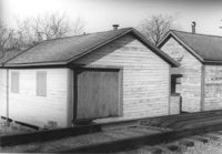
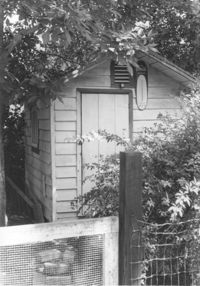
Shed (railroad building) along railroad tracks, on site affected by the construction of Interstate 26 (I-26). Address: 19½ Poinsett Street (rear). Surveyor notations on back of photo: "Dkt.: 10.503. Property owner: S.A.L.R.R. Tract: 105. Station: 5924+35 Rt. & Lt. Date: Feb. 20, 1963." [See collection description for explanation of surveyor notations.]
Shed (railroad building) on site affected by the construction of Interstate 26 (I-26). Address: 19½ Poinsett Street (rear). Surveyor notations on back of photo: "Dkt.: 10.503. Property owner: S.A.L.R.R. Tract: 105. Station: 5924+25 Rt. Date: Feb. 20, 1963." [See collection description for explanation of surveyor notations.]
Shed (railroad building) along railroad tracks, on site affected by the construction of Interstate 26 (I-26). Address: 19½ Poinsett Street (rear). Surveyor notations on back of photo: "Dkt.: 10.503. Property owner: S.A.L.R.R. Tract: 105. Station: 5924+40 Lt. Date: Feb. 20, 1963." [See collection description for explanation of surveyor notations.]
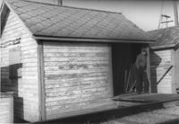
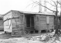
Shed on site affected by the construction of Interstate 26 (I-26). Address: 27 Indian Street. (1951 Sanborn map indicates the address is 17 Indian Street.) Surveyor notations on back of photo: "Dkt.: 10.503. Property owner: Eloise Williams. Tract: 76. Station: 5913+90 Lt. Date: Feb. 20, 1963. In R/W - Bought." [See collection description for explanation of surveyor notations.]
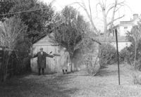
Shed behind house on site affected by the construction of Interstate 26 (I-26). Address: 5 Carolina Street. Surveyor notations on back of photo: "Dkt.: 10.517. Property owner: I.S. Keith Ellsworth, Sr. Tract: 128. Station: 22+50 Rt. (Line "1"). Date: November 4, 1965. Backyard with shed, entirely in R/W." [See collection description for explanation of surveyor notations.]
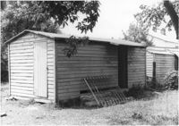
Shed on site affected by the construction of Interstate 26 (I-26). Address: 2130 Montford Avenue. Surveyor notations on back of photo: "Dkt.: 10.490. Property owner: Rosa Lee Knight. Tract: 173. Station: 5884+00 Lt. Date: May 15, 1962. In R/W - Bought." [See collection description for explanation of surveyor notations.]
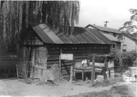
Shed on site affected by the construction of Interstate 26 (I-26). Surveyor notations on back of photo: "Dkt.: 10.480. Property owner: C.H. & Elise V. Meidburg. Tract: 249. Station: 5705+80 Lt. Date: May 31, 1961. In R/W - Bought." [See collection description for explanation of surveyor notations.]
Outbuilding on site affected by the construction of the Crosstown. Address: 39 Lee Street (south side of street). Industrial smokestacks in background (Cigar Factory?). Surveyor notations on back of photo: "Dkt.: 10.518. Property owner: Yetta B. Rosen. Tract: 69. Station: 52+70 Rt. N.B. lane Route 17. Date: Mar. 7, 1963. In R/W - Bought." [See collection description for explanation of surveyor notations.]
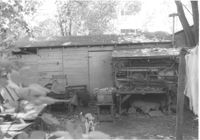
Shed and backyard on site affected by the construction of the Crosstown. Address: 112 Sheppard Street. Surveyor notations on back of photo: "Dkt.: 10.524. Property owner: Alston O. Crum, Est. Tract: 146. Station: 19+60 Lt. S.B. lane. Date: Dec. 2, 1964. Proximity." [See collection description for explanation of surveyor notations.]
Shed on site affected by the construction of Interstate 26 (I-26). Surveyor notations on back of photo: "Dkt.: 10.490. Property owner: Leah D. Governor. Tract: 58. Station: 5800+60 Rt. Line 'G'. Date: September 12, 1962. In R/W - Bought." [See collection description for explanation of surveyor notations.]