Search
« Previous |
201 - 250 of 1,683
|
Next »
Search Results
Date:
1977-1983
Description:
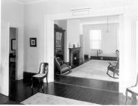
Charleston County, Cassina Point Plantation, ca. 1847. Interior View. 1st Floor - SW Room, Looking to NE corner of SE Room. 4" x 5" B/W photo.
Date:
1977-1983
Description:
Charleston County, Cassina Point Plantation, ca. 1847. Interior View. 1st Floor - North Central Stair Hall, looking North. 4" x 5" B/W photo.
Date:
1977-1983
Description:
Charleston County, Cassina Point Plantation, ca. 1847. Interior View. 2nd Floor - Hall, looking South from landing. 4" x 5" B/W photo.
Date:
1977-1983
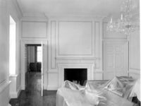
Description:
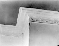
Berkley County, Loch Dhu, ca. 1812. Main House - Interior View. 1st Floor - SW Room, North wall. Detail of cornice. 4" x 5" B/W photo.
Date:
1977-1983
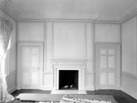
Description:
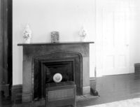
Berkley County, Loch Dhu, ca. 1812. Main House - Interior View. 1st Floor - SE Room, North wall. 4" x 5" B/W photo.
Date:
1977-1983
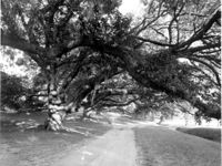
Description:
Berkley County, Mulberry Plantation, ca. 1714. Driveway - View of Live Oak trees. From West, looking East. 4" x 5" B/W photo.
Date:
1977-1983
Description:
6 Glebe Street, St. Philip's Parsonage House (Bishop Robert Smith House), ca. 1770. Interior View. 1st Floor - SW Room, North wall. 4" x 5" B/W photo.
Date:
1977-1983
Description:
6 Glebe Street, St. Philip's Parsonage House (Bishop Robert Smith House), ca. 1770. Interior View. 2nd Floor - SE Room, North wall. 4" x 5" B/W photo.
Date:
1977-1983
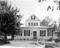
Description:
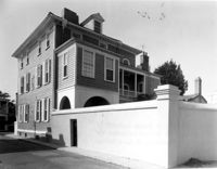
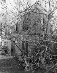
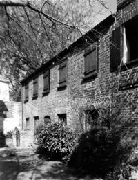
Berkley County, Stephen Williams House, ca. 1842. View of South (Rear) elevation. 4" x 5" B/W photo.
Date:
1977-1983
Description:
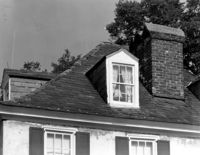
143 - 145 Church Street, Alexander Perronneau Tenements, ca. 1740. Detail View of roof, dormer, cornice and chimney, East (Front) elevation. 4" x 5" B/W photo.
Date:
1977-1983
Description:
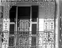
56 South Battery, Osborn-McCrady House, ca. 1770. Detail View of 2nd Floor ironwork, South (Front) elevation. 4" x 5" B/W photo.
Date:
1977-1983
Description:
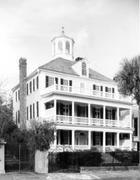
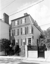
32 South Battery, Colonel John Ashe House, ca. 1762. Main House - View of SW (Front and Side) elevation. 4" x 5" B/W photo.
Date:
1977-1983
Description:
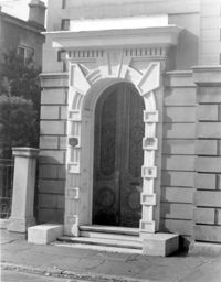
81 Rutledge Avenue, Glover-Sottile House, ca. 1826. Detail View of entry, East (Front) elevation. 4" x 5" B/W photo.
Date:
1977-1983
Description:
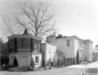
31 Legare Street, Hannah Heyward House, ca. 1789. Stable - View of North (Side) elevation. 4" x 5" B/W photo.
Date:
1977-1983
Description:
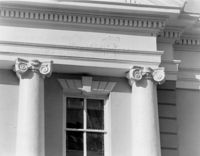
82 - 86 Broad Street, ca 1753. Detail View of columns (East end), South (Rear) elevation. 4" x 5" B/W photo.
Date:
1977-1983
Description:
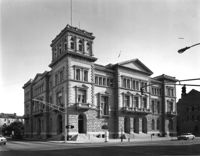
83 Broad Street, Federal Courthouse and Post Office, ca. 1896. View of NE (Front and Side) elevation. 4" x 5" B/W photo.
Date:
1977-1983
Description:
83 Broad Street, Federal Courthouse and Post Office, ca. 1896. View of South (Rear) elevation. 4" x 5" B/W photo.
Date:
1977-1983
Description:
Berkley County, Mulberry Plantation, ca. 1714. Main House - Interior View. 1st Floor - Stair Hall, looking SW. 4" x 5" B/W photo.
Date:
1977-1983
Description:
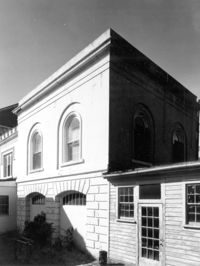
90 Hasell Street, Synagogue of Kahal Kadosh Beth Elohim, ca. 1840. View of South (Side) elevation. 4" x 5" B/W photo.
Date:
1977-1983
Description:
90 Hasell Street, Synagogue of Kahal Kadosh Beth Elohim, ca. 1840. View of East (Rear) elevation. 4" x 5" B/W photo.
Date:
1977-1983
Description:
106 Tradd Street, Colonel John Stuart House, ca. 1772. Main House - View of NE (Rear and Side) elevation. 4" x 5" B/W photo.
Date:
1977-1983
Description:
95 Rutledge Avenue, Grimke-Seabrook House, ca. 1819. View of SE (Front and Side) elevation. 4" x 5" B/W photo.
Date:
1977-1983
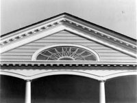
Description:
Charleston County, William Seabrook-Dodge Plantation, ca. 1810. Detail View of portico pediment, South (Front) elevation. 4" x 5" B/W photo.
Date:
1977-1983
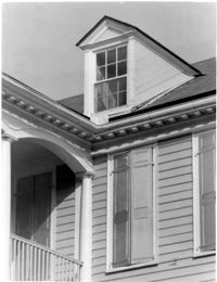
Description:
Charleston County, William Seabrook-Dodge Plantation, ca. 1810. Detail View of dormer and cornice, South (Front) elevation. 4" x 5" B/W photo.
Date:
1977-1983
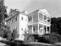
Description:
Charleston County, William Seabrook-Dodge Plantation, ca. 1810. View of SW (Front and Side) elevation. 4" x 5" B/W photo.
Date:
1977-1983
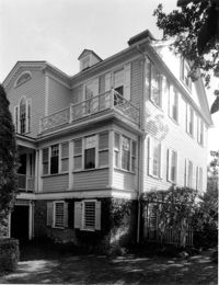
Description:
Charleston County, William Seabrook-Dodge Plantation, ca. 1810. View of NW (Rear and Side) elevation. 4" x 5" B/W photo.
Date:
1977-1983
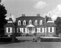
Description:
Berkley County, Mulberry Plantation, ca. 1714. Main House - View of South (Front) elevation. 4" x 5" B/W photo.
Date:
1977-1983
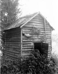
Description:
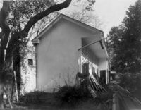
Berkley County, Loch Dhu, ca. 1812. Smokehouse - View of Front and Side elevation. 4" x 5" B/W photo.
Date:
1977-1983
Description:
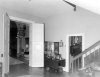
286 Calhoun Street, Jonathan Lucas House, ca. 1809. Main House - Interior View. 1st Floor - front entry, North elevation. 4" x 5" B/W photo.
Date:
1977-1983
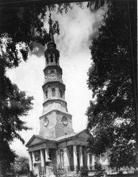
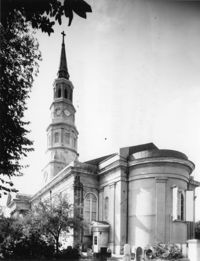
Description:
146 Church Street, St. Philip's Episcopal Church, ca. 1836. View of SW (Front and Side) elevation. 4" x 5" B/W photo.
Date:
1977-1983
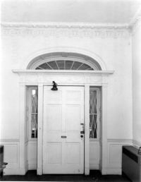
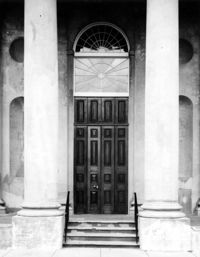
Description:
146 Church Street, St. Philip's Episcopal Church, ca. 1836. Detail View of West (Front) entry. 4" x 5" B/W photo.
Date:
1977-1983
Description:
146 Church Street, St. Philip's Episcopal Church, ca. 1836. Detail View of Side (North) entry. 4" x 5" B/W photo.
Date:
1977-1983
Description:
146 Church Street, St. Philip's Episcopal Church, ca. 1836. View of SE (Rear and Side) elevation. 4" x 5" B/W photo.
Date:
1977-1983
Description:
89 - 91 Church Street, Catfish Row, ca. 1783. View of NE (Front and Side) elevation. 4" x 5" B/W photo.
Date:
1977-1983
Description:
133 Church Street, Planter's Hotel, ca. 1809. View of East (Front) elevation. 4" x 5" B/W photo.
Date:
1977-1983
Description:
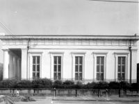
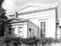
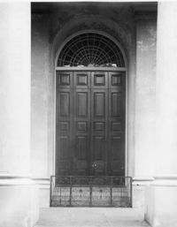
126 Coming Street, Cathedral Church of St. Luke and St. Paul, ca. 1816. Detail View of portico, West (Front) elevation. 4" x 5" B/W photo.
Date:
1977-1983
Description:
172 Rutledge Avenue, Ashley Hall, ca. 1802. Main House - Detail View of bay cornice, West (Side) elevation. 4" x 5" B/W photo.
Date:
1977-1983
Description:
172 Rutledge Avenue, Ashley Hall, ca. 1802. Main House - Detail View of bay, West (Side) elevation. 4" x 5" B/W photo.
Date:
1977-1983
Description:
172 Rutledge Avenue, Ashley Hall, ca. 1802. Carriage House - View of SE (Front and Side) elevation. 4" x 5" B/W photo.
Date:
1977-1983
Description:
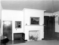
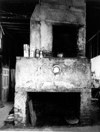
126 Tradd street, Dr. Peter Fayssoux House, ca. 1732. Kitchen House - Interior View. Detail of North fireplace with plaster. 4" x 5" B/W photo.
Date:
1977-1983
Description:
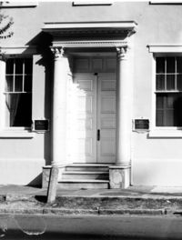
88 Broad Street, Josiah Smith Tenement, ca. 1795. Detail View of entry, South (Front) elevation. 4" x 5" B/W photo.
Date:
1977-1983
Description:
138 Wentworth Street, Edwin L. Kerrison House, ca. 1838. Guest House - View of East (Side) elevation. 4" x 5" B/W photo.
Date:
1977-1983
Description:
8 Meeting Street, Thomas Tucker House, ca.1806. Stable - View of NW (Front and Side) elevation. 4" x 5" B/W photo.
Date:
1977-1983
Description:
72 Tradd Street, Fotheringham-McNeil Tenements, ca. 1765. View of SE (Front and Side) elevation. 4" x 5" B/W photo.
Date:
1977-1983
Description:
8 Meeting Street, Thomas Tucker House, ca.1806. Kitchen House - View of West (Front) elevation. 4" x 5" B/W photo.
Date:
1977-1983
Description:
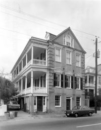
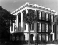
9 East Battery, Roper House, ca. 1842. View of SE (Front and Side) elevation. 4" x 5" B/W photo.
Date:
1977-1983
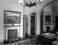
Description:
100 Meeting Street, Fireproof Building, ca. 1822. Interior View - 1st Floor. NW Room - East wall, South elevation. 4" x 5" B/W photo.
Date:
1977-1983
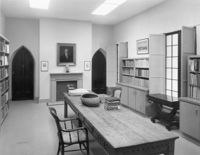
Description:
100 Meeting Street, Fireproof Building, ca. 1822. Interior View - 2nd Floor. Center South Room, West elevation. 4" x 5" B/W photo.
Date:
1977-1983
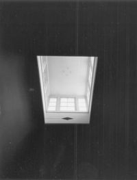
Description:
100 Meeting Street, Fireproof Building, ca. 1822. Interior View - 2nd Floor. Stair Hall - Detail of skylight. 4" x 5" B/W photo.
Date:
1977-1983
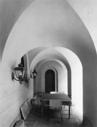
Description:
100 Meeting Street, Fireproof Building, ca. 1822. Detail View of South portico, Ground Floor, West elevation. 4" x 5" B/W photo.