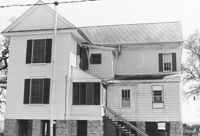
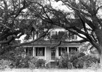
Secessionville Manor (Secessionville Plantation), Battallion Drive. View of South (Front) elevation. Charleston, S.C.;3" x 3" Color photo. Box 12, Folder 2-4-6. One copy.
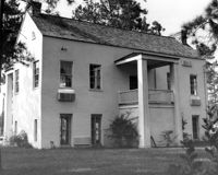
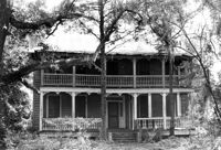
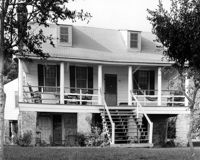
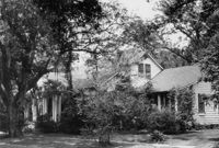
Rockville Historic District - Ladson Webb House (Exchange Plantation House), Sea Island Yacht Club Road. View of North (Front) elevation. Wadmalaw Island, S.C.;6.5" x 10" B/W photo. Box 17, Folder 2-14-8. One copy.
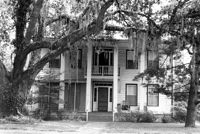
Rockville Historic District - Ladson Webb House (Exchange Plantation House), Sea Island Yacht Club Road. View of South (Rear) elevation. Wadmalaw Island, S.C.;6.5" x 10" B/W photo. Box 17, Folder 2-14-8. One copy.
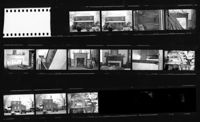
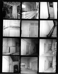
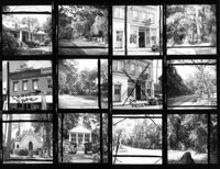
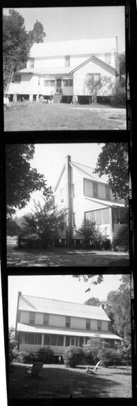
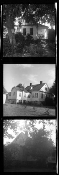
Old Carroll House (Carroll Place), Junction of Quaker and Wire Roads. Contact Sheet 12 - Multiple Views. St. George, S.C.;10" x 5" B/W photo. Box 20, Folder: Miscellaneous Photos: Scanned Contact Sheets. One copy.
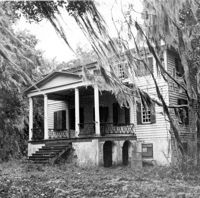
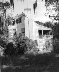
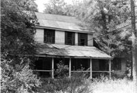
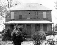
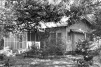
Bailey's House (Sandiford Holmes House), Point of Pines Road. View of NW (Front and Side) elevation. Edisto Island, S.C.;8" x 10" B/W photo. Box 10, Folder 2-3-1. One copy.
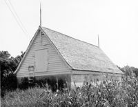
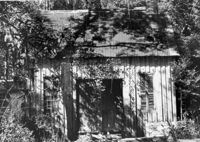
Bleak Hall Plantation, S.C. Hwy. 174. Tractor Shed - View of SW (Side and Rear) elevation. Edisto Island, S.C.;8" x 10" B/W photo. Box 10, Folder 2-3-2. One copy.
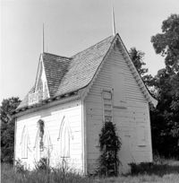
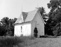
Bleak Hall Plantation, S.C. Hwy. 174. Ice House - View of NE (Front and Side) elevation. Edisto Island, S.C.;8" x 8" B/W photo. Box 10, Folder 2-3-2. One copy.
Bleak Hall Plantation, S.C. Hwy. 174. Ice House - View of NE (Front and Side) elevation. Edisto Island, S.C.;8" x 10" B/W photo. Box 10, Folder 2-3-2. One copy.
Bailey's House (Sandiford Holmes House), Point of Pines Road. View of West (Side) elevation. Edisto Island, S.C.;10" x 8" B/W photo. Box 10, Folder 2-3-1. One copy.
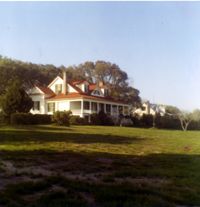
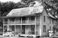
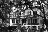
Dodge Plantation - Main House (William Seabrook House). View of North (Front) elevation. Edisto Island, S.C.;8" x 10" B/W photo. Box 10, Folder 2-3-5. Two copies.
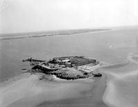
Folly Island Staging Area (Battery Green, U.S. Coast Guard Loran Station, Folly North Site), Address restricted. View facing North. Folly Beach, S.C.;8" x 10" B/W photo. Box 17, Folder 2-16-1. One copy.
Rockville Historic District - Welch's Lane House (Welches Lane House), Sea Island Yacht Club Road. View of South (Front) elevation. Wadmalaw Island, S.C.;6.5" x 10" (and 8" x 10") B/W photo. Box 17, Folder 2-14-24. Two copies.
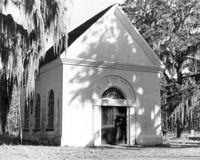
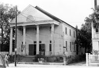
White Church (St. Thomas Church, The Brick Church), Off of Cainhoy Road. Main Building - View of Front and Side elevation. Cainhoy, S.C.;8" x 10" B/W photo. Box 4, Folder 1-12-2. One copy.
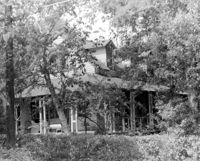
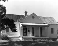
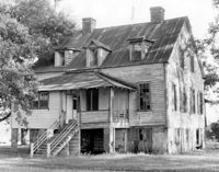
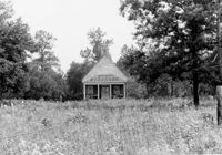
Dean Hall Plantation - Overseers House. View of NNW (Rear and Side) elevation. Oakley, SC. NOTE: Property relocated to Moncks Corner, S.C.;8" x 10" B/W photo. Box 2, Folder 1-8-9. One copy.
Unidentified - House. View of Front elevation. Labeled as, "Iseman D. Ward, Jr. and Carol Smoak - owners". Cainhoy, S.C.;8" x 10" B/W photo. Box 4, Folder 1-12-3. One copy.
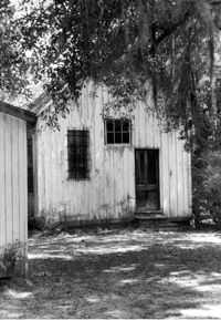
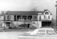
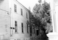
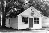
Firetag's Store (Mappus' Store, Six Mile Store), Success Street (between Meeting Street Road and Rivers Avenue). View of SW (Rear and Side) elevation. North Charleston, S.C.;6.5" x 10" B/W photo. Box 5, Folder 2-1-7. One copy.
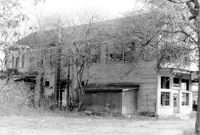
Firetag's Store (Mappus' Store, Six Mile Store), Success Street (between Meeting Street Road and Rivers Avenue). View of West (Side) elevation. North Charleston, S.C.;6.5" x 10" B/W photo. Box 5, Folder 2-1-7. One copy.
Firetag's Store (Mappus' Store, Six Mile Store), Success Street (between Meeting Street Road and Rivers Avenue). View of East (Side) elevation. North Charleston, S.C.;6.5" x 10" B/W photo. Box 5, Folder 2-1-7. One copy.
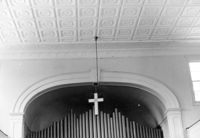
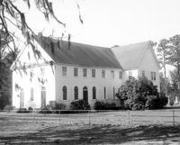
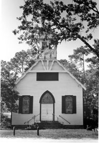
Tavou Church (Taveau Church), Strawberry Ferry Road (S.C. State Road 44). View of Front elevation. Moncks Corner, SC.;8" x 10" B/W photo. Box 2, Folder 1-3-12. One copy.
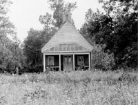
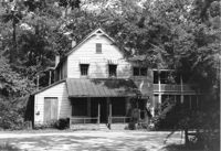
1920 Residence of Charley Jones - Barrows Historic District. View of West side. Moncks Corner, S.C.;6.5" x 9.5" B/W photo. Box 2, Folder 1-1-1. Three copies.
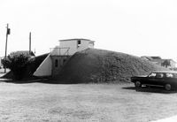
U.S. Coast Guard Historical District, I'on Avenue. Bunker - View of NW (Side and Front) elevation. Sullivans Island, S.C.;6.5" x 10" (and 3.5" x 5") B/W photo. Box 16, Folder 2-13-1. Two copies.
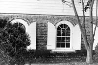
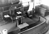
Old Bethel Methodist Church, 222 Calhoun Street. Interior View - Detail of Chancel. NE (Front and Side) elevation. Charleston, S.C.;6.5" x 10" B/W photo. Box 7, Folder 2-1-43. One copy.
Johns Island Presbyterian Church, 2550 Bohicket Road. Church - View of Front and Side elevation. Johns Island, S.C.;8" x 10" B/W photo. Box 12, Folder 2-5-4. One copy.
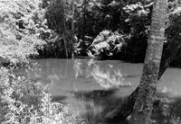
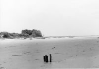
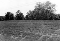
Stono River Rebellion Site (Cato's Rebellion Site), North Side of U.S. Highway 17, west of the Wallace River. View looking West. Hollywood, S.C.;6.5" x 10" B/W photo. Box 16, Folder 2-11-16. One copy.
Old Rectory (Gourdin House). View of North (Front and Side) elevation. Pineville Historic District. St. Stephen, SC.;6.5" x 9.5" B/W photo. Box 3, Folder 1-9-1 (I). One copy.
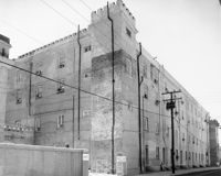
Old Citadel (South Carolina State Arsenal, Embassy Suites Hotel), 337 Meeting Street. View of SW (Front and Side) elevation. Charleston, S.C.;3.5" x 5" B/W photo. Box 5, Folder 2-1-5. Two copies.
Old Citadel (South Carolina State Arsenal, Embassy Suites Hotel), 337 Meeting Street. View of SW (Front and Side) elevation. Charleston, S.C.;8" x 10" B/W photo. Box 5, Folder 2-1-5. Three copies.
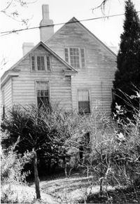
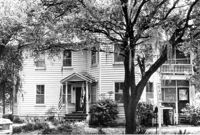
Edward O. Hall House, ca. 1898 - Pivotal to Historic District. View of Front elevation. Pinopolis Historic District South. Pinopolis, S.C.;5" x 7" B/W photo. Box 3, Folder 1-10-1 (II). One copy.
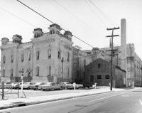
Old Citadel (South Carolina State Arsenal, Embassy Suites Hotel), 337 Meeting Street. View of NE (Rear and Side) elevation. Charleston, S.C.;8" x 10" B/W photo. Box 5, Folder 2-1-5. Two copies.
Old Citadel (South Carolina State Arsenal, Embassy Suites Hotel), 337 Meeting Street. View of NE (Rear and Side) elevation. Charleston, S.C.;8" x 10" B/W photo. Box 5, Folder 2-1-5. One copy.
Pinopolis Methodist Church, ca. 1900 - Pivotal to Historic District. View of Front elevation. Pinopolis Historic District South. Pinopolis, S.C.;7" x 5" B/W photo. Box 3, Folder 1-10-1 (II). One copy.
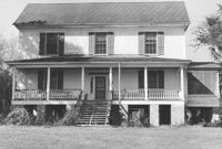
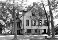
Dr. Morton Waring House - Main House. View of North (Front) elevation. Pinopolis Historic District South. Pinopolis, S.C.;6.5" x 9.5" B/W photo. Box 4, Folder 1-10-1 (III). One copy.
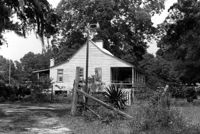
Harlock Webb Harvey Store and Home. View of Side and Front elevations. Pinopolis, S.C.;6.5" x 9.5" B/W photo. Box 4, Folder 1-10-1 (III). Three copies.
Kate Vincent Waring House (ca. 1913), S. Pinckney Street. View of Front elevation. McClellanville Historic District. McClellanville, S.C.;6.5" x 10" B/W photo. Box 14, Folder 2-10-5. One copy.
James A. Lofton House (ca. 1907), S. Pinckney Street. View of Front elevation. McClellanville Historic District. McClellanville, S.C.;6.5" x 10" B/W photo. Box 14, Folder 2-10-5. One copy.
M.F. Skipper House (ca. 1904), S. Pinckney Street. View of Front elevation. McClellanville Historic District. McClellanville, S.C.;6.5" x 10" B/W photo. Box 14, Folder 2-10-5. One copy.
Old Post Office, ca. 1896 - Pivotal to Historic District. View of Front elevation. Pinopolis, S.C.;5" x 7" B/W photo. Box 3, Folder 1-10-1 (II). One copy.
Old Rectory, ca. 1855 - Pivotal to Historic District. View of Front elevation. Pinopolis Historic District South. Pinopolis, S.C.;5" x 7" B/W photo. Box 3, Folder 1-10-1 (II). One copy.
Old Carroll House (Carroll Place), Junction of Quaker and Wire Roads. View of North (Front) elevation. St. George, S.C.;8" x 10" B/W photo. Box 20, Folder: Miscellaneous Photos: Unidentified Images. One copy.
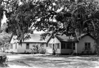
Rockville Historic District - Hagood House (Micah Jenkins House), Grace Chapel Road. View of South (Front) elevation. Wadmalaw Island, S.C.;8" x 10" B/W photo. Box 17, Folder 2-14-16. One copy.
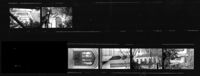
T. Hayne Stall House. Contact Sheet 1 - View of Front and Side elevations. Stallsville Area. Summerville, S.C.;7.5" x 2.25" B/W photo. Box 17, Folder 3-1-1. One Copy.
Unidentified Commercial Building (ca. 1930) - Contributory to Historic District. View of Front elevation. McClellanville Historic District. McClellanville, S.C.;6.5" x 10" B/W photo. Box 14, Folder 2-10-5. One copy.
Unidentified House (ca. 1937) - Contributory to Historic District. View of Side and Front elevation. McClellanville Historic District. McClellanville, S.C.;6.5" x 10" B/W photo. Box 14, Folder 2-10-5. One copy.
Unidentified House (ca. 1943) - Contributory to Historic District. View of Side and Front elevation. McClellanville Historic District. McClellanville, S.C.;6.5" x 10" B/W photo. Box 14, Folder 2-10-5. One copy.
Unidentified House (ca. 1945) - Contributory to Historic District. View of Front and Side elevation. McClellanville Historic District. McClellanville, S.C.;6.5" x 10" B/W photo. Box 14, Folder 2-10-5. One copy.
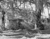
Seaside Plantation (Locksley Hall), off of Cypress Bottom Road. View of South (Front) elevation. Edisto Island, S.C.;8" x 10" B/W photo. Box 11, Folder 2-3-12. One copy.
Unidentified House (ca. post-1922) - Contributory to Historic District. View of Front elevation. McClellanville Historic District. McClellanville, S.C.;6.5" x 10" B/W photo. Box 14, Folder 2-10-5. One copy.
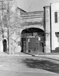
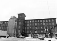
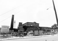
Cigar Factory, 701 East Bay Street. General View of North (Side) elevation (Blake Street in foreground). Charleston, S.C.;7" x 10" B/W photo. Box 9, Folder 2-1-221. One copy.
Unidentified House (ca. 1948) - Contributory to Historic District. View of Front elevation. McClellanville Historic District. McClellanville, S.C.;6.5" x 10" B/W photo. Box 14, Folder 2-10-5. One copy.
Unidentified House (ca. 1947) - Contributory to Historic District. View of Front elevation. McClellanville Historic District. McClellanville, S.C.;6.5" x 10" B/W photo. Box 14, Folder 2-10-5. One copy.
St. Andrews Episcopal Church (Old St. Andrews Parish Church), 2604 Ashley River Road. Detail View of South (Side) elevation. Charleston, S.C.;10" x 8" B/W photo. Box 14, Folder 2-9-7. One copy.
St. Andrews Episcopal Church (Old St. Andrews Parish Church), 2604 Ashley River Road. View of North (Side) elevation. Charleston, S.C.;6.5" x 10" B/W photo. Box 14, Folder 2-9-7. One copy.
St. Andrews Episcopal Church (Old St. Andrews Parish Church), 2604 Ashley River Road. View of North (Side) elevation. Charleston, S.C.;6.5" x 10" B/W photo. Box 14, Folder 2-9-7. One copy.
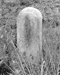
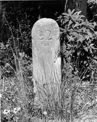
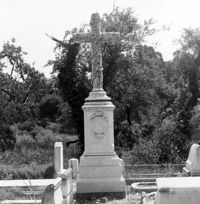
Magnolia Cemetery, Huguenin Avenue and Algonquin Road. Monument of Emma Heyward Haskell. Charleston, S.C.;8" x 8" B/W photo. Box 5, Folder 2-1-3. One copy.
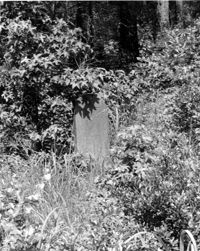
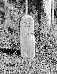
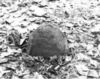
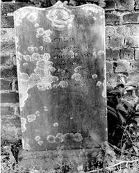
Colonel William Washington Cemetery. Tombstone of William Washington Ancrum (1854). Ravenel, S.C.;10" x 8" B/W photo. Box 16, Folder 2-11-11. One copy.
Rockville Historic District - John F. Townsend House, Sea Island Yacht Club Road. Detail View of Front Porch, NE (Front and Side) elevation.. Wadmalaw Island, S.C.;8" x 10" B/W photo. Box 17, Folder 2-14-7. One copy.
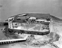
Folly Island Staging Area (Battery Green, U.S. Coast Guard Loran Station, Folly North Site), Address restricted. View facing NNW. Folly Beach, S.C.;8" x 10" B/W photo. Box 17, Folder 2-16-1. One copy.
Mary Lesesne House (B.C. Cox House), ca. 1790. View of SE (Rear and Side) elevation. Cainhoy, S.C.;6.5" x 10" B/W photo. Box 4, Folder 1-12-3. One copy.
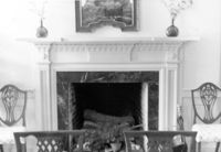
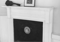
Library Society Building. Interior View - Detail of Mantel on West Side. WNW elevation. Pineville Historic District. St. Stephen, SC.;6.5" x 9.5" B/W photo. Box 3, Folder 1-9-1 (I). One copy.
Library Society Building. View of NE (Side and Front) elevation. Pineville Historic District. St. Stephen, SC.;9.5" x 6.5" B/W photo. Box 3, Folder 1-9-1 (I). One copy.
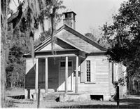
Old Post Office. View of North (Front) elevation. Pineville Historic District. St. Stephen, SC.;6.5" x 9.5" B/W photo. Box 3, Folder 1-9-1 (I). One copy.