Nathaniel Heyward writes to his mother from college in Princeton, New Jersey. He thanks her for the shirts she sent and requests some good cotton or silk stockings which are "difficult to be got in Princeton." He mentions a carriage accident involving his aunt and his desire to visit Philadelphia for vacation. 4p.
In a letter to his mother from Princeton, New Jersey, Nathaniel Heyward writes at length about the death of a local friend and acknowledges receipt of $400 dollars he is to split with his brother for expenses. 4p.
A letter written by Elias Ball III to his brother John Ball at Comingtee Plantation discussing traveling, a Mr. Naylor traveling to Liverpool, Betsey and Polly Smith sailing for Philadelphia, a lot at Strawberry Plantation, the tending of crops and the passage of Captain Drommon from Norfolk.
Page 101 of the City Engineer's Plat Book with two plats. Plat 1 shows lots located between Washington Street and Wharf Street, and between Calhoun Street and Laurens Street. Plat 2 shows lots located near the intersection of Rutledge Avenue and Line Street, with several buildings labelled.
Page 140 of the City Engineer's Plat Book with six plats. Plat 1 shows lots and structures located on and near Queen Street, between King Street and Meeting Street. Plat 2 shows lots located on Rutledge Street. Plat 3 shows lots located between George Street and Burns Lane, near where they intersect with Meeting Street. One lot is labelled "Property of Charleston High School." Plat 4 shows lots and structures located between Lynch Street and the Ashley River, near Broad Street and Beaufain Street. Plat 5 shows lots and structures located on the corner of King Street and Society Street. Plat 6 shows the same area as Plat 5, but with some changes to the structures.
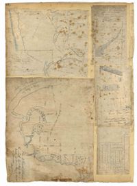
Page 78 of the City Engineer's Plat Book with five plats. Plat 1 features land and lots located near the Ashley River, including geographic features such as marshland, high land, and bodies of water. Plat 1 also shows Boundary Street, Hutson Street, Doughty Street, Bee Street, Elliot Street, Cannon Street, President Street, and Thomas Street. Plat 2 shows a city block between Doughty Street and Bee Street, and between President Street and Thomas Street, with some marsh labelled. Plat 3 features land and lots located near the Ashley River, with shoals and streams labelled. Plat 3 also shows Boundary Street, Pinckney Street, Cannon Street, Hutson Street, Doughty Street, and Bee Street. Plat 4 shows lots located near the intersection of Calhoun Street and Lucas Street, and shows several structures and a stretch of a creek. Plat 5 shows lots features lots located between Lucas Street and Ashley Street, and Mill Street and Doughty Street. Plat 5also shows Palmetto Street, President Street, and a lot labelled "U. S. Arsenal Square."
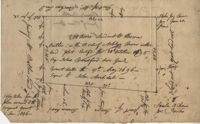
Copy of a plat of 200 acres on the neck of the Ashley River belonging to Thomas Butler. Only property outline and a few notes about the edges of the property are included. Names associated with this plat are Thomas Butler, Barker, John Bradford, and John Archdale. Notable geographic locations include the Ashley River, Clear Spring and St. Andrew's Parish.
1806, 1822, 1809, 1820, 1808, 1821, 1807, and 1810-1819
Description:
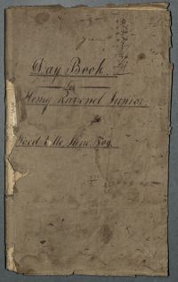
The Day Book for Henry Ravenel Junior, Wood Ville, 1806-1822, is a book divided into two sections. The first section lists the names of slaves and their decedents, lists of purchased slaves with name, name of previous owner, date and price, and slaves who received shoes. The second half, which appears upside down, records family events, visits to the Pineville theatre, traveling, engagements, marriages, deaths, and attendance at the Jockey Club. Also included are entries about a hunting party to capture or kill fugitive slaves, the promise of emancipation for two female "mulatto" child slaves, and a trial over the body of a slave woman who was punished to death. This book contains a second use written upside-down and back to front.