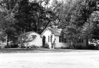
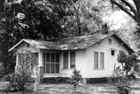
Unidentified House (ca. post-1922) - Contributory to Historic District. View of Front elevation. McClellanville Historic District. McClellanville, S.C.;6.5" x 10" B/W photo. Box 14, Folder 2-10-5. One copy.
Unidentified House (ca. post-1922) - Contributory to Historic District. View of Front elevation. McClellanville Historic District. McClellanville, S.C.;6.5" x 10" B/W photo. Box 14, Folder 2-10-5. One copy.
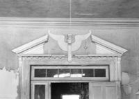
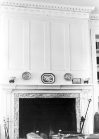
Barnwell House (Prospect Hill Plantation), Sugar Hill Road. Interior View - Detail of Architrave. Hollywood, S.C.;8" x 10" B/W photo. Box 16, Folder 2-11-5. One copy.
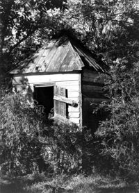
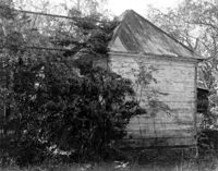
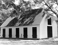
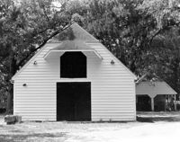
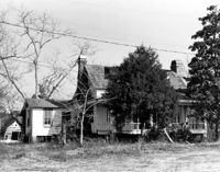
Barnwell House (Prospect Hill Plantation), Sugar Hill Road. Outbuilding - View of Side elevation. Hollywood, S.C.;10" x 8" B/W photo. Box 16, Folder 2-11-5. One copy.
Barnwell House (Prospect Hill Plantation), Sugar Hill Road. Outbuilding - View of Side elevation. Hollywood, S.C.;10" x 8" B/W photo. Box 16, Folder 2-11-5. One copy.
Barnwell House (Prospect Hill Plantation), Sugar Hill Road. Outbuilding - View of Side elevation. Hollywood, S.C.;8" x 10" B/W photo. Box 16, Folder 2-11-5. One copy.
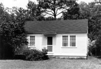
Sarah J. Stanland Graham House (ca. 1900), S. Pinckney Street. View of Front elevation. McClellanville Historic District. McClellanville, S.C.;6.5" x 10" B/W photo. Box 14, Folder 2-10-5. One copy.
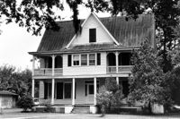
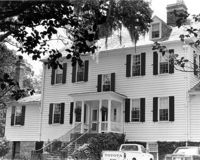
Robert E. Graham House (ca. 1915), S. Pinckney Street. View of Front and Side elevation. McClellanville Historic District. McClellanville, S.C.;6.5" x 10" B/W photo. Box 14, Folder 2-10-5. One copy.
Unidentified House, ca. post-1922 - Contributory to Historic District. View of Front elevation. McClellanville Historic District. McClellanville, S.C.;6.5" x 10" B/W photo. Box 14, Folder 2-10-5. One copy.
Wedge Plantation (William Lucas House), Wedge Plantation Road. Outbuilding #1 - View of Side and Front elevation. McClellanville, S.C.;8" x 10" B/W photo. Box 15, Folder 2-10-6. One copy.
Unidentified House (ca. 1938) - Contributory to Historic District. View of Front elevation. McClellanville Historic District. McClellanville, S.C.;6.5" x 10" B/W photo. Box 14, Folder 2-10-5. One copy.
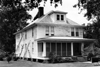
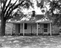
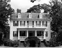
Wedge Plantation (William Lucas House), Wedge Plantation Road. Main House - View of Front elevation. McClellanville, S.C.;8" x 10" B/W photo. Box 15, Folder 2-10-6. One copy.
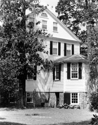
Wedge Plantation (William Lucas House), Wedge Plantation Road. Main House - View of Side elevation. McClellanville, S.C.;10" x 8" B/W photo. Box 15, Folder 2-10-6. One copy.
Wedge Plantation (William Lucas House), Wedge Plantation Road. Main House - View of Side elevation. McClellanville, S.C.;8" x 10" B/W photo. Box 15, Folder 2-10-6. One copy.
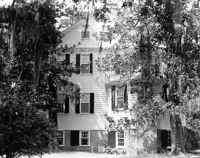
Wedge Plantation (William Lucas House), Wedge Plantation Road. Main House - View of Rear elevation. McClellanville, S.C.;8" x 10" B/W photo. Box 15, Folder 2-10-6. One copy.
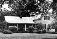
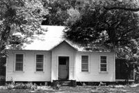
Martha G. Doar House (ca. 1928). View of Front elevation. McClellanville Historic District. McClellanville, S.C.;6.5" x 10" B/W photo. Box 14, Folder 2-10-5. One copy.
How Tavern. View of NE (Front and Side) elevation. Cainhoy (Huger vicinity, Lewisville, Louisville), S.C.;8" x 10" B/W photo. Box 4, Folder 1-12-3. One copy.
Seaside Plantation (Locksley Hall), off of Cypress Bottom Road. Interior View - Parlor, Detail of Fireplace. Edisto Island, S.C.;10" x 8" B/W photo. Box 11, Folder 2-3-12. One copy.