Search
« Previous |
301 - 400 of 1,613
|
Next »
Search Results
Date:
1977-1983
Description:
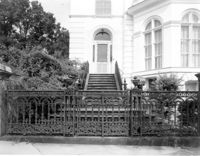
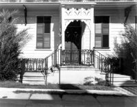
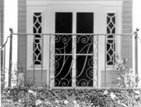
34 Smith Street, Robertson-Pickens House, ca. 1855. Detail View of entry and iron gate, West (Front) elevation. 4" x 5" B/W photo.
Date:
1977-1983
Description:
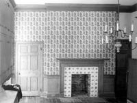
6 Glebe Street, St. Philip's Parsonage House (Bishop Robert Smith House), ca. 1770. Interior View. 1st Floor - NE Room, South wall. 4" x 5" B/W photo.
Date:
1977-1983
Description:
6 Glebe Street, St. Philip's Parsonage House (Bishop Robert Smith House), ca. 1770. Interior View. 1st Floor - SW Room, East wall. 4" x 5" B/W photo.
Date:
1977-1983
Description:
6 Glebe Street, St. Philip's Parsonage House (Bishop Robert Smith House), ca. 1770. Interior View. 1st Floor - SW Room, West wall. 4" x 5" B/W photo.
Date:
1977-1983
Description:
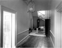
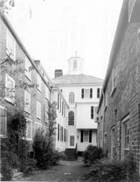
6 Glebe Street, St. Philip's Parsonage House (Bishop Robert Smith House), ca. 1770. Interior View. 1st Floor - Hall, looking North. 4" x 5" B/W photo.
Date:
1977-1983
Description:
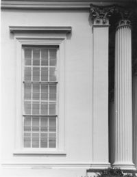
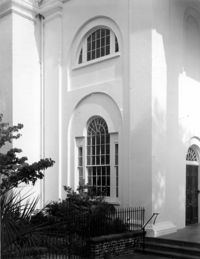
275 Meeting Street, Trinity Methodist Church, ca. 1848. Detail View of window, South (Side) elevation. 4" x 5" B/W photo.
Date:
1977-1983
Description:
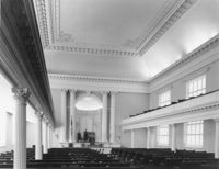
275 Meeting Street, Trinity Methodist Church, ca. 1848. Interior View - Nave, East elevation. 4" x 5" B/W photo.
Date:
1977-1983
Description:
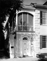
56 South Battery, Osborn-McCrady House, ca. 1770. Detail View of entry, South (Front) elevation. 4" x 5" B/W photo.
Date:
1977-1983
Description:
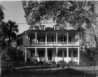
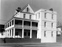
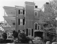
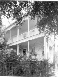
20 South Battery, Stevens-Lathers House, ca. 1843. Main House - View of SE (Front and Side) elevation. 4" x 5" B/W photo.
Date:
1977-1983
Description:
32 South Battery, Colonel John Ashe House, ca. 1762. Main House - View of North (Rear) elevation. 4" x 5" B/W photo.
Date:
1977-1983
Description:
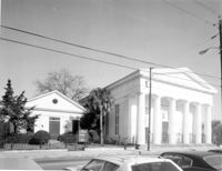
60 Wentworth Street, Centenary Methodist Church, ca. 1842. View of SW (Front and Side) elevation. 4" x 5" B/W photo.
Date:
1977-1983
Description:
Charleston County, Oak Island Plantation, ca. 1830. Interior View. 1st Floor - SW Room, looking West through Hall to SE Room. 4" x 5" B/W photo.
Date:
1977-1983
Description:
Charleston County, Oak Island Plantation, ca. 1830. Interior View. 1st Floor - SW Room. Detail of Mantle, North wall. 4" x 5" B/W photo.
Date:
1977-1983
Description:
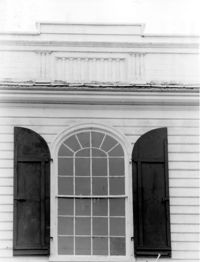
342 Meeting Street, Second Presbyterian Church, ca. 1811. Detail View of windows in tower base, North elevation. 4" x 5" B/W photo.
Date:
1977-1983
Description:
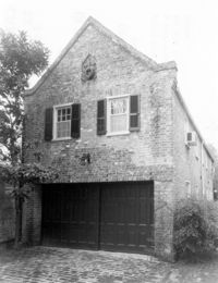
60 Montague Street, Gaillard-Bennett House, ca. 1800. Carriage House - Detail view of SW (Side and Front) elevation. 4" x 5" B/W photo.
Date:
1977-1983
Description:
48 Elizabeth Street, Aiken-Rhett House, ca.1818. Courtyard - View of South elevation from North side of Main House. 4" x 5" B/W photo.
Date:
1977-1983
Description:
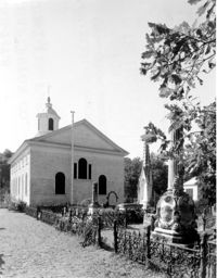
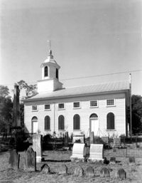
Charleston County, Edisto Island Presbyterian Church, ca. 1831. Church - View of North (Rear) elevation. 4" x 5" B/W photo.
Date:
1977-1983
Description:
Charleston County, Edisto Island Presbyterian Church, ca. 1831. Church - View of East (Side) elevation. 4" x 5" B/W photo.
Date:
1977-1983
Description:
635 East Bay Street, Faber-Ward House, ca. 1832. Main House and Complex - View of North (Side) elevation 4" x 5" B/W photo.
Date:
1977-1983
Description:
31 Legare Street, Hannah Heyward House, ca. 1789. Main House - View of NE (Rear and Side) elevation. 4" x 5" B/W photo.
Date:
1977-1983
Description:
31 Legare Street, Hannah Heyward House, ca. 1789. Main House - View of East (Front) elevation. 4" x 5" B/W photo.
Date:
1977-1983
Description:
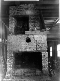
126 Tradd street, Dr. Peter Fayssoux House, ca. 1732. Kitchen House - Interior View. Detail of South fireplace without plaster. 4" x 5" B/W photo.
Date:
1977-1983
Description:
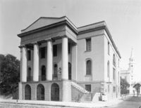
100 Meeting Street, Fireproof Building, ca. 1822. Interior View - 2nd Floor. Stair Hall - West corridor, East elevation. 4" x 5" B/W photo.
Date:
1977-1983
Description:
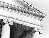
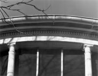
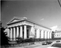
172 Rutledge Avenue, Ashley Hall, ca. 1802. Main House - Detail View of portico, cornice, and column cap, South (Front) elevation. 4" x 5" B/W photo.
Date:
1977-1983
Description:
2 - 4 Court House Square, Daniel Blake Tenements, ca. 1760. Interior View - 2nd Floor. SW Room, North elevation. 4" x 5" B/W photo.
Date:
1977-1983
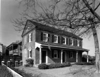
Description:
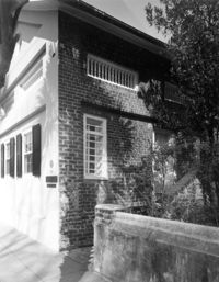
2 Amherst Street, Christopher Belser House, ca. 1804. View of East (Side) elevation. 4" x 5" B/W photo.
Date:
1977-1983
Description:
106 Tradd Street, Colonel John Stuart House, ca. 1772. Main House - View of SW (Side and Front) elevation. 4" x 5" B/W photo.
Date:
1977-1983
Description:
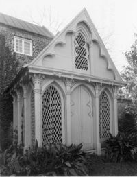
31 Meeting Street, James Ladson House, ca. 1792. Gazebo, ca. 1848. View of NW (Front and Side) corner. 4" x 5" B/W photo.
Date:
1977-1983
Description:
34 Meeting Street, Daniel Elliott Huger House, ca. 1759. Main House - View of East (Rear) elevation. 4" x 5" B/W photo.
Date:
1977-1983
Description:
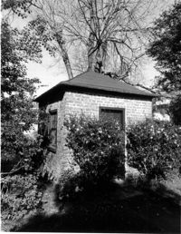
34 Meeting Street, Daniel Elliott Huger House, ca. 1759. Privy - View of SW corner. 4" x 5" B/W photo.
Date:
1977-1983
Description:
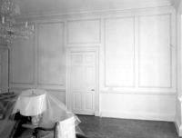
100 Meeting Street, Fireproof Building, ca. 1822. Interior View - Ground Floor. NW Room, SE elevation. 4" x 5" B/W photo.
Date:
1977-1983
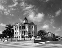
Description:
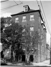
141 Meeting Street, Charleston Gas Light Company, ca. 1876. View of NE (Front and Side) elevation. 4" x 5" B/W photo.
Date:
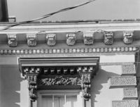
1977-1983
Description:
21 King Street, Patrick O'Donnell House, ca. 1852. Detail View of 3rd Floor window cornice, building cornice, and quoining, East (Front) elevation. 4" x 5" B/W photo.
Date:
1977-1983
Description:
100 Meeting Street, Fireproof Building, ca. 1822. Interior View - 1st Floor. NW Room - Detail of mantle. 4" x 5" B/W photo.
Date:
1977-1983
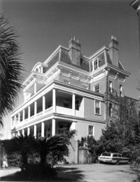
Description:
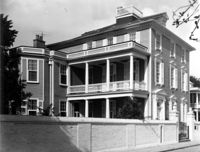
26 South Battery, Colonel John Algernon Sydney Ashe House, ca. 1853. Main House - South (Front) elevation. 4" x 5" B/W photo.
Date:
1977-1983
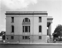
Description:
100 Meeting Street, Fireproof Building, ca. 1822. View of NW (Front and Side) elevation 4" x 5" B/W photo.
Date:
1977-1983
Description:
2 - 4 Court House Square, Daniel Blake Tenements, ca. 1760. Interior View - 2nd Floor. SW Room, Detail of mantle. 4" x 5" B/W photo.
Date:
1977-1983
Description:
2 - 4 Court House Square, Daniel Blake Tenements, ca. 1760. Interior View - 2nd Floor. SE Room, West elevation. 4" x 5" B/W photo.
Date:
1977-1983
Description:
2 - 4 Court House Square, Daniel Blake Tenements, ca. 1760. Interior View - 2nd Floor. NE Room, East elevation. 4" x 5" B/W photo.
Date:
1977-1983
Description:
635 East Bay Street, Faber-Ward House, ca. 1832. Main House and Complex - View of NE (Front and Side) elevation 4" x 5" B/W photo.
Date:
1977-1983
Description:
635 East Bay Street, Faber-Ward House, ca. 1832. North Dependency - View SE (Front and Side) elevation. 4" x 5" B/W photo.
Date:
1977-1983
Description:
635 East Bay Street, Faber-Ward House, ca. 1832. North Dependency - View NE (Rear and Side) elevation. 4" x 5" B/W photo.
Date:
1977-1983
Description:
48 Elizabeth Street, Aiken-Rhett House, ca.1818. Main House - Interior View. 1st Floor - East Room. Detail of cornice and over mantle mirror frame. 4" x 5" B/W photo.
Date:
1977-1983
Description:
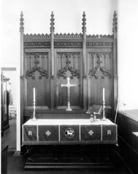
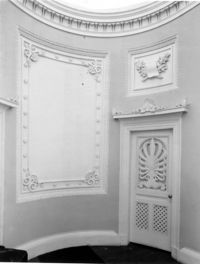
126 Coming Street, Cathedral Church of St. Luke and St. Paul, ca. 1816. Interior View - Detail view of altar from original St. Luke's Church (see #CNB_342 - CNB_344). 4" x 5" B/W photo.
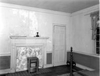
Date:
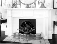
1977-1983
Description:
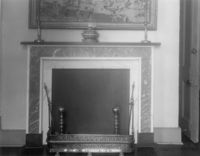
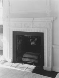
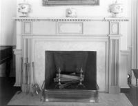
Berkley County, Loch Dhu, ca. 1812. Main House - Interior View. 1st Floor - NE Room, Detail of chimneypiece and mantel. 4" x 5" B/W photo.
Date:
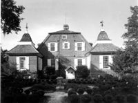
1977-1983
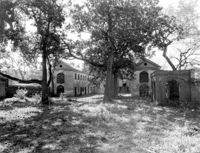
Description:
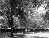
Beaufort County, Auldbrass Plantation, ca. 1951. Stable, Groom's Room, Passage and Kennels (From Left to Right) - View of West elevation. 4" x 5" B/W photo.
Date:
1977-1983
Description:
Beaufort County, Auldbrass Plantation, ca. 1951. Gate House, Covered Entry, Stable, Passages and Kennels - View of West elevation. 4" x 5" B/W photo.
Date:
1977-1983
Description:
20 Montague Street, Cobia-Moultrie House, ca. 1808. Main House - View of West (Side) elevation. 4" x 5" B/W photo.
Date:
1977-1983
Description:
20 Montague Street, Cobia-Moultrie House, ca. 1808. Main House - View of South (Front) elevation. 4" x 5" B/W photo.
Date:
1977-1983
Description:
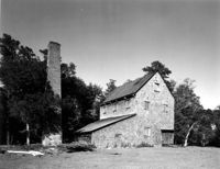
Georgetown County, Chicora Wood Plantation, ca. 1819. Rice Threshing Mill with Chimney Stack - View of SW (front and Side) elevation. 4" x 5" B/W photo.
Date:
1977-1983
Description:
116 Broad Street, John Rutledge House, ca. 1763. Main House - Detail View of sheet metal quoining, SW (Front and Side) corner. 4" x 5" B/W photo.
Date:
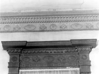
1977-1983
Description:
116 Broad Street, John Rutledge House, ca. 1763. Main House - Detail View of cornice and windows, SW (Front and Side) elevation. 4" x 5" B/W photo.
Date:
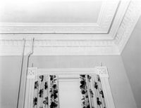
1977-1983
Description:
6 Gibbes Street, Parker-Drayton House, ca.1806. Detail View of 1st Floor cornice, South (Front) elevation. 4" x 5" B/W photo.
Date:
1977-1983
Description:
69 Church Street, Capers-Motte House, ca. 1745. View of Kitchen and Slave Quarters, South (Front) elevation. 4" x 5" B/W photo.
Date:
1977-1983
Description:
6 Gibbes Street, Parker-Drayton House, ca.1806. Detail View of Roof cornice, South (Front) elevation. 4" x 5" B/W photo.
Date:
1977-1983
Description:
59 Church Street, Thomas Rose House, ca. 1735. Detail View of entry, East (Front) elevation. 4" x 5" B/W photo.
Date:
1977-1983
Description:
86 Church Street, Isaac Mazyck House, ca. 1783. View of NW (Front and Side) elevation. 4" x 5" B/W photo.
Date:
1977-1983
Description:
78 Church Street, ca. 1785. View of SE (Front and Side) elevation. 4" x 5" B/W photo.
Date:
1977-1983
Description:
48 Elizabeth Street, Aiken-Rhett House, ca.1818. Main House - Interior View. 1st Floor - SE Room. Looking NW to SW Room. 4" x 5" B/W photo.
Date:
1977-1983
Description:
Berkley County, Mulberry Plantation, ca. 1714. Main House - View of East (Side) elevation, showing main core and corner pavilions. 4" x 5" B/W photo.
Date:
1977-1983
Description:
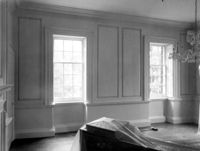
Berkley County, Lawson's Pond, ca. 1823. Interior View. 1st Floor - NW Room, Detail of window entablature and room cornice. 4" x 5" B/W photo.
Date:
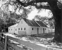
1977-1983
Description:
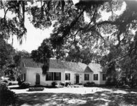
Georgetown County, Mansfield Plantation, ca. 1780. Slave Quarters - View of Side and Front elevation. 4" x 5" B/W photo.
Date:
1977-1983
Description:
Charleston County, Edisto Island Presbyterian Church, ca. 1831. Church - Detail View of front entry with Venetian window, South (Front) elevation. 4" x 5" B/W photo.
Date:
1977-1983
Description:
Georgetown County, Mansfield Plantation, ca. 1780. Main House - View of West (Front) elevation. 4" x 5" B/W photo.
Date:
1977-1983
Description:
275 Meeting Street, Trinity Methodist Church, ca. 1848. Interior View - Detail of chancel. 4" x 5" B/W photo.
Date:
1977-1983
Description:
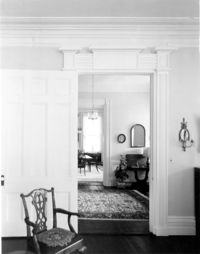
18 Bull Street, William Blacklock House, ca. 1800. Main House - Interior View. 1st Floor - SW Room, showing arches. 4" x 5" B/W photo.
Date:
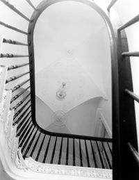
1977-1983
Description:
18 Bull Street, William Blacklock House, ca. 1800. Main House - Interior View. 1st Floor - Stair Hall, looking Up. 4" x 5" B/W photo.
Date:
1977-1983
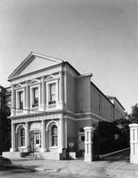
Description:
90 Hasell Street, Synagogue of Kahal Kadosh Beth Elohim, ca. 1840. View of SW (Front and Side) elevation. 4" x 5" B/W photo.
Date:
1977-1983
Description:
Charleston County, Oak Island Plantation, ca. 1830. Detail View of stair window and parapet wall, North (Rear) elevation. 4" x 5" B/W photo.
Date:
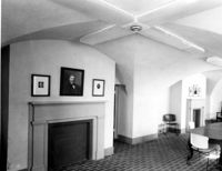
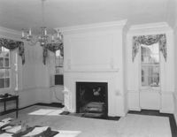
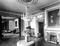
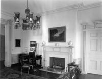
1977-1983
Description:
21 East Battery, Edmonston-Alston House, ca. 1828. Main House - Interior View. 1st Floor - West Drawing Room, North wall. 4" x 5" B/W photo.
Date:
1977-1983
Description:
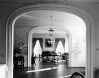
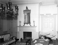
21 East Battery, Edmonston-Alston House, ca. 1828. Main House - Interior View. 1st Floor - East Drawing Room, Detail of mantle. 4" x 5" B/W photo.
Date:
1977-1983
Description:
21 East Battery, Edmonston-Alston House, ca. 1828. Main House - Interior View. 1st Floor - East Drawing Room, North wall. 4" x 5" B/W photo.
Date:
1977-1983
Description:
69 Barre Street, Gov. Thomas Bennett House, ca. 1822. Main House - Interior View. 2nd Floor - SE Room; Detail of window architrave and cornice. 4" x 5" B/W photo.
Date:
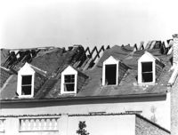
1977-1983
Description:
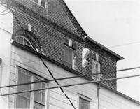
85 - 87 Broad Street, Josiah Smith Tenement, ca. 1795. Detail View of roof showing 1978 fire damage, South (Rear) elevation. 4" x 5" B/W photo.
Date:
1977-1983
Description:
69 Barre Street, Gov. Thomas Bennett House, ca. 1822. Main House - Interior View. 2nd Floor - Stairwell; Detail of window. 4" x 5" B/W photo.
Date:
1977-1983
Description:
77 Church Street, Louis Danjou House (Brewton's Corner), ca. 1810. View of NE (Front and Side) elevation. 4" x 5" B/W photo.
Date:
1977-1983
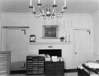
Description:
4 Orange Street, Samuel Carne House, ca. 1770. Main House - Interior View. 1st Floor - East Room, NW wall. 4" x 5" B/W photo.
Date:
1977-1983
Description:
143 - 145 Church Street, Alexander Perronneau Tenements, ca. 1740. View of East (Front) elevation. 4" x 5" B/W photo.
Date:
1977-1983
Description:
48 Elizabeth Street, Aiken-Rhett House, ca.1818. Courtyard - View of South elevation from North side of Main House. 4" x 5" B/W photo.
Date:
1977-1983
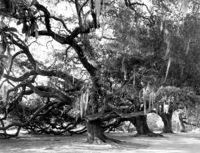
Description:
Berkley County, Mulberry Plantation, ca. 1714. Driveway - View of Live Oak trees. 4" x 5" B/W photo.
Date:
1977-1983
Description:
Charleston County, William Seabrook-Dodge Plantation, ca. 1810. Detail View of monogrammed iron railing, 1st Floor portico, South (Front) elevation. 4" x 5" B/W photo.
Date:
1977-1983
Description:
126 Coming Street, Cathedral Church of St. Luke and St. Paul, ca. 1816. Detail View of center entry door, West (Front) elevation. 4" x 5" B/W photo.
Date:
1977-1983
Description:
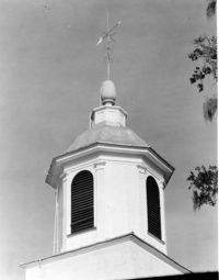
Charleston County, Edisto Island Presbyterian Church, ca. 1831. Church - Detail View of cupola. 4" x 5" B/W photo.
Date:
1977-1983
Description:
Camden Depot of the S.C.R.R., ca. 1845; South side of Ann Street between Meeting and King Streets. Attributed to E.B. White, architect. View of entry from the NW. 4" x 5" B/W photo.
Date:
1977-1983
Description:
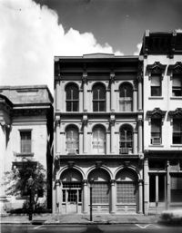
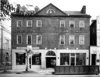
49 Broad Street, Benjamin Smith Building, ca. 1740. View of North (Front) elevation. 4" x 5" B/W photo.
Date:
1977-1983
Description:
48 Elizabeth Street, Aiken-Rhett House, ca.1818. Main House - View of West (Side) elevation. 4" x 5" B/W photo.
Date:
1977-1983
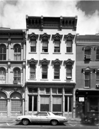
Description:
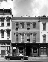
43, 45, 47 Broad Street, ca. 1855. View of NW (Front and Side) elevation. 4" x 5" B/W photo.
Date:
1977-1983
Description:
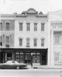
36 Broad Street, ca. 1803. View of North (Front) elevation. 4" x 5" B/W photo.
Date:
1977-1983
Description:
38 Broad Street, ca. 1801. View of South (Front) elevation. 4" x 5" B/W photo.
Date:
1977-1983
Description:
37 Broad Street, ca. 1794. View of North (Front) elevation. 4" x 5" B/W photo.
Date:
1977-1983
Description:
41 Broad Street, ca. 1835. View of North (Front) elevation. 4" x 5" B/W photo.
Date:
1977-1983
Description:
42 Broad Street, ca. 1797. View of South (Front) elevation. 4" x 5" B/W photo.
Date:
1977-1983
Description:
40 Broad Street, ca. 1740. View of South (Front) elevation. 4" x 5" B/W photo.
Date:
1977-1983
Description:
100 Meeting Street, Fireproof Building, ca. 1822. View of West (Side) elevation 4" x 5" B/W photo.
Date:
1977-1983
Description:
Orangeburg County, Rocks Plantation (The Rocks), ca. 1805. Main House - Interior View. 2nd Floor - NW Room, South wall. 4" x 5" B/W photo.
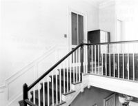
Date:
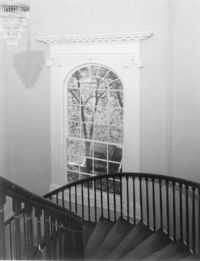
1977-1983
Description:
Orangeburg County, Rocks Plantation (The Rocks), ca. 1805. Main House - Interior View. 2nd Floor - Stair Landing. 4" x 5" B/W photo.
Date:
1977-1983
Description:
32 South Battery, Colonel John Ashe House, ca. 1762. Carriage House - View of South (Front) elevation. 4" x 5" B/W photo.
Date:
1977-1983
Description:
286 Meeting Street, Noyer-Wildhagen House, ca. 1807. Detail View of Console and Cornice. 4" x 5" B/W photo.
Date:
1977-1983
Description:
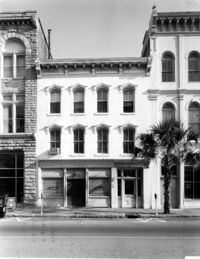
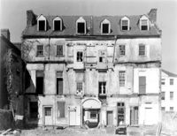
85 - 87 Broad Street, Josiah Smith Tenement, ca. 1795. View of North (Front) elevation. 4" x 5" B/W photo.
Date:
1977-1983
Description:
85 - 87 Broad Street, Josiah Smith Tenement, ca. 1795. View of South (Rear) elevation. 4" x 5" B/W photo.