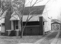
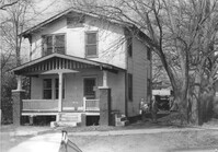
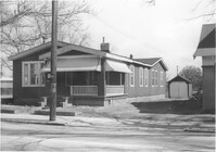
House on site affected by the construction of Interstate 26 (I-26). Address: 170 Laurel Avenue. Number 28 on porch column. Surveyor notations on back of photo: "Dkt.: 10.503. Property owner: Eula Mae Ryan. Tract: 12. Station: 5893+40 Lt. Date: Feb. 19, 1963. In R/W - Bought." [See collection description for explanation of surveyor notations.]
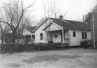
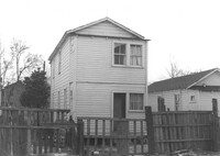
House (rear view) on site affected by the construction of Interstate 26 (I-26). Address: 40 Enston Avenue [40 North Enston Avenue[. Surveyor notations on back of photo: "Dkt.: 10.503. Property owner: George Stamos, et al. Tract: 2. Station: 5891+35 Rt. Date: Feb. 19, 1963. In R/W - Bought." [See collection description for explanation of surveyor notations.]
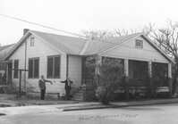
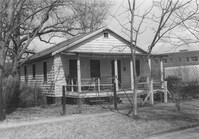
House on site affected by the construction of Interstate 26 (I-26). Address: 29 Mount Pleasant Street. Surveyor notations on back of photo: "Dkt.: 10.503. Property owner: Charles B. Cromer, et al. Tract: 14. Station: 5892+90 Lt. Date: Feb. 19, 1963. In R/W - Bought." [See collection description for explanation of surveyor notations.]
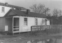
House (rear view?) on site affected by the construction of Interstate 26 (I-26). Address: 16 Lenox Street. Surveyor notations on back of photo: "Dkt.: 10.503. Property owner: Harry Thompson. Tract: 38. Station: 5901+50 Rt. Date: Feb. 19, 1963. In R/W - Bought." [See collection description for explanation of surveyor notations.]
House (rear view) on site affected by the construction of Interstate 26 (I-26). Address: 14 Lenox Street. Surveyor notations on back of photo: "Dkt.: 10.503. Property owner: Harry Thompson. Tract: 38. Station: 5901+50 Rt. Date: Feb. 19, 1963. In R/W - Bought." [See collection description for explanation of surveyor notations.]
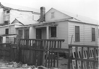
House (rear view) on site affected by the construction of Interstate 26 (I-26). Address: 12 Lenox Street. Surveyor notations on back of photo: "Dkt.: 10.503. Property owner: Harry Thompson. Tract: 38. Station: 5901+50 Lt. Date: Feb. 19, 1963. In R/W - Bought." [See collection description for explanation of surveyor notations.]
House on site affected by the construction of Interstate 26 (I-26). Address: 28 San Souci Street. Surveyor notations on back of photo: "Dkt.: 10.503. Property owner: Acme Realty Co. Tract: 25. Station: 5898+60 Rt. Date: Feb. 19, 1963. In R/W - Bought." [See collection description for explanation of surveyor notations.]
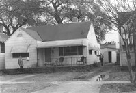
House on site affected by the construction of Interstate 26 (I-26).Address: 172 Laurel Avenue. Surveyor notations on back of photo: "Dkt.: 10.503. Property owner: Marguerite E. Jacques. Tract: 13. Station: 5893+20 Lt. Date: Feb. 19, 1963. In R/W - Bought." [See collection description for explanation of surveyor notations.]
House on site affected by the construction of Interstate 26 (I-26). Address: 1202 King Street. Surveyor notations on back of photo: "Dkt.: 10.503. Property owner: Gertrude E. Cone. Tract: 23. Station: 5897+30 on CL. Date: Feb. 19, 1963. In R/W - Bought." [See collection description for explanation of surveyor notations.]
House on site affected by the construction of Interstate 26 (I-26). Address: 26 Sans Souci Street. Surveyor notations on back of photo: "Dkt.: 10.503. Property owner: Annie E. Koger. Tract: 26. Station: 5898+85 Rt. Date: Feb. 19, 1963. In R/W - Bought." [See collection description for explanation of surveyor notations.]