Search
« Previous |
301 - 362 of 362
|
Next »
Search Results
Date:
1960
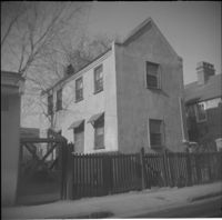
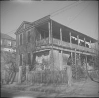
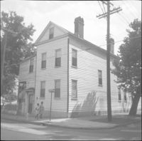
Description:
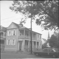
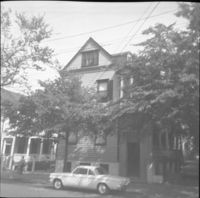
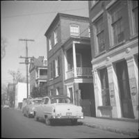
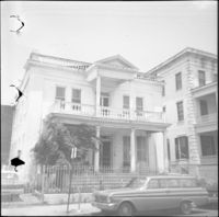
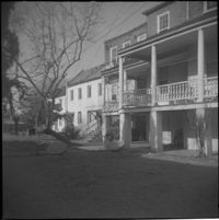
61 Charlotte Street.
Date:
1960
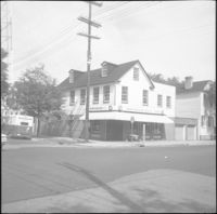
Description:
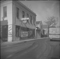
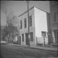
61 Anson Street (Kestler's Market), corner store located at the northwest corner of Anson and Society Streets.
Date:
1960
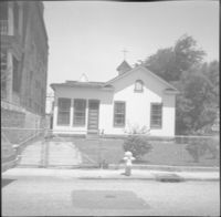
Description:
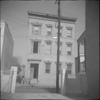
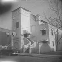
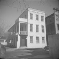
62 Society Street (Hieronymus-Tiedeman House).
Date:
1960
Description:
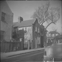
62 Hasell Street.
Date:
1960
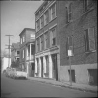
Description:
63-65 Society Street (St. Paul’s Catholic Church [German Church], later American Legion Palmetto Post 112). 61 Society Street also in view (at left).
Date:
1960
Description:
63-65 Society Street (St. Paul’s Catholic Church [German Church], later American Legion Palmetto Post 112).
Date:
1960
Description:
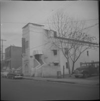
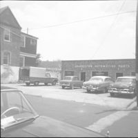
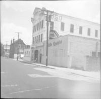
Charleston Automotive Services (63 Hasell Street), now a parking lot.
Date:
1960
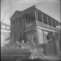
Description:
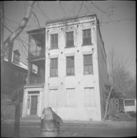
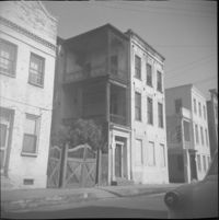
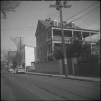
63 Charlotte Street.
Date:
1960
Description:
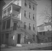
63 and 65 Anson Street (Susan Robinson Dependencies).
Date:
1960
Description:
63 Anson Street (Susan Robinson Dependency).
Date:
1960
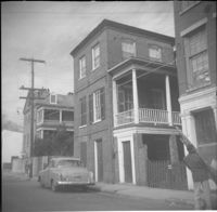
Description:
Right to left: 64 Anson Street (later demolished), 66 Anson Street (Chazal House), and 72 Anson Street (Kohne-Leslie House).
Date:
1960
Description:
Right to left: 64 Anson Street (later demolished) and 66 Anson Street (Chazal House).
Date:
1960
Description:
64 Hasell Street (Benjamin Smith House).
Date:
1960
Description:
Right to left: 64 Anson Street (later demolished) and 66 Anson Street (Chazal House).
Date:
1960
Description:
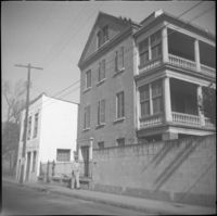
64 Society Street.
Date:
1960
Description:
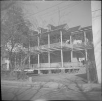
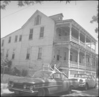
65-67 Hasell Street (USO Building).
Date:
1960
Description:
66 Society Street (Hieronymous-Roper House).
Date:
1960
Description:
66 Hasell Street (Lazarus-Gadsden Building). Partial view of 64 Hasell Street at right.
Date:
1960
Description:
66 Society Street (Hieronymous-Roper House), flanked by 66½ Society Street (left) and 64 Society Street (right).
Date:
1960
Description:
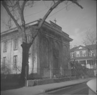
67 Anson Street (St. Stephen's Episcopal Church.
Date:
1960
Description:
67 Anson Street (St. Stephen's Episcopal Church.
Date:
1960
Description:
68 Anson Street, later demolished.
Date:
1960
Description:
71 Anson Street (Thomas Doughty House).
Date:
1960
Description:
Right to left: 72 Anson Street (Kohne-Leslie House) and the original house at 74 Anson Street before its demolition.
Date:
1960
Description:
Right to left: 72 Anson Street (Kohne-Leslie House) and the original house at 74 Anson Street before its demolition.
Date:
1960
Description:
Original house with the address 73 Anson Street, demolished in 1963.
Date:
1960
Description:
74 Anson Street before its demolition. (The house originally at 15 Wall Street was moved to the site in 1966.)
Date:
1960
Description:
75 Anson Street (Joseph Legare House) before the removal of the third story ca. 1969.
Date:
1960
Description:
76 Anson Street before its demolition, located at the southeast corner of Anson and Laurens Streets.
Date:
1960
Description:
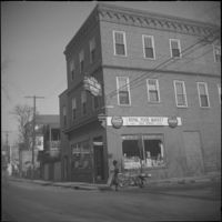
78 Anson Street (Royal Food Market), corner store located at the northeast corner of Anson and Laurens Streets, before its demolition.
Date:
1960
Description:
78 Anson Street (Royal Food Market), corner store located at the northeast corner of Anson and Laurens Streets, before its demolition.
Date:
1960
Description:
79 Anson Street (Daniel Legare House).
Date:
1960
Description:
79 Anson Street (Daniel Legare House).
Date:
1960
Description:
8 George Street (Sarah Daniell Lawrence House).
Date:
1960
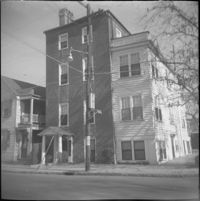
Description:
8 Wentworth Street.
Date:
1960
Description:
The original house at 82 Anson Street, later demolished to clear the lot for the relocation of the house at 86 Anson Street (Mary Smith House).
Date:
1960
Description:
The original house at 82 Anson Street, later demolished to clear the lot for the relocation of the house at 86 Anson Street (Mary Smith House).
Date:
1960
Description:
Right to left: 84 Anson Street before demolition and 86 Anson Street (Mary Smith House) before its relocation to its current address (82 Anson Street).
Date:
1960
Description:
86 Anson Street (Mary Smith House) prior to its relocation to its current address (82 Anson Street).
Date:
1960
Description:
89 Alexander Street at the southwest corner of Alexander and Charlotte Streets.
Date:
1960
Description:
90 Alexander Street at the southeast corner of Alexander and Charlotte Streets.
Date:
1960
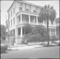
Description:
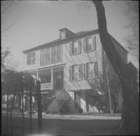
George Street elevation of 91 Anson Street (St. John's Reformed Episcopal Church).
Date:
1960 and 1969
Description:
Black-and-white photograph of the interior of El Ghriba Synagogue in Djerba.
Date:
1960
Description:
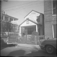
Unidentified house on East Bay Street, east side of street, likely within the 320 block, since demolished.
Date:
1960
Description:
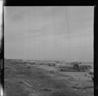
Black and white negative of cars parked on a beach at Hilton Head Island, 1960; 6 x 6.5 cm.
Date:
1960
Description:
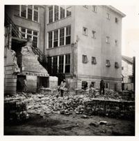
Photograph detailing the demolition of the Bennett School on St. Philip St. The Charleston public school was razed to make way for Craig Residence Hall.
Date:
1960
Description:
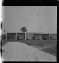
Black and white negative of the exterior of the Hilton Head Company's corporate headquarters building, 1960; 6.5 x 6.5 cm.
Date:
1960
Description:
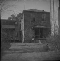
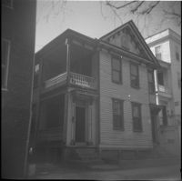
Unidentified Charlotte Street House, probably demolished. Emanuel A.M.E. Church steeple in the background.
Date:
1960
Description:
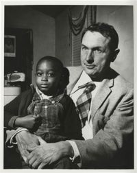
Black and white photograph. Inscribed on back of photograph: "Rural Charleston - Myles Horton with Johns Island Child, ca. 1960."
Date:
1960
Description:
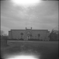
Old Citadel building. Parade grounds (now Marion Square) in foreground.
Date:
1960
Description:
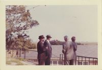
Color photograph of four men looking over rooftop of building. Writing on back of image reads, "Country Club 1960. W.E. McLeod pointing. Others not remembered."
Date:
1960
Description:
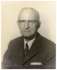
A portrait of Cohen.
Date:
1960
Description:
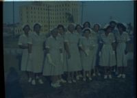
Color negative of Grey Ladies standing outside in their uniforms.
Date:
1960
Description:
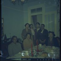
Color negative of Parker and friends at Albertha Simmons house
Date:
1960
Description:
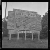
Black and white negative of a roadside sign and map for the Hilton Head Company and its property, 1960; 6 x 6.5 cm.
Date:
1960
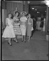
Description:
Black and white negative of four female models wearing the latest Spring season fashions on sale at Schein's Department Store, 1960; 10 x 12 cm.
Date:
1960
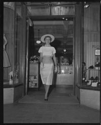
Description:
Black and white negative of model wearing the latest Spring season fashions on sale at Schein's Department Store, 1960; 10 x 13 cm.
Date:
1960
Description:
Looking east on Wentworth Street from 26 Wentworth Street (Gardner Kitchen House). Features (left to right): 26 Wentworth Street, 22-24 Wentworth Street (Francis Q. McHugh Tenements), 18-20 Wentworth Street, and 14 Wentworth Street.
Date:
1960
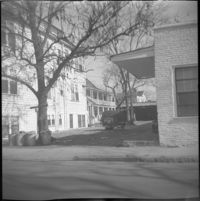
Description:
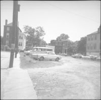
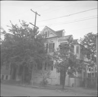
Unidentified houses, probably on Elizabeth Street.
Date:
1960
Description:
Looking east on George Street to where it ended at Anson Street before the continuation of George Street occurred. Left to right: What was 86 Anson Street, later relocated to 82 Anson Street, and the original house at 82 Anson Street, later demolished for the relocation of 86 Anson Street.
Date:
1960
Description:
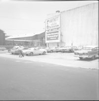
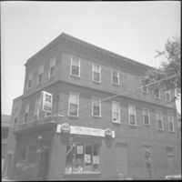
Northeast corner of Hasell Street and Meeting Street. Parking lot and building with billboards advertising "Hartnett for House" and Paul Motor Co.
Date:
1960
Description:
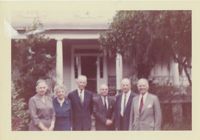
Color photograph depicting image of six people standing in front of McLeod Plantation. Writing on back of image reads, "McLeod house James Island, 1960. L-R -(?) Rose M.L.Barnwell, Dr. E.H. Barnwell (?) W.E. McLeod (?)."


![[Der grosse Gebetssaal der Wundervollen ist ein schönes Beispiel andalusischer Architekture]](https://iiif.library.cofc.edu/iiif/2/24786/full/200,/0/default.jpg)