Search
« Previous |
1 - 100 of 266
|
Next »
Search Results
Date:
1960
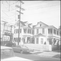
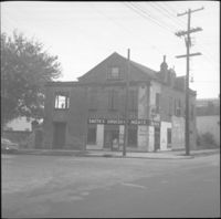
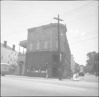
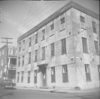
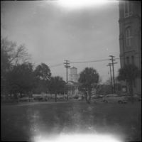
Description:
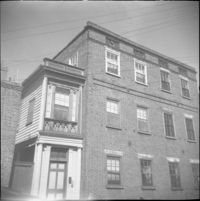
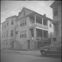
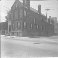
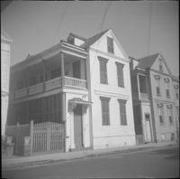
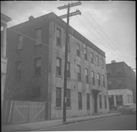
1 Wall Street, located at the northwest corner of Wall Street and Laurens Street.
Date:
1960
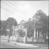
Description:
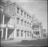
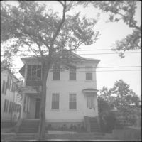
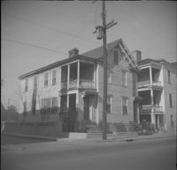
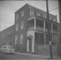
10 Wentworth Street (Charles W. Seignious House), with partial view of 12 Wentworth Street (left edge) and 8 Wentworth Street and 6 Wentworth Street (far right).
Date:
1960
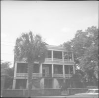
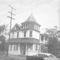
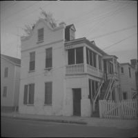
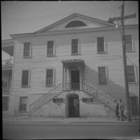
Description:
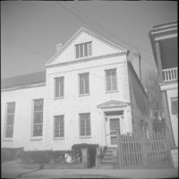
10 Wentworth Street (Charles W. Seignious House).
Date:
1960
Description:
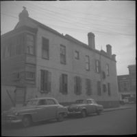
Original 11 George Street, since demolished and currently the site of a parking lot.
Date:
1960
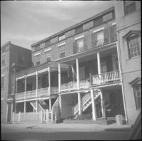
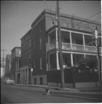
Description:
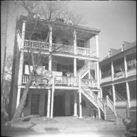
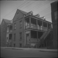
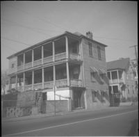
7-11 Wentworth Street (Edward Winslow Tenements).
Date:
1960
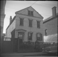
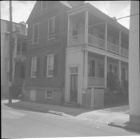
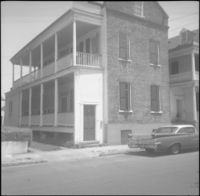
Description:
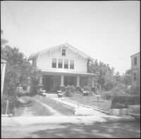
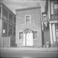
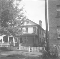
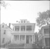
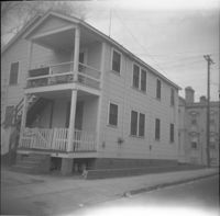
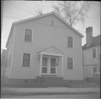
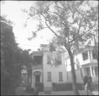
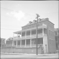
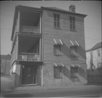
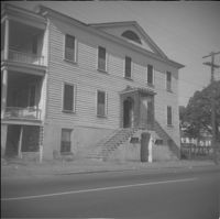
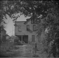
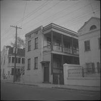
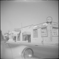
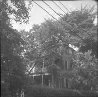
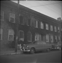
7 George Street (Mary Scott House), now known as 11 George Street.
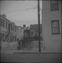
Date:
1960
Description:
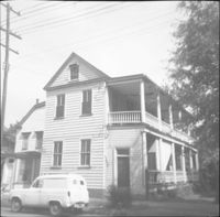
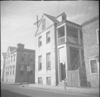
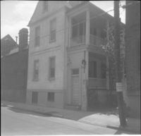
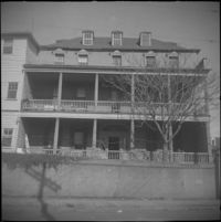
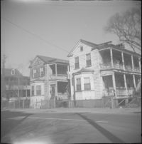
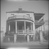
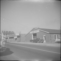
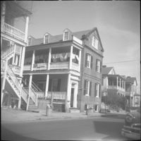
The house originally located at 116 Anson Street being moved to its new location at 39 Laurens Street.
Date:
1960
Description:
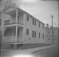
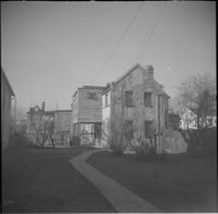
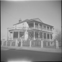
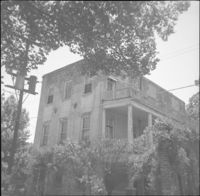
The house originally located at 116 Anson Street being moved to its new location at 39 Laurens Street.
Date:
1960
Description:
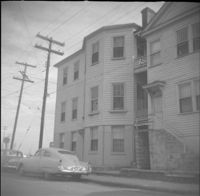
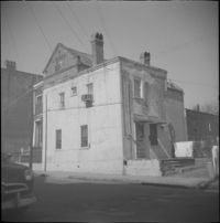
12 George Street, since demolished.
Date:
1960
Description:
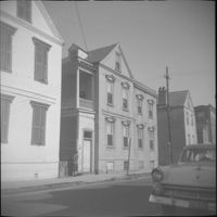
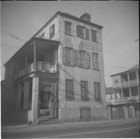
12 Wentworth Street (William C. Armstrong House), before removal of front piazza.
Date:
1960
Description:
14-16 Wentworth Street, later demolished. Also features partial view of 18 Wentworth Street (left) and 10 Wentworth Street (right).
Date:
1960
Description:
14 George Street (Middleton-Pinckney House), when it was the Commissioner of Public Works [Water Works] building.
Date:
1960
Description:
15 Charlotte Street, later demolished, 17 Charlotte Street.
Date:
1960
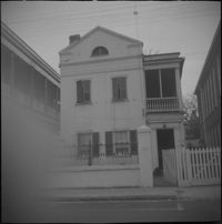
Description:
16 Charlotte Street (Robert Martin House)
Date:
1960
Description:
18-20 Wentworth Street (Lopez-Moise Tenements).
Date:
1960
Description:
19 Wentworth Street (William Lebby House).
Date:
1960
Description:
19 Elizabeth Street (Henry Bullwinkle Grocery).
Date:
1960
Description:
20 Charlotte Street (Joseph Aiken House).
Date:
1960
Description:
21 Charlotte Street (Sarah Westcoat House).
Date:
1960
Description:
22 Charlotte Street (Maria Smith House), located at the northwest corner of Charlotte and Alexander Streets.
Date:
1960
Description:
22 Elizabeth Street (New Tabernacle Fourth Baptist Church).
Date:
1960
Description:
22-24 Wentworth Street (Francis Q. McHugh Tenements).
Date:
1960
Description:
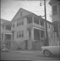
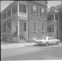
23 Wentworth Street (James J. Jeffords House), flanked by 21 Wentworth Street (left) and partial view of 25 Wentworth Street.
Date:
1960
Description:
23-25 Charlotte Street before the connecting hyphen was removed.
Date:
1960
Description:
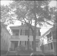
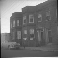
Left to right: 23 Society Street and 25 Society Street, later demolished. The houses were at the southwest corner of Society Street and East Bay Street.
Date:
1960
Description:
Left to right: 23 Society Street, 25 Society Street, and partial view of 27 Society Street. All were later demolished.
Date:
1960
Description:
24 Charlotte Street.
Date:
1960
Description:
25 Wentworth Street (Margaretta Hube House). Partial view of 23 Wentworth Street (James J. Jeffords House) at left edge.
Date:
1960
Description:
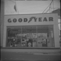
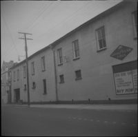
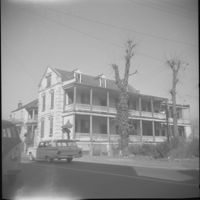
256 Meeting Street (William Gayer Carriage Factory) as a Goodyear Tire service center, before rehabilitation with a reconstructed façade. Located at the southeast corner of Meeting Street and Wentworth Street.
Date:
1960
Description:
Wentworth Street façade of 256 Meeting Street (William Gayer Carriage Factory) when it was a Goodyear Tire service center. Located at the southeast corner of Meeting Street and Wentworth Street.
Date:
1960
Description:
26 Wentworth Street, flanked by 28 Wentworth Street (left edge) and 22-24 Wentworth Street (right edge).
Date:
1960
Description:
26 Charlotte Street
Date:
1960
Description:
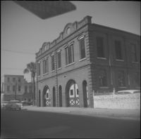
Wentworth Street elevation of the Central Fire Station (260-264 Meeting Street), located at the northeast corner of Meeting Street and Wentworth Street.
Date:
1960
Description:
27 Charlotte Street
Date:
1960
Description:
27 Wentworth Street flanked by 25 Wentworth (left).
Date:
1960
Description:
27 Society Street flanked by partial views of 25 Society Street (left) and 29 Society Street. 25 and 27 Society Street were later demolished.
Date:
1960
Description:
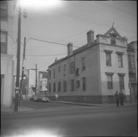
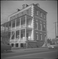
270 Meeting Street (Daniel Hart House), located at the southeast corner of Meeting Street and Society Street.
Date:
1960
Description:
Society Street elevation of 270 Meeting Street (Daniel Hart House), located at the southeast corner of Meeting Street and Society Street.
Date:
1960
Description:
Society Street elevation of 272 Meeting Street, conjoined with 66½ Society Street, located at the northeast corner of Meeting Street and Society Street.
Date:
1960
Description:
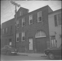
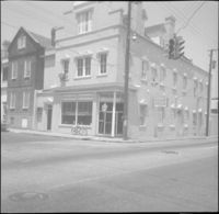
28 Hasell Street (Charleston Blueprint and Supply Co.), located at the northwest corner of Hasell Street and East Bay Street.
Date:
1960
Description:
Left to right: 30 Hasell Street, 28 Hasell Street .
Date:
1960
Description:
28 Wentworth Street, located at the northeast corner of Wentworth Street and Anson Street. Also features 26 Wentworth Street (right edge) and 53 Anson Street (William Thompson Tenement) (at left). Note, the Wentworth Street elevation of 53 Anson Street is 30 Anson Street.
Date:
1960
Description:
28 Charlotte Street.
Date:
1960
Description:
28 Wentworth Street. 26 Wentworth also in view (right).
Date:
1960
Description:
283 East Bay Street, located at the southwest corner of East Bay Street and Hasell Street.
Date:
1960
Description:
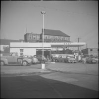
Humble Oil gas station (288 Meeting Street), located at the southeast corner of Meeting Street and George Street. Later demolished.
Date:
1960
Description:
Anson Street elevation of 29 Wentworth Street.
Date:
1960
Description:
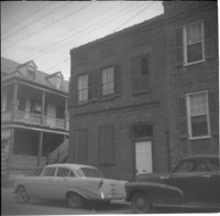
29 Hasell Street.
Date:
1960
Description:
29 Charlotte Street (Cunningham-Gordon House).
Date:
1960
Description:
Anson Street elevation of 29 Wentworth Street.
Date:
1960
Description:
29 Wentworth Street.
Date:
1960
Description:
29 Society Street (John W. Robinson Tenement).
Date:
1960
Description:
Gulf gas station located at 299 East Bay Street, northwest corner of East Bay Street and Society Street.
Date:
1960
Description:
3-5 Wentworth Street. Partial view of 289 East Bay Street at left edge.
Date:
1960
Description:
Left to right: 32 Society Street (Gabriel B. Browne House and 30 Society Street.
Date:
1960
Description:
Left to right: 32 Wentworth Street and 30 Wentworth Street (William Thompson Houses).
Date:
1960
Description:
30 Charlotte Street.
Date:
1960
Description:
30 Society Street.
Date:
1960
Description:
Left to right: 32 Wentworth Street and 30 Wentworth Street (William Thompson Houses).
Date:
1960
Description:
309 East Bay Street (Watson's Grocery), located at the southwest corner of East Bay and Laurens Street, before demolition. (The house at 116 Anson Street was moved to this site with the current address 39 Laurens Street.)
Date:
1960
Description:
31 Hasell Street.
Date:
1960
Description:
31 Wentworth Street.
Date:
1960
Description:
View of the fenced lot flanked by 31 Wentworth Street (left) and 33 Wentworth Street (right).
Date:
1960
Description:
311 East Bay Street (Stephen Shrewsbury House), located at the corner of East Bay Street and Laurens Street.
Date:
1960
Description:
311 East Bay Street (Stephen Shrewsbury House), located at the corner of East Bay Street and Laurens Street. Laurens Street elevation.
Date:
1960
Description:
313 East Bay Street.
Date:
1960
Description:
315 East Bay Street.
Date:
1960
Description:
317 East Bay Street (Benjamin Dupre House) and 319 East Bay Street.
Date:
1960
Description:
317 East Bay Street (Benjamin Dupre House).
Date:
1960
Description:
319 East Bay Street.
Date:
1960
Description:
32 Anson Street, which had been located at the northeast corner of Anson and Hasell Streets, later demolished. 45 Hasell Street at right.
Date:
1960
Description:
32 Anson Street, which had been located at the northeast corner of Anson and Hasell Streets, later demolished.
Date:
1960
Description:
32 Hasell Street.
Date:
1960
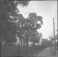
Description:
Likely the 320 block of East Bay Street, east side of street, houses since demolished.
Date:
1960
Description:
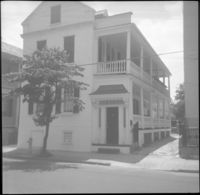
321 East Bay Street (Blake-Grimke House).
Date:
1960
Description:
321 East Bay Street (Blake-Grimke House).
Date:
1960
Description:
322 East Bay Street (right), 324 East Bay Street (middle), partial view of 326 East Bay Street (left), since demolished.
Date:
1960
Description:
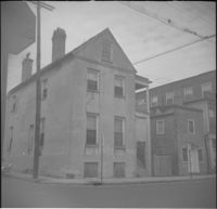
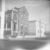
Possibly an outbuilding to 325 East Bay Street, since demolished.
Date:
1960
Description:
325 East Bay Street, since demolished.
Date:
1960
Description:
325 East Bay Street, since demolished.
Date:
1960
Description:
328 East Bay Street (Andrew Moffett House).
Date:
1960
Description:
329 East Bay Street (Gadsden-Morris House).
Date:
1960
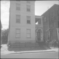
Description:
33 Hasell Street (John Hamilton House).
Date:
1960
Description:
33 Charlotte Street (J. Thomas Hamlin White House).
Date:
1960
Description:
33 Wentworth Street (William Proctor House), flanked by 31 Wentworth Street (left) and 35 Wentworth Street (right).
Date:
1960
Description:
332 East Bay Street (Robert Primerose House).
Date:
1960
Description:
332 East Bay Street (Robert Primerose House).
Date:
1960
Description:
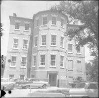
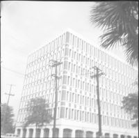
332-334 Meeting Street (L. Mendel Rivers Federal Building).
Date:
1960
Description:
Businesses located at the northeast corner of East Bay Street and Vernon Street: Milbren's Laundry and Dry Cleaning (334 East Bay Street) and Fort Sumter Paper Co. (336 East Bay Street), since demolished.
Date:
1960
Description:
Fort Sumter Paper Co. (336 East Bay Street) and Sam Solomon Co. (338 East Bay Street), since demolished.
Date:
1960
Description:
34 Society Street. (30 Society Street also in view at right.)
Date:
1960
Description:
34-36 Wentworth Street (St. Peter's Roman Catholic Church and Rectory)
Date:
1960
Description:
34 Charlotte Street.
Date:
1960
Description:
34 Anson Street (Mary Lanneau House), flanked by 36-40 Anson Street which was later demolished.
Date:
1960
Description:
34-36 Wentworth Street (St. Peter's Roman Catholic Church and Rectory)
Date:
1960
Description:
34 Hasell Street.
Date:
1960
Description:
View of Second Presbyterian Church (342 Meeting Street) from Marion Square.
Date:
1960
Description:
Second Presbyterian Church (342 Meeting Street). View obstructed by trees.
Date:
1960
Description:
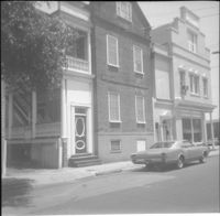
35 Hasell Street (John McNellage House).
Date:
1960
Description:
35 Wentworth Street
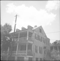
![7 George Street [11 George Street]](https://iiif.library.cofc.edu/iiif/2/36332/full/200,/0/default.jpg)
![116 Anson Street [now at 39 Laurens Street]](https://iiif.library.cofc.edu/iiif/2/48432/full/200,/0/default.jpg)
![116 Anson Street [now at 39 Laurens Street]](https://iiif.library.cofc.edu/iiif/2/48431/full/200,/0/default.jpg)