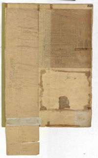
Page 229 of the City Engineer's Plat Book with two plats. Plat 1 features lots located on Queen Street, near its intersections with Mazyck Street, Friend Street, King Street, and Meeting Street. Plat 2 features lots located between Sans Souci Street and Simons Street, and between Rutledge Avenue and King Street.
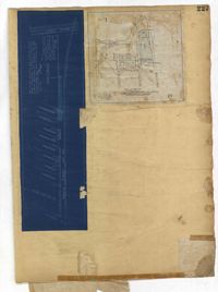
Page 227 of the City Engineer's Plat Book with two plats. Plat 1 shows lots and structures located on Grove Street, between King Street and Russell Street. Plat 2 features a "Plot of Ground Surrounding Charleston Colored Industrial School." Plat 2 also shows Fishburne Street, Mount Street, Congress Street, and President Street.
A report from the mayor, city council, and various governmental departments of Charleston, South Carolina for the year 1912. The Year Book opens with an address from the mayor, John P. Grace, followed by reports from various departments
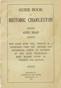
Presents "in a condensed form the historic and interesting points of interest in and near Charleston most sought after by tourists and visitors." Includes "interesting facts about the first churches and congregations; old historic buildings, halls and colleges; historical houses; relics of the old days; queer streets, alleys and lanes; parks, squares, cemeteries." Map of the peninsula includes "a sketch of the resorts and historical points in and around Charleston." Cover title: Guide Book of Historic Charleston and Map. Published by Lanneau's Art Store (Charleston, S.C.). 24 p., 16 cm. + 1 map, 40 x 50 cm. folded to 10 x 14 cm. (Note: paging begins at page 3.)
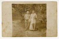
(Front) A postcard image of A.A. and Blanche Strauss posing outside. The image has several marks from water damage. (Back) A note to Mary Pearlstine discussing travel plans.
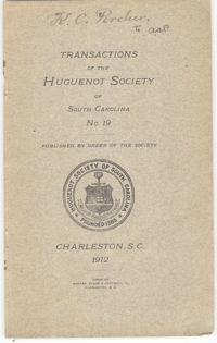
The Huguenot Society of South Carolina's Transactions include articles about the organization's financial records, member memorials, and Huguenot genealogy and history.