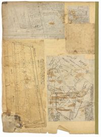
Page 108 of the City Engineer's Plat Book with five plats. Plat 1 features lots and some structures located near South Bay Street's intersections with Meeting Street and Church Street. It also shows a lot labelled "Battery Garden." Plat 2 shows lots located near East Bay Street. Plat 3 features White Point Garden, also known as Battery Park, located south of South Battery Street, near the Church Street and Meeting Street. Plat 4 shows a lot located near the intersection of Meeting Street and Broad Street. Plat 5 shows land located between Broad Road and the Ashley River, and includes labels marking salt marshes, cleared lands, a fish pond.
Page 109 of the City Engineer's Plat Book with six plats. Plat 1 shows lots located near the intersection of Exchange Street and Champney Street. Plat 2 shows lots and some buildings located on Church Street. Plat 3 shows lots located along Elliott Street, between East Bay and Church Street. Plat 4 shows lots and structures located near the corner of Church Street and Atlantic Street. Plat 5 shows lots and structures located near the corner of Church Street and Atlantic Street. Plat 6 shows lots and structures located near the intersection of East Bay Street and Guignard Street.
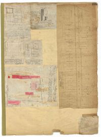
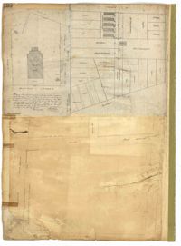
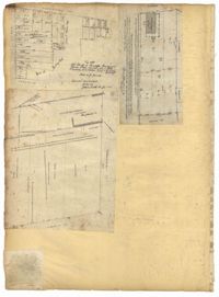
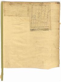
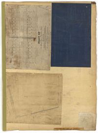
Page 125 of the City Engineer's Plat Book with seven plats. Plat 1 shows several measurements for a structure. Plat 2 shows the line of division between St. Mary's Church Yard and the "Property of Mrs. Anna D. Fleming." Plat 3 shows two wharves. Plat 4 shows lots and structures near wharf street. Plat 5 shows lots near the intersection of Washington Street and Laurens Street. Plat 6 shows lots between Rose Lane and Market Street, near where they intersect with East Bay Street. Plat 7 shows lots between Congress Street and Race Street, near Rutledge Street.
Page 136 of the City Engineer's Plat Book with seven plats. Plat 1 shows lots and structures located on and near the intersection of Liberty Street and St. Philips Street. Plat 2 shows lots located on Archdale Street, near Bennett's Mill Pond. Plat 3 shows lots and structures located on and near the intersection of Rutledge Street and Montague Street. Plat 4 shows lots and structures located on Archdale Street, including a building labelled "Hope Engine House." Plat 5 shows a lot located along Clifford Alley, near a lot labelled "Unitarian Church." Plat 6 shows lots located along King Street. Plat 7 shows lots located on and near Calhoun Street, located between Smith Street and Rutledge Street.
Page 137 of the City Engineer's Plat Book with six plats. Plat 1 shows lots located on and near Mazyck Street, between Short Street and King Street. Plat 2 shows lots located on and near the intersection of Pitt Street and Montague Street. Plat 3 features a lot located on the intersection of Archdale Street and Berresford Street. Plat 4 features a lot located at the intersection of Queen Street and Meeting Street. Plat 5 shows a lot located at the intersection of Queen Street and King Street. Plat 6 shows lots located on and near the intersection of Mazyck Street and Magazine Street, including one labelled "Roper Hospital Lot."
Page 138 of the City Engineer's Plat Book with three plats. Plat 1 features a lot located on Hasell Street, with a large building labelled "St. Mary's Church." Plat 2 shows lots and structures located between Rutledge Street and Trapmann Street, and between Queen Street and Broad Street. Plat 3 features a lot located on Radcliffe Street, between Rutledge Street and Smith Street.
Page 139 of the City Engineer's Plat Book with five plats. Plat 1 shows a lot and structures located at the corner of Calhoun Street and Alexander Street. Plat 2 shows lots located on Queen Street, near where it intersects with Back Street. Plat 3 shows lots located on and near Mazyck Street, near its intersection with Magazine Street. Plat 3 also shows lots labelled "Roper Hospital Lot," and "City Lot." Plat 4 shows lots located between Vanderhorst Street and Boundary Street, and between Coming Street and Pitt Street.
Page 154 of the City Engineer's Plat Book with three plats. Plat 1 shows lots and structures located between Radcliffe Street and Warren Street, near where they intersect with Coming Street. Plat 2 shows lots and structures located between Thomas Street and Smith Street. Plat 3 shows lots and structures located near the intersection of St. Philips Street and Vanderhorst Street. Plat 3 also includes labels reading "Kitchen building," and "Lot of the Irish Volunteers."
Page 157 of the City Engineer's Plat Book with two plats. Plat 1 features a lot of land located on the South Side of Line Street. Plat 2 shows lots located on and near the intersection of Spring Street and Kracke's Court.
Page 204 of the City Engineer's Plat Book with one plat. The plat shows lots and structures located near the intersection of Meeting Street and Broad Street.
Page 194 of the City Engineer's Plat Book with three plats. Plat 1 shows lots located near the intersection of Line Street and Comming Street. Plat 2 shows lots and structures located near Chesnut Street. Plat 3 shows lots and structures located on and near Calhoun Street, between Meeting Street and Anson Street.
Page 179 of the City Engineer's Plat Book with two plats. Plat 1 shows lots located on and near Hinloch Court and Meeting Street. Plat 2 shows lots located between Moultrie Street and Price Street.
Page 173 of the City Engineer's Plat Book with five plats. Plat 1 shows lots and structures located near the intersection of Meeting Street and Brigade Street. Plat 2 shows lots located between Meeting Street and Lee Street, and includes a lot labeled "German Cemetery." Plat 3 shows lots located between Cunnington Avenue and Wiliman Street, and between Meeting Street and Lee Street, and shows a lot labeled "4th Brigade." Plat 4 shows lots located near Brigade Street. Plat 5 features lots located in the Village of Hampstead, between Bay Street and Town Creek.
Page 177 of the City Engineer's Plat Book with two plats. Plat 1 shows lots located between Meeting Street and King Street, near Russell Street, "Rumney" Street, and Poinsett Street. Plat 2 shows lots, structures, and streams located near Hanover Street, America Street, and Payne Street.
Page 169 of the City Engineer's Plat Book with three plats. Plat 1 shows lots and structures on and near Dehon Street, between King Street and Meeting Street. Plat 2 shows lots located between King Street and Meeting Street, south of Romney Street. Plat 3 shows lots and structures located between Chapel Street and Charlotte Street, near where they intersect with Elizabeth Street. One lot is labelled "St. Luke's Church."
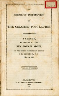
A sermon delivered by Reverend John B. Adger in The Second Presbyterian Church, Charleston, S.C. May 9th, 1847. The speech stresses the master's caring for enslaved people, often quoting the New Testament and Old Testament. References to Jesus's compassion for the care and teaching of the poor. Stresses the role of paternalism in the treatment of enslaved peoples and teaching of the gospel. Originally bound in v. 22 of the Thomas Smith Grimke pamphlet collection.
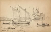
Pencil sketches by Charleston-born architect William Martin Aiken. Primarily interior architectural features from Venice, Italy, with a few outdoor scenes.
A report from the mayor, city council and various governmental departments of Charleston, South Carolina, for the year 1889. The Year Book opens with an address from Mayor George D. Bryan followed by reports from various departments.
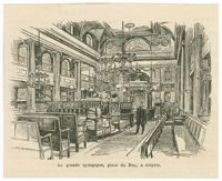
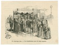
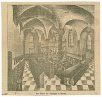
Black-and-white offset print reproduction of the interior of the Great Synagogue in London at Duke's Place. Published in the December 14, 1889, edition of L'Univers illustré.
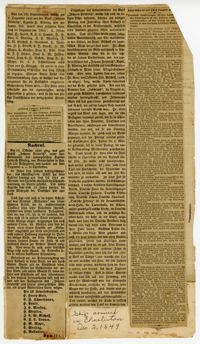
Newpaper clippings in German and English commemorating the fortieth anniversary of arrival of one hundred and thirty five German immigrants in Charleston in 1849 aboard the Johann Frierich ship.
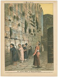
Caricature by Bernhard Gillam published in Puck. The caricature depicts William Walter Phelps, Murat Halstead, and Joseph Medill standing at the "Solomon's Wall" of Blainiac Republicans (referring to James Gillespie Blaine), which is labeled with the words "party patronage." William M. Evarts is shown approaching the wall. In German, the text reads : "Die Juden von Jerusalem versammeln sich noch heutzutage an der sog. 'Salomon’s Mauer' der Tempel-Ruinen und wehklagen über die verschwundene Herrlichkeit Israel’s." In English, the text reads : "The Jews of Jerusalem gather even today in front of what is called "Salomon's Wall" (Western Wall) of the Temple ruins and lament the vanished glory of Israel."
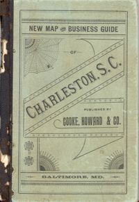
Directory of local businesses of all sorts. Published by Cooke, Howard & Co. (Baltimore, Md.), ca. 1889. Advertisements interspersed throughout, many of which are illustrated. Business types include bakers and confectioners, barbers, blacksmiths, building materials, butchers, contractors and builders, cigars and tobacco, groceries, furniture, hotels, insurance, house furnishings, painters, plumbers, railroad companies, restaurants, sailmakers, tailors, tin roofing, undertakers, wines and liquors, wheelwrights, and others. Also includes listings for municipal and state government, with names of offices and officers; listings of cemeteries, parks, halls, public buildings, and other points of interest; and a street directory that includes boundaries. In addition to an alphabetical index, the business guide is arranged by type. Missing map. 130 p., ill., 18 cm. (Note: Page numbering starts at 4 on the title page verso, after six unnumbered preliminary pages.)
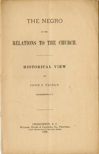
The pamphlet by John S. Fairly, written after slavery had been abolished, outlines the past relationship between enslaved peoples and the church. Originally published in the Charleston World, May 4, 1889.
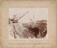
Still images found among the belongings of Henry T. Zacharias, a Charleston builder and contractor in the late 19th- and early-20th century. Zacharias built and/or repaired many notable buildings in Charleston. Includes photographs and one engraving of buildings on which he worked (or likely worked); photographs of battleships in dry dock at the Charleston Navy Yard; and a photograph of his gravesite at Magnolia Cemetery. (Note: Two of Mr. Zacharias's ledger books are in Special Collections at College of Charleston, 'Henry T. Zacharias Ledgers, 1905-1910.')
Caricature depicting a Jewish family on the water in Manhattan Beach. The text reads : "Mister! Vas costen to go in dot vouter?" Caricature printed by Tobin N.Y.
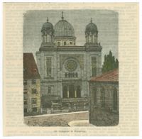
Color offset print reproduction of the exterior of the Hauptsynagoge (Main Synagogue) on Hans-Sachs-Platz in Nuremberg. From the Geïllustreerde encyclopaedie: woordenboek voor wetenschap en kunst, beschaving en nijverheid, Volume 8, by Antony Winkler Prins.
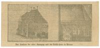
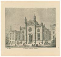
Black-and-white offset print reproduction of the exterior of the Leopoldstädter Tempel in Vienna. From Die alten Strassen und Plätze von Wien's Vorstädten und ihre historisch interessanten Häuser, Volume 1, by Wilhelm Kisch.


![[Mister! Vas costen to go in dot vouter?]](https://iiif.library.cofc.edu/iiif/2/59968/full/200,/0/default.jpg)
![[Die türkischen Israeliten in Wien...]](https://iiif.library.cofc.edu/iiif/2/25752/full/200,/0/default.jpg)