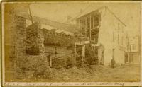
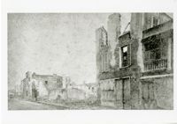
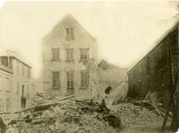
Charleston Earthquake scene. Possibly from Cook's Earthquake views, No.157, scene near Accomodation Wharf. Written on front, at bottom: 'Charleston Earthquake Scene - ruins on Accomodation Wharf.' Charleston city directory for 1886 lists Accomodation Wharf as opposite 176 East Bay Street.
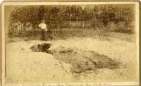
Caption: 'Cook's Earthquake Views of Charleston and Vicinity. Taken after the 31st of August, 1886. No.51, Wide fissure, Ten Mile Hill.' Handwritten at bottom, front: 'Charleston Earthquake scene - Large geyser near Ten Mile Hill.'
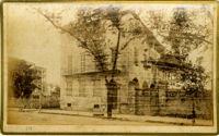
Caption: 'Cook's Earthquake Views of Charleston and Vicinity. Taken after the 31st of August, 1886. No.59, Pringle Smith, Meeting Street.' Written on front, at bottom: 'Earthquake scene Charleston, So.Ca.'
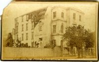
Caption: 'Cook's Earthquake Views of Charleston and Vicinity. Taken after the 31st of August, 1886. No.114, residence Col. Inglesby.' Charleston city directory for 1886 shows Charles Inglesby at 20 Meeting Street.
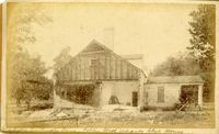
Caption: 'Cook's Earthquake Views of Charleston and Vicinity. Taken after the 31st of August, 1886. No.46, Club House, Otranto, rear.' Written on front, at bottom: 'Charleston Earthquake scene - fallen wall, Otranto Club House.'
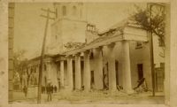
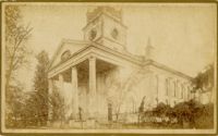
Caption: 'Cook's Earthquake Views of Charleston and Vicinity. Taken after the 31st of August, 1886. No. 17, St. Paul's Church.' St. Luke and St. Paul's Episcopal Cathedral, Coming Street.
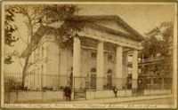
Caption: 'Cook's Earthquake Views of Charleston and Vicinity. Taken after the 31st of August, 1886. No.76, First Baptist Church, front.' Handwritten at bottom, front: 'Charleston Earthquake scene - First Baptist Church, Church Street.'
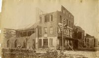
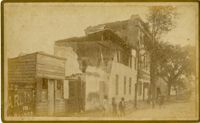
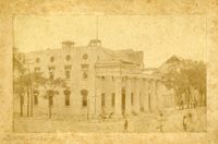
Charleston Earthquake scene. Written on front, at bottom: 'Sailor's Home, Charleston, S.C. after the Earthquake.' Sign at top of building reads: 'Charleston Port Society.'