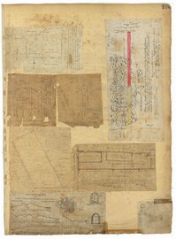
Page 105 of the City Engineer's Plat Book with seven plats. Plat 1 shows several lots located on Chalmers Street. Plat 2 shows lots located near the intersection of East Bay Street and Market Street, and several structures, including docs and wharves. Plat 3 features lots and structures located on Chalmers Street. Plat 4 features a lot located on the intersection of Church Street and Waters Street, and shows several structures. Plat 5 shows a lot and several structures located on Waters Street. Plat 6 features a lot and buildings located on Broad Street. Plat 7 features the profiles of streets where tidal drains will be built. The profiles include Calhoun Street, Mazyck Street, Logan Street, Tradd Street, Coming Street, Chesnut Street, Spring Street, and Meeting Street.
Page 171 of the City Engineer's Plat Book with three plats. Plat 1 shows lots located on and near the intersection of Meeting Street and Mt. Pleasant Street. Plat 2 shows lots located along King Street, near its intersection with Mt. Pleasant Street. Plat 3 shows the intersection of Calhoun Street and Smith Street.
Page 81 of the City Engineer's Plat Book with five plats. Plat 1 shows lots between Cooper Street and Blake Street, near their intersections with Drake Street. Plat 2 features an extension of Columbus Street stretching from Bay Street to the Cooper River, and also shows lots belonging to a cotton factory, the Northeastern Railroad Company (N.E.R.R. Co.), and the South Carolina Railway Company (So. Ca. R. Way Co.). Plat 3 features lots on a city block between Blake Street, Cooper Street, Drake Street, and Bay Street. Plat 4 shows land near Boundary Street, Pinckney Street, Doughty Street, and "Commings Creek." It also shows an island, a mill pond, several lots in the area, Hutson Street, Thomas Street, and President Street. Plat 5 shows land located between Calhoun Street and Bull Street, and Lynch Street and Rutledge Street, including Cannon Park.
1879, 1838, 1786, 1877, 1835, 1847, 1805, and 1807
Description:
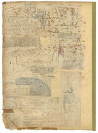
Page 72 of the City Engineer's Plat Book with eight plats. Plat 1 is labelled as a "Plan of Mazyckborough" and shows land located near the intersections of Charlotte Street with Alexander Street and Washington Street. Plat 1 also shows marshlands, streams, and the Cooper River. Plat 2 features a lot and its structures located on Henrietta Street. Plat 3 shows lots located between Concord Street and the edge of the Cooper River Channel, and also shows Wharf Street. Plat 5 shows land and buildings located on Washington Street, and includes some marshland and a stream labelled "Creek to Cooper River." Plat 6 shows a "Plan of a Part of Wraggsborough" located between Elizabeth Street and the Cooper River Channel. The plat also labels some marshlands, part of a creek, Mazyckborough, the Village of Hampstead, "The Mall," Chapel Street, and Washington Street. Plat 7 shows a lot located near the intersection of King Street and Calhoun Street, and shows several structures including a kitchen. Plat 8 shows a plan for a market located on Boundary Street, near Water Street, Front Street, and Gadsden's Canal.
Page 71 of the City Engineer's Plat Book with eight plats. Plat 1 shows lots and structures on a city block between Rutledge Street and Smith Street, and between Beaufain Street and Wentworth Street. Plat 2 shows lots located near the intersection of Moore Street and Meeting Street. Plat 3 shows lots and structures located near the intersection of King Street and Beaufain Street. Plat 4 shows lots and structures located on the east side of Coming Street. Plat 5 shows lots located on King Street, including a lot labelled "Unitarian Church property" and a stretch labelled "Unitarian Church Cemetery." Plat 6 shows lots located on King Street, and shows the "Old line of street." Plat 7 shows plots located on King Street. Plat 8 features a lot and buildings located on Spring Street, and shows how Rosemont Street is projected to cross that property.
Page 65 of the City Engineer's Plat Book with six plats. Plat 1 shows wharves and other structures located near the intersection of East Bay Street and Elliott Street, and also shows a building labelled "Old Post Office." Plat 2 features a wharf on the Cooper River, and shows several structures. Plat 3 shows wharves and brick storehouses located near the intersection of Prioleau Street and Queen Street. Plat 4 shows lots near the intersection of Bull Street and Smith Street. Plat 5 shows lots and structures located near the intersection of King Street and Morris Street. Plat 6 shows land located along a stretch of Coming Street, between Race Street and Sumter Street.
Page 58 of the City Engineer's Plat Book with six plats. Plat 1 shows lots between Broad Street and Short Street, near their intersections with Mazyck Street. Plat 2 features lots on Greenhill Street, Limehouse Street, and Tradd Street. Plat 2 also shows a line labelled "Edge of High Land." Plat 3 shows lots near Broad Street, including lots labelled "Hawens Square" and "Burying Ground." Plat 3 also shows structures labelled "Magazine" and "Work House." Plat 4 shows lots located on King Street. Plat 5 shows land located between Meeting Street and Lee Street, and a dotted line labelled "City Boundary." Plat 6 shows lots located between President Street and Norman Street.
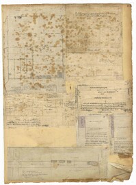
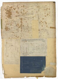
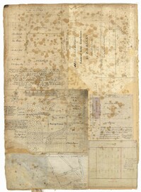
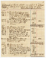
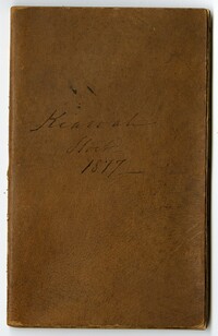
The Kiawah Stock Account Book, 1877-1882, is kept by a member of the Vanderhorst Family for their estate Kiawah Plantation on Kiawah Island, South Carolina. Entries include information on the numbers of livestock sold, list of expenses and marketing and account statements for the overseer Quash Stevens.
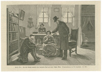
Black-and-white offset print reproduction of a scene from Raaf's Mine by Salomon Hermann Mosenthal, depicting Reinach offering his condolences to the rabbi and his daughter Mine as they are sitting shiva. From an illustration by Moritz Oppenheim. Published in Über Land und Meer, Jahrgang 19, Band 37, Heft 15.