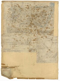
Page 183 of the City Engineer's Plat Book with five plats. Plat 1 shows lots located along Simons Street, between King Street and a stretch of marshland. Plat 2 shows lots on and near "Simmons" Street. It also shows lots near King Street and Romney Court. Plat 3 shows lots located near the intersection of King Street and Grove Street. Plat 4 shows lots and structures located near the intersection of Simons Street and King Street. Plat 5 shows lots along Simons Street, located between King Street and a stretch of marshland.
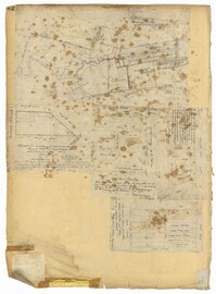
Page 83 of the City Engineer's Plat Book with eight plats. Plat 1 shows lots and some buildings located near Amherst Street, between Hanover Street and Nassau Street. Plat 2 shows lots located near the intersection of Mary Street and America Street, including a lot with structures including stables, a coach house, and a kitchen. Plat 3 shows lots located on Bay Street, near its intersections with North Street, Cooper Street, Drake Street, and Columbus Street. Plat 4 shows lots located along Drake Street, between Reid Street and Amherst Street. Plat 5 shows lots located on Meeting Street and Line Street. Plat 6 shows lots located near Line Street, between Meeting Street and Nassau Street. Plat 7 shows lots located near the intersection of Meeting Street and Columbus Street, and also shows a small Stretch of Spring Street. Plat 8 shows lots along Line Street, between Meeting Street and Aiken Street.
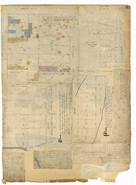
Page 42 of the City Engineer's Plat Book with five plats. Plat 1 shows land between King Street and the Ashley River, and shows bodies of water. Plat 2 shows land between Tradd Street and Payne Street, and several buildings. Plat 3 shows land and buildings on Cumberland Street, and shows two cemeteries, "Cemetery of the Circular Church," and "St Philip's Cemetery." Plat 4 shows plots near the intersection of Henrietta Street and Elizabeth Street. Plat 5 shows lots between "Marsh Street" and "Back Street."
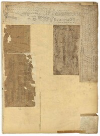
Page 40 of the City Engineer's Plat Book with three plats. Plat 1 shows lots located between Laurence Street and Boundary Street, and Anson Street and the Charleston Harbor on the Cooper River. Plat 1 also shows East Bay Street, Washington Street, Concord Street, several wharfs, marshland, and a label reading "Mazyck Borough." Plat 2 shows lots on Simmons Street, between King Street and a stretch of marshland. Plat 3 shows lots of land between New Street and Logan Street, and several buildings.
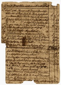
The Account Book of John Ball Sr., 1788-1812, is an unbound book containing financial accounts for clients such as Hyde Park Plantation overseer David Franklin and the freedman Robin. The account book also makes various references to enslaved persons named Almanza, Caesar, Daniel, Hercules, Mauney, Plimoth, Sampson and Terror.
The Daniel Huger Receipt Book 1803-1812 is a bound book documenting the receipts by various employees of Daniel Huger and Charleston merchants he frequented. Receipts include the payments made to buyers of enslaved people, money sent for subscriptions to newspapers and to the Charleston Library Society and the American Revolution Society. Other receipts include dividends to the State Bank and employee wages.
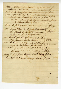
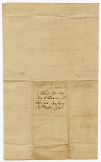
An account current and received for John Ball's son Doctor William Ball in account with the estate of George Lockey for expenses such as a watch chain, shoes, postage and sundries.
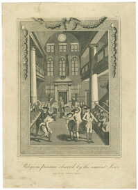
Black-and-white engraving depicting the Yom Kippur ritual of malkot (lashes) in the Great Synagogue of Amsterdam. Engraving after Bernard Picart. From A new univeral history of the religious rites, ceremonies and customs of the whole world by William Hurd, published Manchester: J. Gleave.
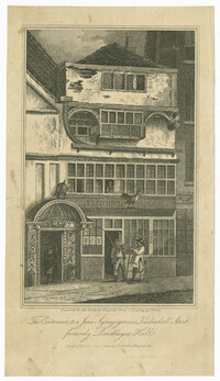
Black-and-white etching of the exterior of the New Synagogue at Leadenhall Street in London. Engraved for the The European Magazine, and London Review from a drawing by John Nixon. London: Published by J. Asperne, Cornhill, 1st. August, 1811.
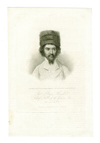
Black-and-white engraved portrait of Chief Rabbi Solomon Hirschel. Engraving by William Ridley after a painting by Samuel Drummond. Published in the European Magazine.