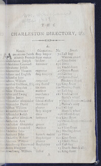
Published in 1790, the city directory for Charleston includes a city plan from 1788, a street reference to accompany the city plan, alphabetical listings of residents with occupations and addresses, meetings of lodges and societies, a list of corporation, signals at the fort, and the revenue system of the United States. The directory is 56 pages long and features on fold-out city plan illustration.
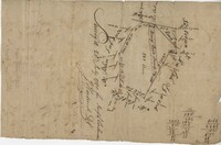
Plat of 130 acres on the Pee Dee River. Explains the plat and the surrounding area, drawing itself has little detail. Names associated with this plat are William Swinton, Joseph LaBruce, John White, James St. John, Elias Hopkin, and Thomas [?]. Notable geographic locations include the Pee Dee River, Black River, Weehaw Plantation, Kensington Plantation, Weehaw Creek, Georgetown, and Craven County [now in parts of Berkeley, Charleston, Georgetown, and Williamsburg counties].
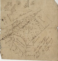
Plat of 383 acres on Mary Creek Swamp belonging to Joseph Coachman. Details include the property lines, the location of the swamp, and location of a few trees. Names associated with this plat are Joseph Coachman, J. Hardwick, John LaBruce, Cattle, and Ralph Izard.
400 acre plot of David Elliot that includes what appears to be a marsh called Great Bay, no land types or detail. Names associated with this plat are David Elliot, Washington, Henry Sattus and J. Hardwick. Notable geographic locations include Georgetown and Great Bay.
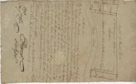
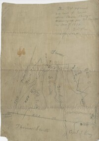
Plat of 200 acres above Bacon Bridge surveyed for William Drayton. Details include the property lines, trees, the location of the swamp, a field, a canal and roads. Names associated with this plat are Joseph Coachman, William Drayton, Thomas, Thomas Smith, J.J. Keersy [?], Chandless, Gales, and J.H. Waring. Notable geographic locations include Mary Creek Swamp [?], Broad Road, and Bacon Bridge.

![Chakram- Indian Machine for raising water, [Francis] Buchanan's Mysore](https://rspace.library.cofc.edu/iiif/image/45438/full/200,/0/default.jpg)