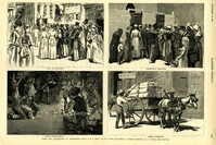
Caption: 'After The Earthquake At Charleston.--drawn by W.A. Rogers and W.P. Snyder from sketches by Frederic Remington and A.J. Gustin.--[see page 610.]' Individual captions: (top left): 'Open air preaching.' (top right): Subsistence committee.' (bottom left): 'Negro prayer-meeting.' (bottom right): 'Relief committee.' [full date September 18, 1886.]
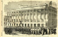
Caption: 'General McGowan addressing the Abbeville Volunteers in front of the Charleston Hotel--from a sketch by our Special Artist now in Charleston.' [full date February 23, 1861.]
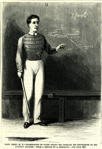
Caption: 'West Point, N.Y.--examination of Cadet Grant--he displays his knowledge of his father's battles.--from a sketch by A. Berghaus.--see page 241.' [full date June 24, 1871.]
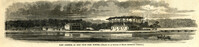
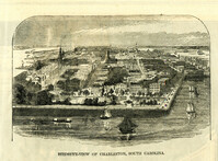
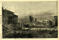
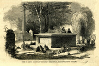
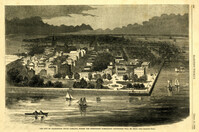
Caption: 'The city of Charleston, South Carolina, where the Democratic Nominating Convention will be held.--[see preceding page.]' [full date April 21, 1860.]
[Color image.] Caption at top: 'The harbor of Charleston, S.C.--From sketches by our special artist.--Fort Moultrie, on Sullivan's Island.' Caption at middle: 'Fort Pinckney, Charleston, S.C.' Caption at bottom: 'Fort Sumter, Charleston, S.C.' [full date Dec. 1, 1860.]
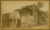
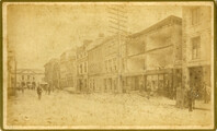
Caption: 'Cook's Earthquake Views of Charleston and Vicinity. Taken after the 31st of August, 1886. No.21, Broad Street, south side.' Sign on building, at right, reads: 'Cigars & Tobacco' and 'W.W. Smith, 27.' Charleston city directory for 1886 lists William M. Smith, seal, stencil and stamp works, at 29 Broad Street.
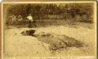
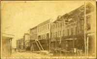
Caption: 'Cook's Earthquake Views of Charleston and Vicinity. Taken after the 31st of August, 1886. No.25, Vendue Range.' Written on front, at bottom: 'Charleston Earthquake scene - Vendue Range, foot of Queen St. near the wharf.' Sign for John Werner visible. Charleston city directory for 1886 shows business at 27 Vendue Range.
List of volunteer firefighters of city engine number 6, including their names, ages, description, occupation, and residence. Donated to the Charleston Museum by Charles Pequette, 1925
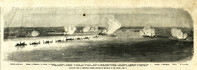
Caption: 'Panoramic view of Charleston Harbor--advance of iron-clads to the attack, April 7. Union--A. Keokuk. B. Nahunt. C. Nantucket. D. Catskill. E. Ironsides. F. Patapsco. G. Montauk. H. Passaie. K. Weehawken. Rebel--1. Morris Island sand battery. 2. Fort Wagner. 3. Battery Bee, on Cummings Point. 4. [Fort] Johnson. 5. Fort Ripley. 6. Sumter. 7. Charleston City. 8. Castle Pinckney. 9. Fort Redan. 10. Fort Moultrie. 11. Moultrie House. 12. Fort Beauregard. 13. Harbor obstructions. 14. Cooper River. 15. Ashley River.' [full date May 2, 1863.]
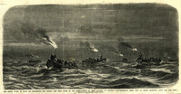
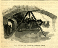
Caption: 'The night guard of boats on Charleston Bar during the first of the bombardment of Fort Sumpter (sic), to prevent reinforcements being sent to Major Anderson, April 12th, 1861.--from a sketch by our artist on Morris Island.'
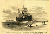
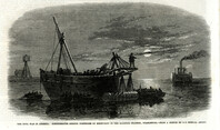
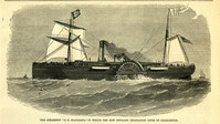
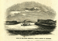
Caption: 'The Southern steamship Columbia. Captain Berry, on shore in Maffit's Bay, in the harbor of Charleston, S.C., on Wednesday, Jan. 23.--from a sketch by our Special Artist in Charleston.--see page 194.' [full date February 16, 1861.]
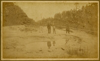
Caption: 'Cook's Earthquake Views of Charleston and Vicinity. Taken after the 31st of August, 1886. No.51, Wide fissure, Ten Mile Hill.' Handwritten at bottom, front: 'Charleston Earthquake scene - Large geyser near Ten Mile Hill.'
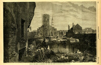
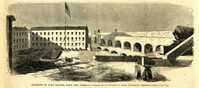
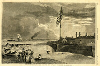
Caption: 'Quarters of the Union officers exposed to the Federal fire in Charleston.--sketched by one of the Officers.--[see page 550.]' [full date August 27, 1864.]
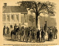
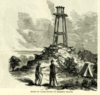
Caption: 'View of Darlington Court-House and the Sycamore-Tree where Amy Spain, the Negro slave, was hung by the citizens of Darlington, South Carolina.--[Sketched by N.N. Edwards.]' [full date September 30, 1865.]
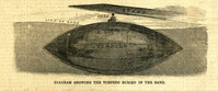
Caption: 'The Civil War in America: Confederates sinking torpedoes by moonlight in the harbour channel, Charleston.--from a sketch by our Special Artist.' [full date May 16, 1863.]
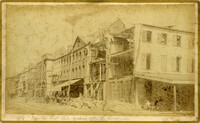
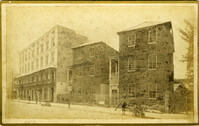
Caption: 'Cook's Earthquake Views of Charleston and Vicinity. Series No.2. No.154, East Bay, 60 days after the earthquake.' Written on front, at bottom: 'View on East Bay 60 days after the Earthquake.' Sign on building reads: 'Otto Tiedman & Sons.' Charleston city directory for 1886 shows business at 172-174 East Bay.
Caption: 'Cook's Earthquake Views of Charleston and Vicinity. Taken after the 31st of August, 1886. No.59, Pringle Smith, Meeting Street.' Written on front, at bottom: 'Earthquake scene Charleston, So.Ca.'
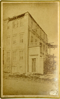
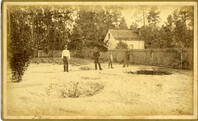
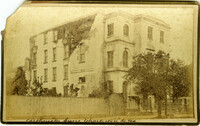
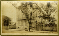
Caption: 'Cook's Earthquake Views of Charleston and Vicinity. Taken after the 31st of August, 1886. No.114, residence Col. Inglesby.' Charleston city directory for 1886 shows Charles Inglesby at 20 Meeting Street.
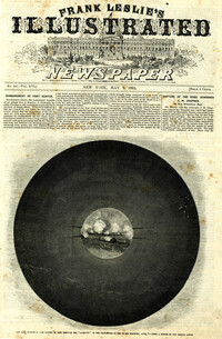
Caption: 'The bombardment of Fort Sumter, as seen through the "look out" in the pilot-house of one of the monitors, April 7.--from a sketch by our Special Artist.' [full date May 9, 1863]
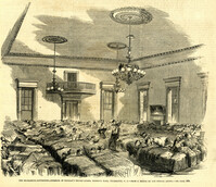
Caption: 'The Charleston Convention--interior of Douglas's headquarters, Hibernia (sic) Hall, Charleston, S.C.--from a sketch by our special artist.--see page 360.' [May 5, 1860.]
![Descriptive List of Free Negroes Belonging to City Engine No. 6 [Copy 1]](https://rspace.library.cofc.edu/iiif/image/50347/full/200,/0/default.jpg)