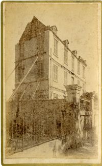
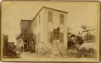
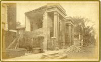
Caption: 'Cook's Earthquake Views of Charleston and Vicinity. Series No.2. No.182, Porch of Lazarus House.' Hassell Street. Charleston city directory for 1886 shows Mrs. B.D. Lazarus at 64 Hassell Street.
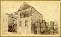
Caption: 'Cook's Earthquake Views of Charleston and Vicinity. Taken after the 31st of August, 1886. No.60, J.M. Wilson, Meeting St.' Charleston city directory for 1886 shows James M. Wilson at 39 Meeting Street.
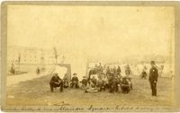
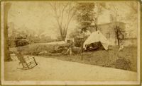
Handwritten at bottom, front: 'Charleston Earthquake scene - Marion Square - Citadel Academy in rear.' Tent village populated primarily by African-Americans. Policeman standing to the right.
Caption: 'Departure of the Great Southern Expedition from Beaufort, North Carolina.--sketched by an amateur.--[see page 119.]' [full date February 21, 1863.]
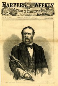
Caption: 'Admiral Samuel F. DuPont, Commanding the fleet off Charleston--photographed by Gutekurst, of Philadelphia.--see page 270.' [Full date April 25, 1863]
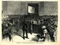
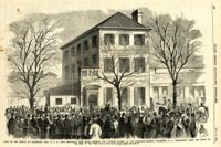
Caption: 'Scene on the arrival of Lieutenant Hall, U.S.A., with despatches (sic) from Major Anderson for Governor Pickens, at the Executive Mansion, Charleston, S.C., immediately after the firing on the Star of the West.--from a sketch by our Special Artist.--see page 151.' [full date January 26, 1861.]
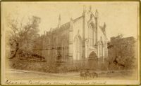
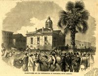
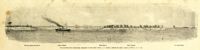
Caption: 'The advance upon Charleston--entrance to the Stono River, S.C.--from a sketch by Lieut. Coleman, 100th N.Y.S. Vol.' Also identified with captions: 'Kiawah Island and River. John's Island. Stono River. Cole's Island. Old Rebel Fort.' [full date April 25, 1863.]
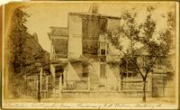
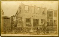
Caption: 'Cook's Earthquake Views of Charleston and Vicinity. Taken after the 31st of August, 1886. No.70, E.B. Hume, Legare Street.' Charleston city directory for 1886 shows Errington B. Hume at 17 Legare Street.