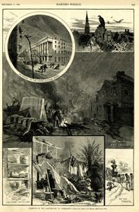
Main caption: 'Incidents of the Earthquake at Charleston.--drawn by Schell and Hogan.--[see page 590.]' Caption top left: 'In front of the Charleston Hotel.' Caption top right: 'looking over the roofs.' Caption middle: 'A camp on the East Battery.' Caption bottom left: 'The front wall gone.' Caption bottom center: 'In a rich man's garden.' Caption bottom right: ' On the track.' [full date September 11, 1886.]
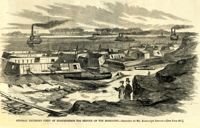
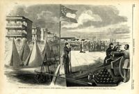
Caption: 'General Halleck's fleet of mortar-boats for service on the Mississippi.--sketched by Mr. Alexander Simplot.--[see page 827.]' [full date December 28, 1861.]
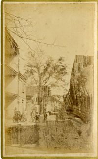
Caption: 'Cook's Earthquake Views of Charleston and Vicinity. Series No.2. No.181, Beresford Street.' This may be Beresford Alley which is also known as Clifford Street.
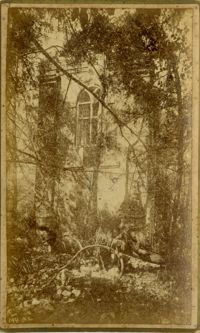
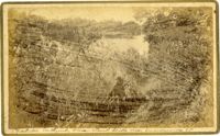
Caption: 'Cook's Earthquake Views of Charleston and Vicinity. Taken after the 31st of August, 1886. No.148, Landslide on the Ashley.' Handwritten at bottom, front: 'Charleston Earthquake view - Land slide near Summerville, S.C.'
Caption: 'The Battery or Park Promenade at Charleston, South Carolina, during the bombardment of Fort Sumter--Sketched by our Special Artist--[see next page].' [full date May 18, 1861.]
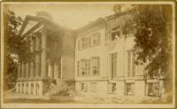
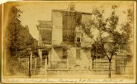
Caption: 'Cook's Earthquake Views of Charleston and Vicinity. Taken after the 31st of August, 1886. No.60, J.M. Wilson, Meeting St.' Charleston city directory for 1886 shows James M. Wilson at 39 Meeting Street.
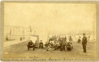
Handwritten at bottom, front: 'Charleston Earthquake scene - Marion Square - Citadel Academy in rear.' Tent village populated primarily by African-Americans. Policeman standing to the right.
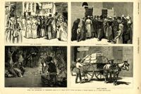
Caption: 'After The Earthquake At Charleston.--drawn by W.A. Rogers and W.P. Snyder from sketches by Frederic Remington and A.J. Gustin.--[see page 610.]' Individual captions: (top left): 'Open air preaching.' (top right): Subsistence committee.' (bottom left): 'Negro prayer-meeting.' (bottom right): 'Relief committee.' [full date September 18, 1886.]
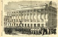
Caption: 'General McGowan addressing the Abbeville Volunteers in front of the Charleston Hotel--from a sketch by our Special Artist now in Charleston.' [full date February 23, 1861.]
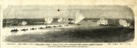
Caption: 'Panoramic view of Charleston Harbor--advance of iron-clads to the attack, April 7. Union--A. Keokuk. B. Nahunt. C. Nantucket. D. Catskill. E. Ironsides. F. Patapsco. G. Montauk. H. Passaie. K. Weehawken. Rebel--1. Morris Island sand battery. 2. Fort Wagner. 3. Battery Bee, on Cummings Point. 4. [Fort] Johnson. 5. Fort Ripley. 6. Sumter. 7. Charleston City. 8. Castle Pinckney. 9. Fort Redan. 10. Fort Moultrie. 11. Moultrie House. 12. Fort Beauregard. 13. Harbor obstructions. 14. Cooper River. 15. Ashley River.' [full date May 2, 1863.]
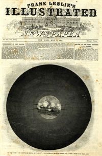
Caption: 'The bombardment of Fort Sumter, as seen through the "look out" in the pilot-house of one of the monitors, April 7.--from a sketch by our Special Artist.' [full date May 9, 1863]
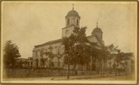
Caption: 'The Charleston Convention--interior of Douglas's headquarters, Hibernia (sic) Hall, Charleston, S.C.--from a sketch by our special artist.--see page 360.' [May 5, 1860.]